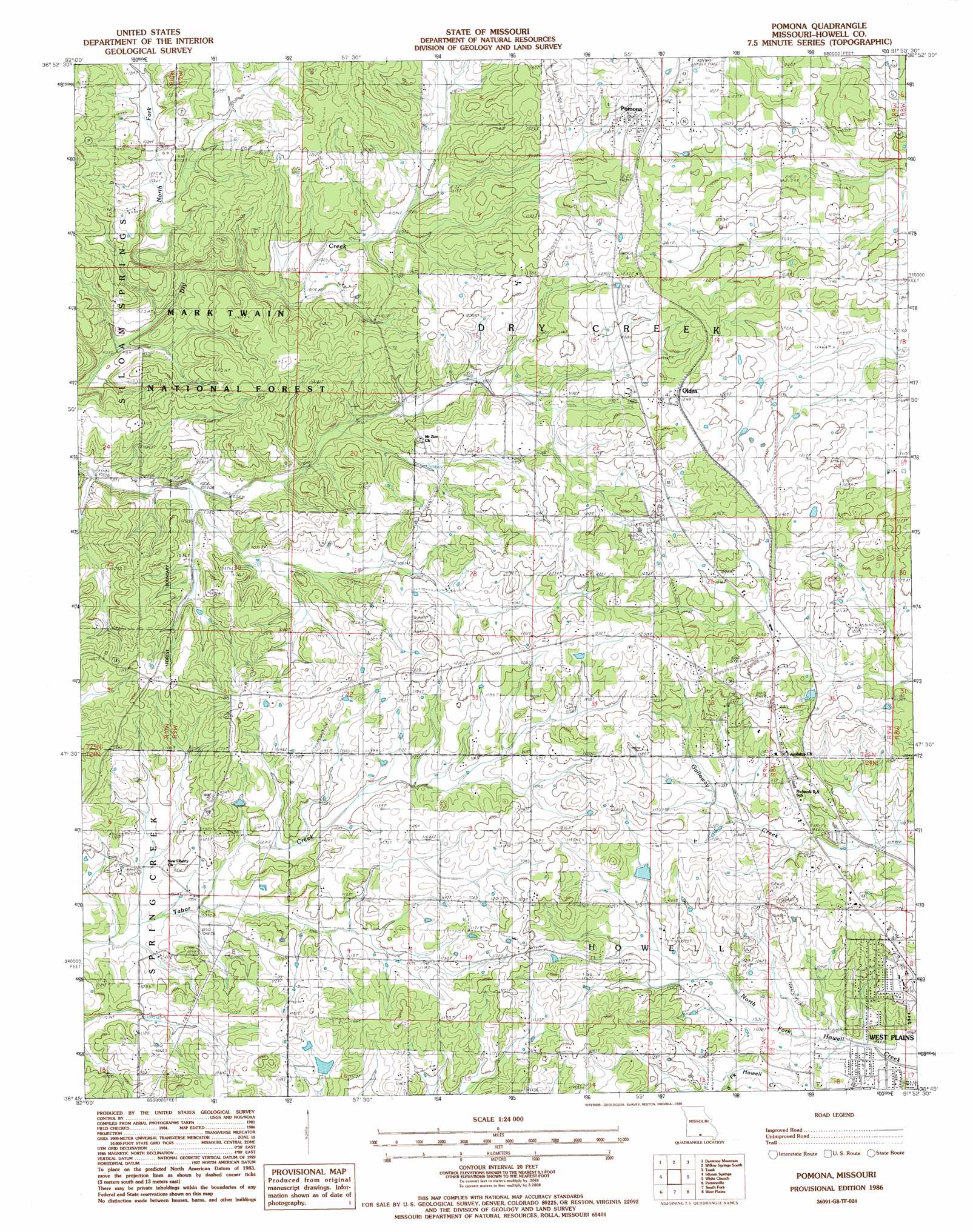
Pomona Topo Map Missouri
To zoom in, hover over the map of Pomona
USGS Topo Quad 36091g8 - 1:24,000 scale
| Topo Map Name: | Pomona |
| USGS Topo Quad ID: | 36091g8 |
| Print Size: | ca. 21 1/4" wide x 27" high |
| Southeast Coordinates: | 36.75° N latitude / 91.875° W longitude |
| Map Center Coordinates: | 36.8125° N latitude / 91.9375° W longitude |
| U.S. State: | MO |
| Filename: | o36091g8.jpg |
| Download Map JPG Image: | Pomona topo map 1:24,000 scale |
| Map Type: | Topographic |
| Topo Series: | 7.5´ |
| Map Scale: | 1:24,000 |
| Source of Map Images: | United States Geological Survey (USGS) |
| Alternate Map Versions: |
Willow Springs SW MO 1976, updated 1977 Download PDF Buy paper map Pomona MO 1986, updated 1986 Download PDF Buy paper map Pomona MO 2004, updated 2006 Download PDF Buy paper map Pomona MO 2011 Download PDF Buy paper map Pomona MO 2015 Download PDF Buy paper map |
| FStopo: | US Forest Service topo Pomona is available: Download FStopo PDF Download FStopo TIF |
1:24,000 Topo Quads surrounding Pomona
Cabool Sw |
Cabool Se |
Willow Springs North |
Clear Springs |
Pine Crest |
Nichols Knob |
Dyestone Mountain |
Willow Springs South |
Trask |
Mountain View |
Dora |
Siloam Springs |
Pomona |
White Church |
Peace Valley |
Cureall Nw |
Pottersville |
South Fork |
West Plains |
Brandsville |
Bakersfield |
Caulfield |
Moody |
Lanton |
Koshkonong |
> Back to 36091e1 at 1:100,000 scale
> Back to 36090a1 at 1:250,000 scale
> Back to U.S. Topo Maps home
Pomona topo map: Gazetteer
Pomona: Airports
Rays Roost Airport elevation 360m 1181′Sky Haven Airport (historical) elevation 336m 1102′
Pomona: Dams
Henderson and Day Dam elevation 335m 1099′Pomona: Populated Places
Olden elevation 377m 1236′Pomona elevation 380m 1246′
Pomona: Streams
North Fork Dry Creek elevation 306m 1003′Pomona digital topo map on disk
Buy this Pomona topo map showing relief, roads, GPS coordinates and other geographical features, as a high-resolution digital map file on DVD: