Dudenville Topo Map Missouri
To zoom in, hover over the map of Dudenville
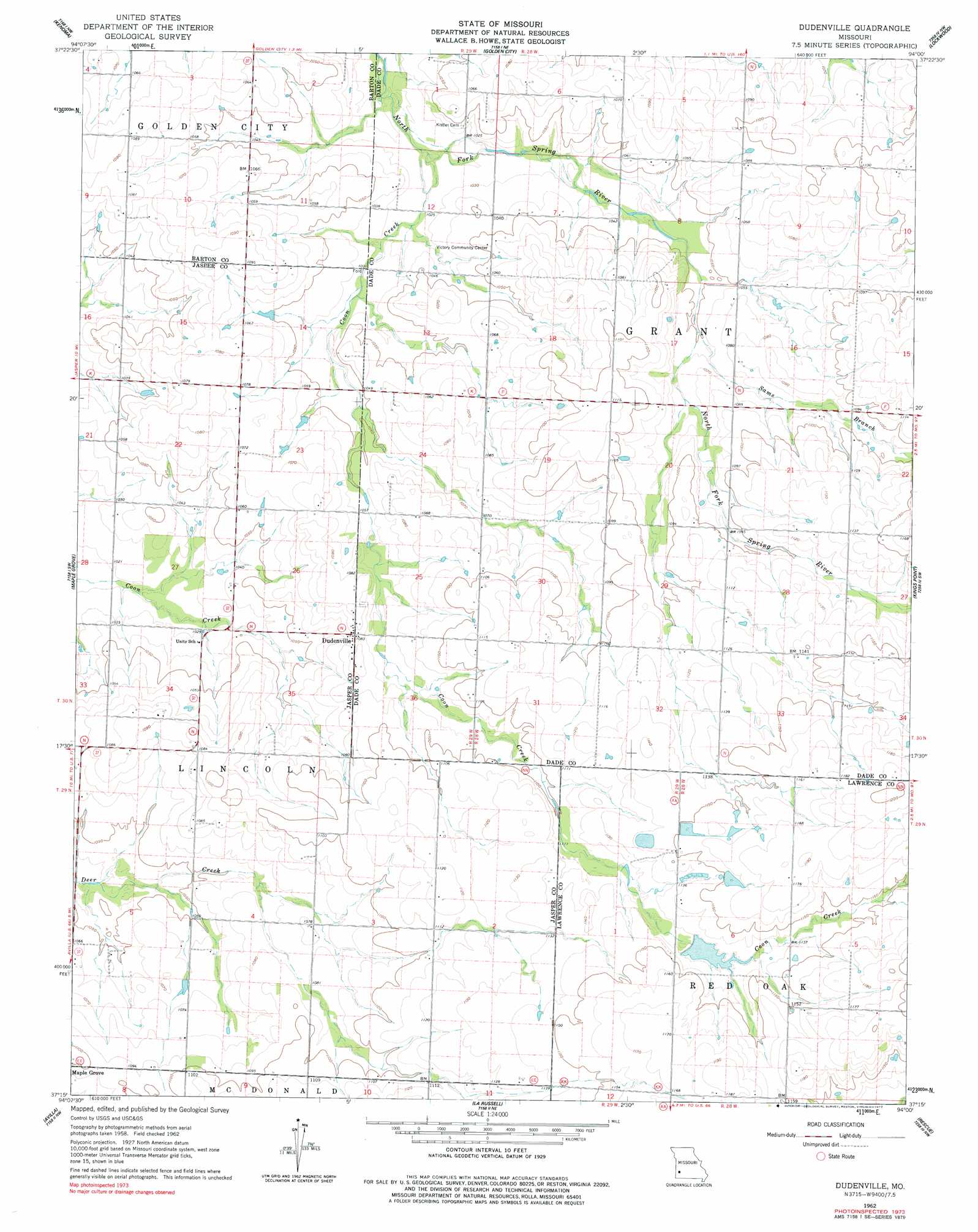
USGS Topo Quad 37094c1 - 1:24,000 scale
| Topo Map Name: | Dudenville |
| USGS Topo Quad ID: | 37094c1 |
| Print Size: | ca. 21 1/4" wide x 27" high |
| Southeast Coordinates: | 37.25° N latitude / 94° W longitude |
| Map Center Coordinates: | 37.3125° N latitude / 94.0625° W longitude |
| U.S. State: | MO |
| Filename: | o37094c1.jpg |
| Download Map JPG Image: | Dudenville topo map 1:24,000 scale |
| Map Type: | Topographic |
| Topo Series: | 7.5´ |
| Map Scale: | 1:24,000 |
| Source of Map Images: | United States Geological Survey (USGS) |
| Alternate Map Versions: |
Dudenville MO 1962, updated 1963 Download PDF Buy paper map Dudenville MO 1962, updated 1977 Download PDF Buy paper map Dudenville MO 2011 Download PDF Buy paper map Dudenville MO 2015 Download PDF Buy paper map |
1:24,000 Topo Quads surrounding Dudenville
Lamar North |
Milford |
Jerico Springs |
Cedarville |
Crisp |
Lamar South |
Kenoma |
Golden City |
Lockwood |
Greenfield |
Jasper |
Maple Grove |
Dudenville |
Kings Point |
South Greenfield |
Carthage |
Avilla |
La Russell |
Rescue |
Miller |
Fidelity |
Reeds |
Sarcoxie |
Stotts City |
Mount Vernon |
> Back to 37094a1 at 1:100,000 scale
> Back to 37094a1 at 1:250,000 scale
> Back to U.S. Topo Maps home
Dudenville topo map: Gazetteer
Dudenville: Airports
Leaming Field elevation 345m 1131′Dudenville: Dams
Davis Lake Dam elevation 320m 1049′Harlan Stump Dam elevation 352m 1154′
Poirot Farms Incorporated Dam elevation 339m 1112′
Poirot Lake Dam Shallow Dam elevation 344m 1128′
Pyle Lake Dam elevation 348m 1141′
Schilling Lake Dam elevation 338m 1108′
Townley Lake Dam elevation 324m 1062′
Dudenville: Populated Places
Dudenville elevation 331m 1085′Dudenville: Reservoirs
Number 71 Lake elevation 344m 1128′Poirot Farms Lake elevation 339m 1112′
Schilling Lake elevation 338m 1108′
Townley Lake elevation 324m 1062′
Dudenville: Streams
Coon Creek elevation 311m 1020′Sams Branch elevation 320m 1049′
Dudenville digital topo map on disk
Buy this Dudenville topo map showing relief, roads, GPS coordinates and other geographical features, as a high-resolution digital map file on DVD: