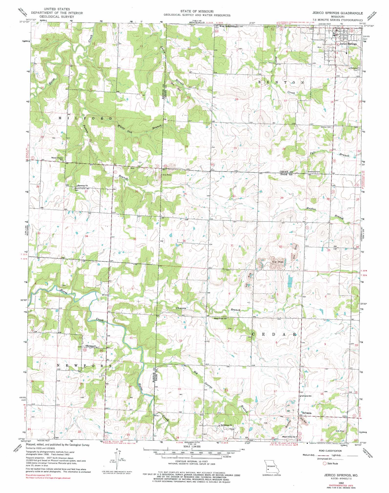
Jerico Springs Topo Map Missouri
To zoom in, hover over the map of Jerico Springs
USGS Topo Quad 37094e1 - 1:24,000 scale
| Topo Map Name: | Jerico Springs |
| USGS Topo Quad ID: | 37094e1 |
| Print Size: | ca. 21 1/4" wide x 27" high |
| Southeast Coordinates: | 37.5° N latitude / 94° W longitude |
| Map Center Coordinates: | 37.5625° N latitude / 94.0625° W longitude |
| U.S. State: | MO |
| Filename: | o37094e1.jpg |
| Download Map JPG Image: | Jerico Springs topo map 1:24,000 scale |
| Map Type: | Topographic |
| Topo Series: | 7.5´ |
| Map Scale: | 1:24,000 |
| Source of Map Images: | United States Geological Survey (USGS) |
| Alternate Map Versions: |
Jerico Springs MO 1962, updated 1963 Download PDF Buy paper map Jerico Springs MO 1962, updated 1976 Download PDF Buy paper map Jerico Springs MO 2011 Download PDF Buy paper map Jerico Springs MO 2015 Download PDF Buy paper map |
1:24,000 Topo Quads surrounding Jerico Springs
Nevada |
Dederick |
Eldorado Springs South |
Filley |
Caplinger Mills |
Sheldon |
Bellamy |
Montevallo |
Wagoner |
Stockton |
Lamar North |
Milford |
Jerico Springs |
Cedarville |
Crisp |
Lamar South |
Kenoma |
Golden City |
Lockwood |
Greenfield |
Jasper |
Maple Grove |
Dudenville |
Kings Point |
South Greenfield |
> Back to 37094e1 at 1:100,000 scale
> Back to 37094a1 at 1:250,000 scale
> Back to U.S. Topo Maps home
Jerico Springs topo map: Gazetteer
Jerico Springs: Dams
Campbell Lake Dam elevation 289m 948′Number 706 Dam elevation 307m 1007′
Winningham Lake Dam elevation 312m 1023′
Jerico Springs: Populated Places
Flory (historical) elevation 307m 1007′Jerico Springs elevation 310m 1017′
Newport elevation 307m 1007′
Sylvania elevation 326m 1069′
Jerico Springs: Reservoirs
Don Henley Lake elevation 312m 1023′Jerico Springs: Streams
Big George Branch elevation 312m 1023′Chaney Branch elevation 277m 908′
Patton Branch elevation 263m 862′
White Oak Branch elevation 268m 879′
Jerico Springs digital topo map on disk
Buy this Jerico Springs topo map showing relief, roads, GPS coordinates and other geographical features, as a high-resolution digital map file on DVD: