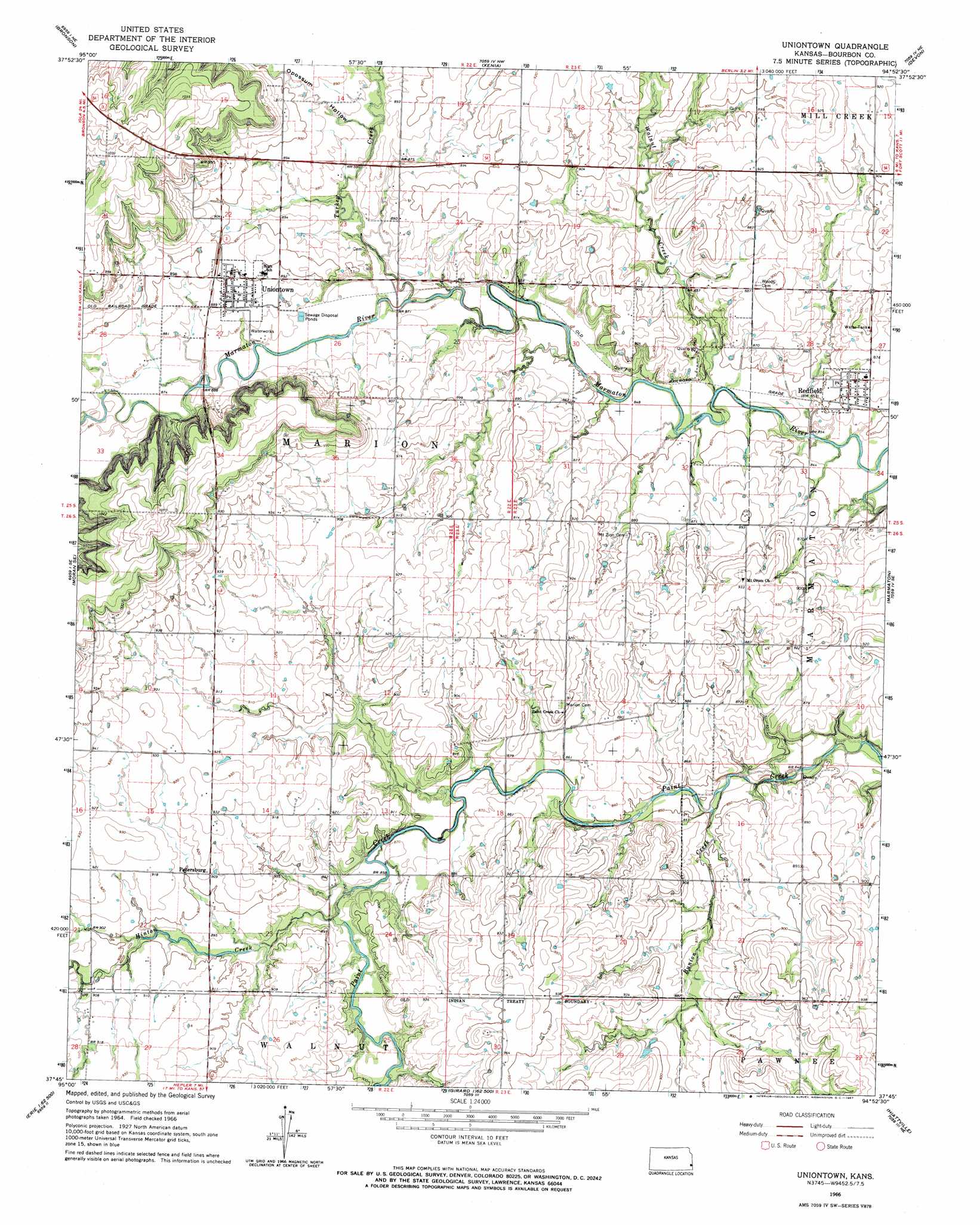
Uniontown Topo Map Kansas
To zoom in, hover over the map of Uniontown
USGS Topo Quad 37094g8 - 1:24,000 scale
| Topo Map Name: | Uniontown |
| USGS Topo Quad ID: | 37094g8 |
| Print Size: | ca. 21 1/4" wide x 27" high |
| Southeast Coordinates: | 37.75° N latitude / 94.875° W longitude |
| Map Center Coordinates: | 37.8125° N latitude / 94.9375° W longitude |
| U.S. State: | KS |
| Filename: | o37094g8.jpg |
| Download Map JPG Image: | Uniontown topo map 1:24,000 scale |
| Map Type: | Topographic |
| Topo Series: | 7.5´ |
| Map Scale: | 1:24,000 |
| Source of Map Images: | United States Geological Survey (USGS) |
| Alternate Map Versions: |
Uniontown KS 1966, updated 1967 Download PDF Buy paper map Uniontown KS 2009 Download PDF Buy paper map Uniontown KS 2012 Download PDF Buy paper map Uniontown KS 2015 Download PDF Buy paper map |
1:24,000 Topo Quads surrounding Uniontown
Kincaid |
Blue Mound |
Mapleton |
Mantey |
Prescott |
Moran |
Bronson |
Xenia |
Devon |
Hammond |
Elsmore |
Moran Se |
Uniontown |
Marmaton |
Fort Scott |
Stark |
Porterville |
Hepler |
Hiattville |
Cato |
Erie |
Walnut |
Brazilton |
Girard |
Arma |
> Back to 37094e1 at 1:100,000 scale
> Back to 37094a1 at 1:250,000 scale
> Back to U.S. Topo Maps home
Uniontown topo map: Gazetteer
Uniontown: Populated Places
Petersburg elevation 279m 915′Redfield elevation 263m 862′
Uniontown elevation 273m 895′
Uniontown: Streams
Bunion Creek elevation 253m 830′Hinton Creek elevation 262m 859′
Turkey Creek elevation 259m 849′
Walnut Creek elevation 254m 833′
Uniontown: Valleys
Opossum Hollow elevation 265m 869′Uniontown digital topo map on disk
Buy this Uniontown topo map showing relief, roads, GPS coordinates and other geographical features, as a high-resolution digital map file on DVD: