Erie Topo Map Kansas
To zoom in, hover over the map of Erie
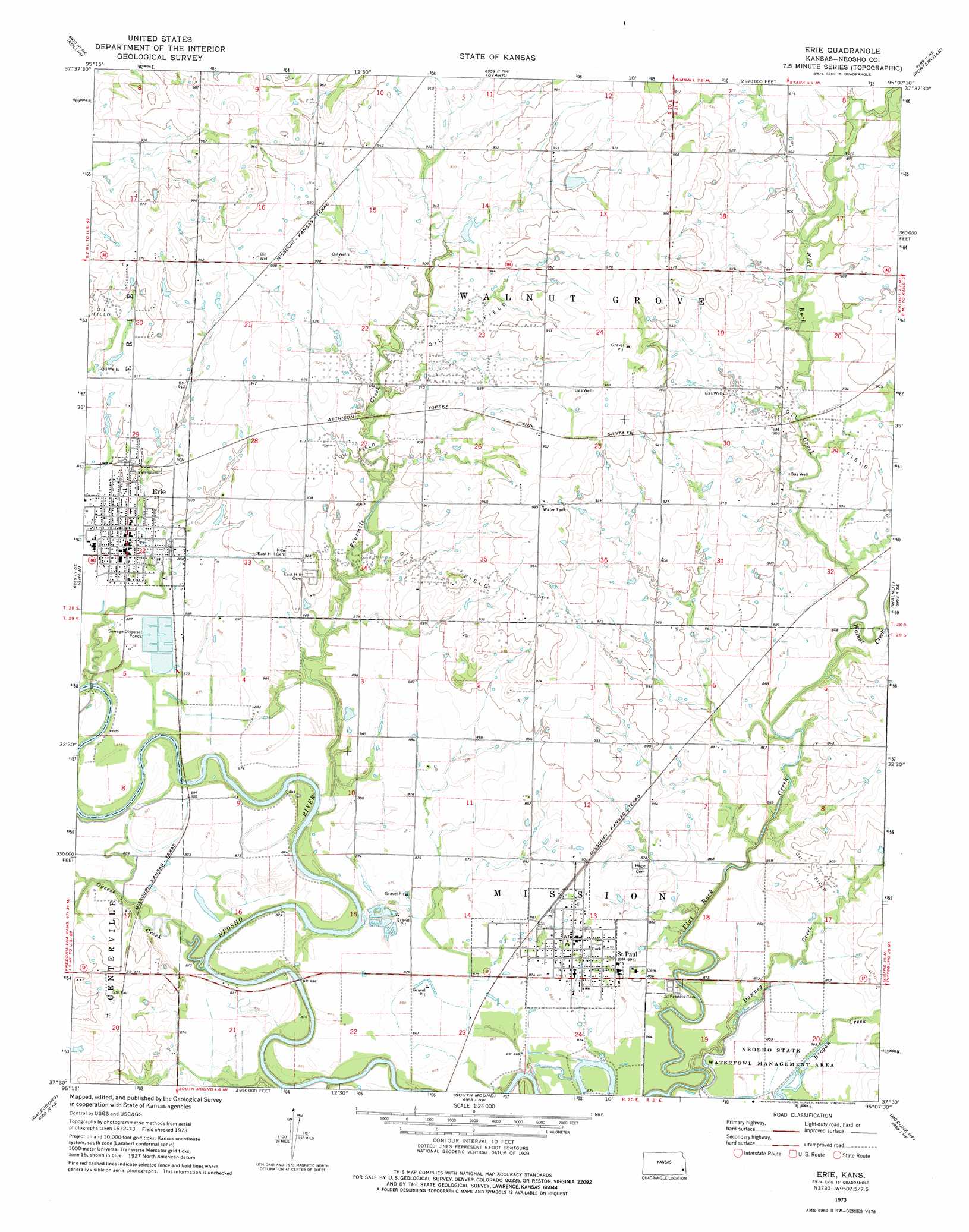
USGS Topo Quad 37095e2 - 1:24,000 scale
| Topo Map Name: | Erie |
| USGS Topo Quad ID: | 37095e2 |
| Print Size: | ca. 21 1/4" wide x 27" high |
| Southeast Coordinates: | 37.5° N latitude / 95.125° W longitude |
| Map Center Coordinates: | 37.5625° N latitude / 95.1875° W longitude |
| U.S. State: | KS |
| Filename: | o37095e2.jpg |
| Download Map JPG Image: | Erie topo map 1:24,000 scale |
| Map Type: | Topographic |
| Topo Series: | 7.5´ |
| Map Scale: | 1:24,000 |
| Source of Map Images: | United States Geological Survey (USGS) |
| Alternate Map Versions: |
Erie KS 1973, updated 1975 Download PDF Buy paper map Erie KS 2010 Download PDF Buy paper map Erie KS 2012 Download PDF Buy paper map Erie KS 2016 Download PDF Buy paper map |
1:24,000 Topo Quads surrounding Erie
Humboldt |
Iola Se |
Elsmore |
Moran Se |
Uniontown |
Chanute |
Rollin |
Stark |
Porterville |
Hepler |
Earlton |
Shaw |
Erie |
Walnut |
Brazilton |
Thayer |
Galesburg |
South Mound |
Mccune Ne |
Grindstone Creek |
Dennis |
Parsons West |
Parsons East |
Mccune |
West Mineral |
> Back to 37095e1 at 1:100,000 scale
> Back to 37094a1 at 1:250,000 scale
> Back to U.S. Topo Maps home
Erie topo map: Gazetteer
Erie: Populated Places
Erie elevation 273m 895′Saint Paul elevation 272m 892′
Erie: Streams
Bachelor Creek elevation 259m 849′Flat Rock Creek elevation 256m 839′
Fourmile Creek elevation 265m 869′
Ogeese Creek elevation 259m 849′
Walnut Creek elevation 261m 856′
Erie digital topo map on disk
Buy this Erie topo map showing relief, roads, GPS coordinates and other geographical features, as a high-resolution digital map file on DVD: