Yates Center Topo Map Kansas
To zoom in, hover over the map of Yates Center
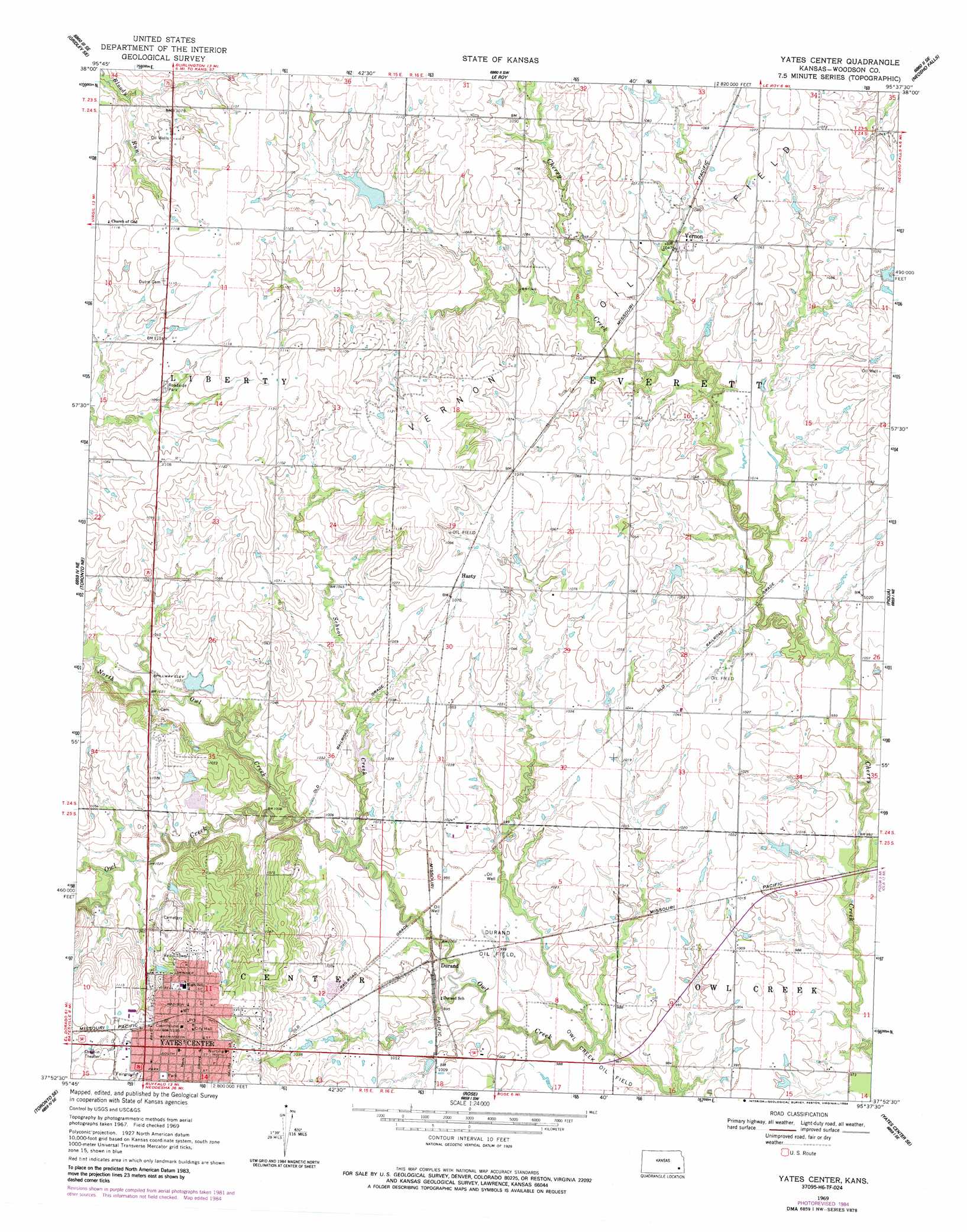
USGS Topo Quad 37095h6 - 1:24,000 scale
| Topo Map Name: | Yates Center |
| USGS Topo Quad ID: | 37095h6 |
| Print Size: | ca. 21 1/4" wide x 27" high |
| Southeast Coordinates: | 37.875° N latitude / 95.625° W longitude |
| Map Center Coordinates: | 37.9375° N latitude / 95.6875° W longitude |
| U.S. State: | KS |
| Filename: | o37095h6.jpg |
| Download Map JPG Image: | Yates Center topo map 1:24,000 scale |
| Map Type: | Topographic |
| Topo Series: | 7.5´ |
| Map Scale: | 1:24,000 |
| Source of Map Images: | United States Geological Survey (USGS) |
| Alternate Map Versions: |
Yates Center KS 1969, updated 1971 Download PDF Buy paper map Yates Center KS 1969, updated 1984 Download PDF Buy paper map Yates Center KS 2009 Download PDF Buy paper map Yates Center KS 2012 Download PDF Buy paper map Yates Center KS 2015 Download PDF Buy paper map |
1:24,000 Topo Quads surrounding Yates Center
Gridley Nw |
John Redmond Dam |
Burlington |
Aliceville |
Westphalia |
Gridley |
Gridley Se |
Le Roy |
Neosho Falls |
Geneva |
Quincy |
Toronto Ne |
Yates Center |
Piqua |
Iola |
Toronto |
Toronto Se |
Rose |
Yates Center Se |
Humboldt |
Coyville |
Middletown |
Buffalo |
Vilas |
Chanute |
> Back to 37095e1 at 1:100,000 scale
> Back to 37094a1 at 1:250,000 scale
> Back to U.S. Topo Maps home
Yates Center topo map: Gazetteer
Yates Center: Oilfields
Durand Oil Field elevation 302m 990′Owl Creek Oil Field elevation 299m 980′
Yates Center: Parks
Woodson County Fairgrounds elevation 312m 1023′Yates Center: Populated Places
Durand elevation 304m 997′Hasty elevation 328m 1076′
Vernon elevation 324m 1062′
Yates Center elevation 345m 1131′
Yates Center: Streams
North Owl Creek elevation 301m 987′School Creek elevation 302m 990′
Yates Center digital topo map on disk
Buy this Yates Center topo map showing relief, roads, GPS coordinates and other geographical features, as a high-resolution digital map file on DVD: