Trout Creek Topo Map Kansas
To zoom in, hover over the map of Trout Creek
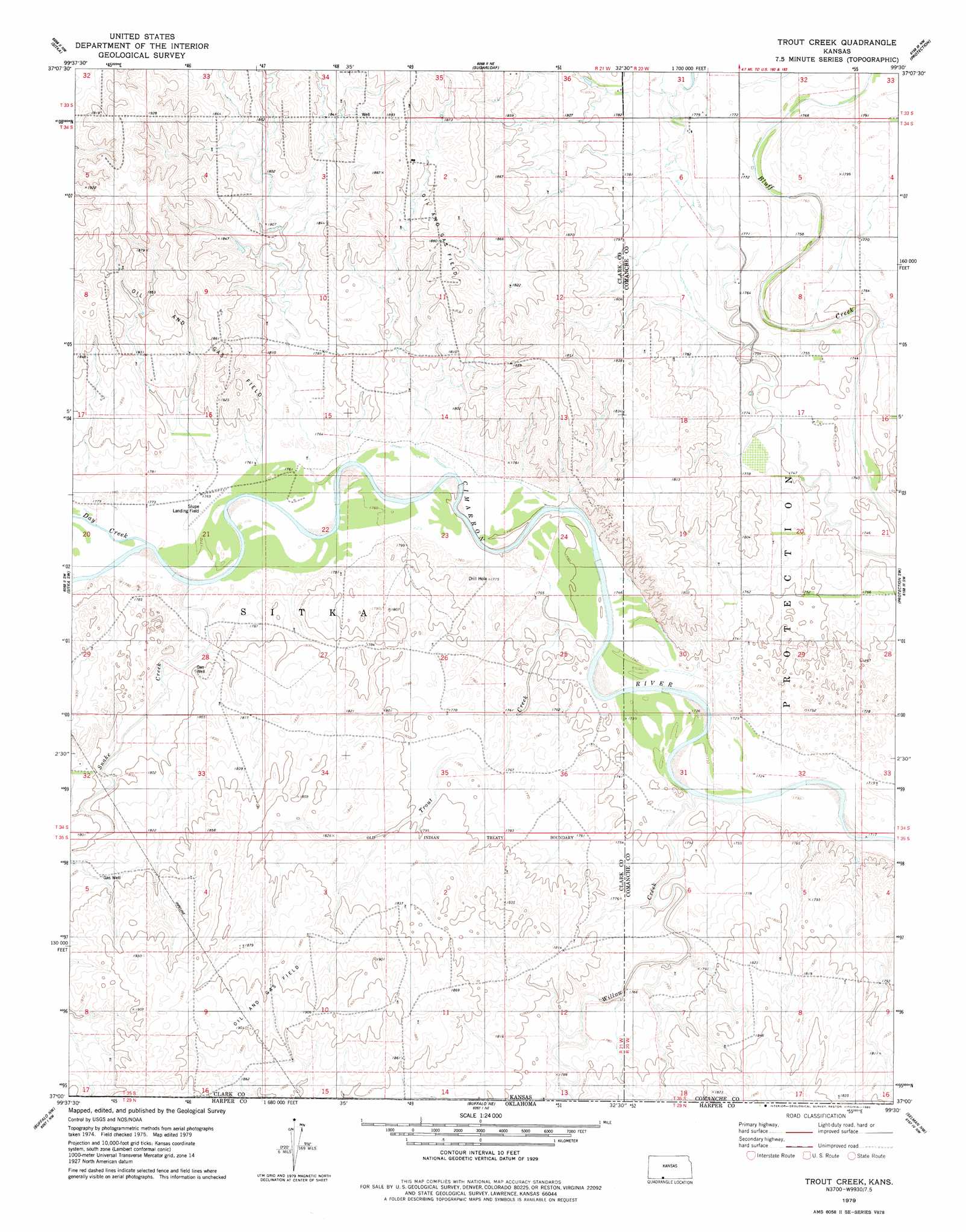
USGS Topo Quad 37099a5 - 1:24,000 scale
| Topo Map Name: | Trout Creek |
| USGS Topo Quad ID: | 37099a5 |
| Print Size: | ca. 21 1/4" wide x 27" high |
| Southeast Coordinates: | 37° N latitude / 99.5° W longitude |
| Map Center Coordinates: | 37.0625° N latitude / 99.5625° W longitude |
| U.S. State: | KS |
| Filename: | o37099a5.jpg |
| Download Map JPG Image: | Trout Creek topo map 1:24,000 scale |
| Map Type: | Topographic |
| Topo Series: | 7.5´ |
| Map Scale: | 1:24,000 |
| Source of Map Images: | United States Geological Survey (USGS) |
| Alternate Map Versions: |
Trout Creek KS 1979, updated 1980 Download PDF Buy paper map Trout Creek KS 2010 Download PDF Buy paper map Trout Creek KS 2012 Download PDF Buy paper map Trout Creek KS 2015 Download PDF Buy paper map |
1:24,000 Topo Quads surrounding Trout Creek
Bloom Se |
Mount Jesus |
Lexington |
East Kiowa Creek South |
Coldwater |
Ashland |
Sitka |
Sugarloaf |
Protection |
Protection Ne |
Ashland Se |
Sitka Sw |
Trout Creek |
Protection Sw |
Buttermilk |
Rosston Ne |
Buffalo Nw |
Buffalo Ne |
Selman Nw |
Lookout |
Rosston Se |
Buffalo |
Buffalo Se |
Selman |
Selman Se |
> Back to 37099a1 at 1:100,000 scale
> Back to 37098a1 at 1:250,000 scale
> Back to U.S. Topo Maps home
Trout Creek topo map: Gazetteer
Trout Creek: Airports
Shupe Airport elevation 539m 1768′Trout Creek: Streams
Day Creek elevation 541m 1774′Snake Creek elevation 539m 1768′
Snake Creek elevation 539m 1768′
Trout elevation 530m 1738′
Willow Creek elevation 526m 1725′
Willow Creek elevation 526m 1725′
Trout Creek digital topo map on disk
Buy this Trout Creek topo map showing relief, roads, GPS coordinates and other geographical features, as a high-resolution digital map file on DVD: