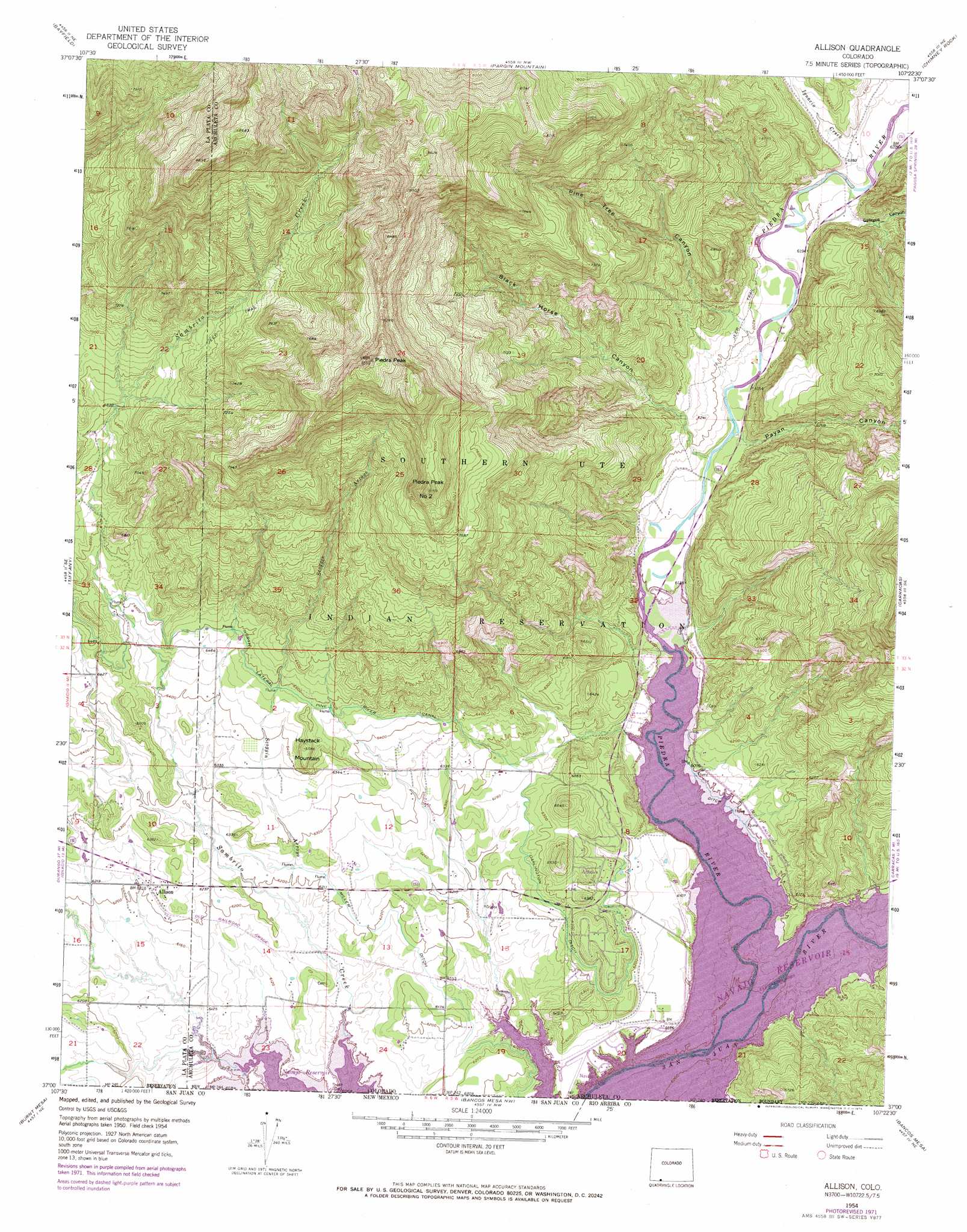
Allison Topo Map Colorado
To zoom in, hover over the map of Allison
USGS Topo Quad 37107a4 - 1:24,000 scale
| Topo Map Name: | Allison |
| USGS Topo Quad ID: | 37107a4 |
| Print Size: | ca. 21 1/4" wide x 27" high |
| Southeast Coordinates: | 37° N latitude / 107.375° W longitude |
| Map Center Coordinates: | 37.0625° N latitude / 107.4375° W longitude |
| U.S. State: | CO |
| Filename: | o37107a4.jpg |
| Download Map JPG Image: | Allison topo map 1:24,000 scale |
| Map Type: | Topographic |
| Topo Series: | 7.5´ |
| Map Scale: | 1:24,000 |
| Source of Map Images: | United States Geological Survey (USGS) |
| Alternate Map Versions: |
Allison CO 1954, updated 1955 Download PDF Buy paper map Allison CO 1954, updated 1955 Download PDF Buy paper map Allison CO 1954, updated 1965 Download PDF Buy paper map Allison CO 1954, updated 1965 Download PDF Buy paper map Allison CO 1954, updated 1973 Download PDF Buy paper map Allison CO 1954, updated 1973 Download PDF Buy paper map Allison CO 1954, updated 1978 Download PDF Buy paper map Allison CO 2010 Download PDF Buy paper map Allison CO 2013 Download PDF Buy paper map Allison CO 2016 Download PDF Buy paper map |
1:24,000 Topo Quads surrounding Allison
Rules Hill |
Ludwig Mountain |
Baldy Mountain |
Devil Mountain |
Chris Mountain |
Gem Village |
Bayfield |
Pargin Mountain |
Chimney Rock |
Lonetree Canyon |
Ignacio |
Tiffany |
Allison |
Carracas |
Pagosa Junction |
Anastacio Spring |
Burnt Mesa |
Bancos Mesa Nw |
Bancos Mesa |
Carracas Canyon |
Archuleta |
Navajo Dam |
Gomez Ranch |
Espinosa Ranch |
Bixler Ranch |
> Back to 37107a1 at 1:100,000 scale
> Back to 37106a1 at 1:250,000 scale
> Back to U.S. Topo Maps home
Allison topo map: Gazetteer
Allison: Airports
Navajo Landing Strip elevation 1863m 6112′Allison: Canals
Darlington Ditch elevation 1908m 6259′Miller Ditch elevation 1893m 6210′
North Pine River Lateral elevation 1979m 6492′
Allison: Populated Places
Allison elevation 1895m 6217′Arboles elevation 1914m 6279′
Allison: Streams
Ignacio Creek elevation 1897m 6223′Piedra River elevation 1856m 6089′
Scoggin Arroyo elevation 1879m 6164′
Allison: Summits
Haystack Mountain elevation 2009m 6591′Piedra Peak elevation 2581m 8467′
Piedra Peak Number 2 elevation 2481m 8139′
Allison: Valleys
Black Horse Canyon elevation 1872m 6141′Gallegos Canyon elevation 1899m 6230′
Payan Canyon elevation 1875m 6151′
Pine Tree Canyon elevation 1912m 6272′
Allison digital topo map on disk
Buy this Allison topo map showing relief, roads, GPS coordinates and other geographical features, as a high-resolution digital map file on DVD: