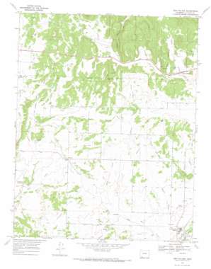
Gem Village Topo Map Colorado
To zoom in, hover over the map of Gem Village
USGS Topo Quad 37107b6 - 1:24,000 scale
| Topo Map Name: | Gem Village |
| USGS Topo Quad ID: | 37107b6 |
| Print Size: | ca. 21 1/4" wide x 27" high |
| Southeast Coordinates: | 37.125° N latitude / 107.625° W longitude |
| Map Center Coordinates: | 37.1875° N latitude / 107.6875° W longitude |
| U.S. State: | CO |
| Filename: | o37107b6.jpg |
| Download Map JPG Image: | Gem Village topo map 1:24,000 scale |
| Map Type: | Topographic |
| Topo Series: | 7.5´ |
| Map Scale: | 1:24,000 |
| Source of Map Images: | United States Geological Survey (USGS) |
| Alternate Map Versions: |
Gem Village CO 1968, updated 1972 Download PDF Buy paper map Gem Village CO 2010 Download PDF Buy paper map Gem Village CO 2013 Download PDF Buy paper map Gem Village CO 2016 Download PDF Buy paper map |
1:24,000 Topo Quads surrounding Gem Village
> Back to 37107a1 at 1:100,000 scale
> Back to 37106a1 at 1:250,000 scale
> Back to U.S. Topo Maps home
Gem Village topo map: Gazetteer
Gem Village: Canals
Doctor Morrison Ditch elevation 2042m 6699′King Consolidated Ditch elevation 2098m 6883′
Morrison Consolidated Ditch elevation 2040m 6692′
Pioneer Ditch elevation 2080m 6824′
Ridge Ditch elevation 2086m 6843′
Gem Village: Parks
Ute Park elevation 1973m 6473′Gem Village: Populated Places
Gem Village elevation 2082m 6830′Oxford elevation 2012m 6601′
Gem Village: Valleys
Brice Canyon elevation 2028m 6653′Hartman Canyon elevation 2073m 6801′
Holman Canyon elevation 2123m 6965′
Lone Pine Gulch elevation 2043m 6702′
Long Hollow elevation 2049m 6722′
Yeager Canyon elevation 2095m 6873′
Gem Village digital topo map on disk
Buy this Gem Village topo map showing relief, roads, GPS coordinates and other geographical features, as a high-resolution digital map file on DVD:


