Cowhorn Valley Topo Map California
To zoom in, hover over the map of Cowhorn Valley
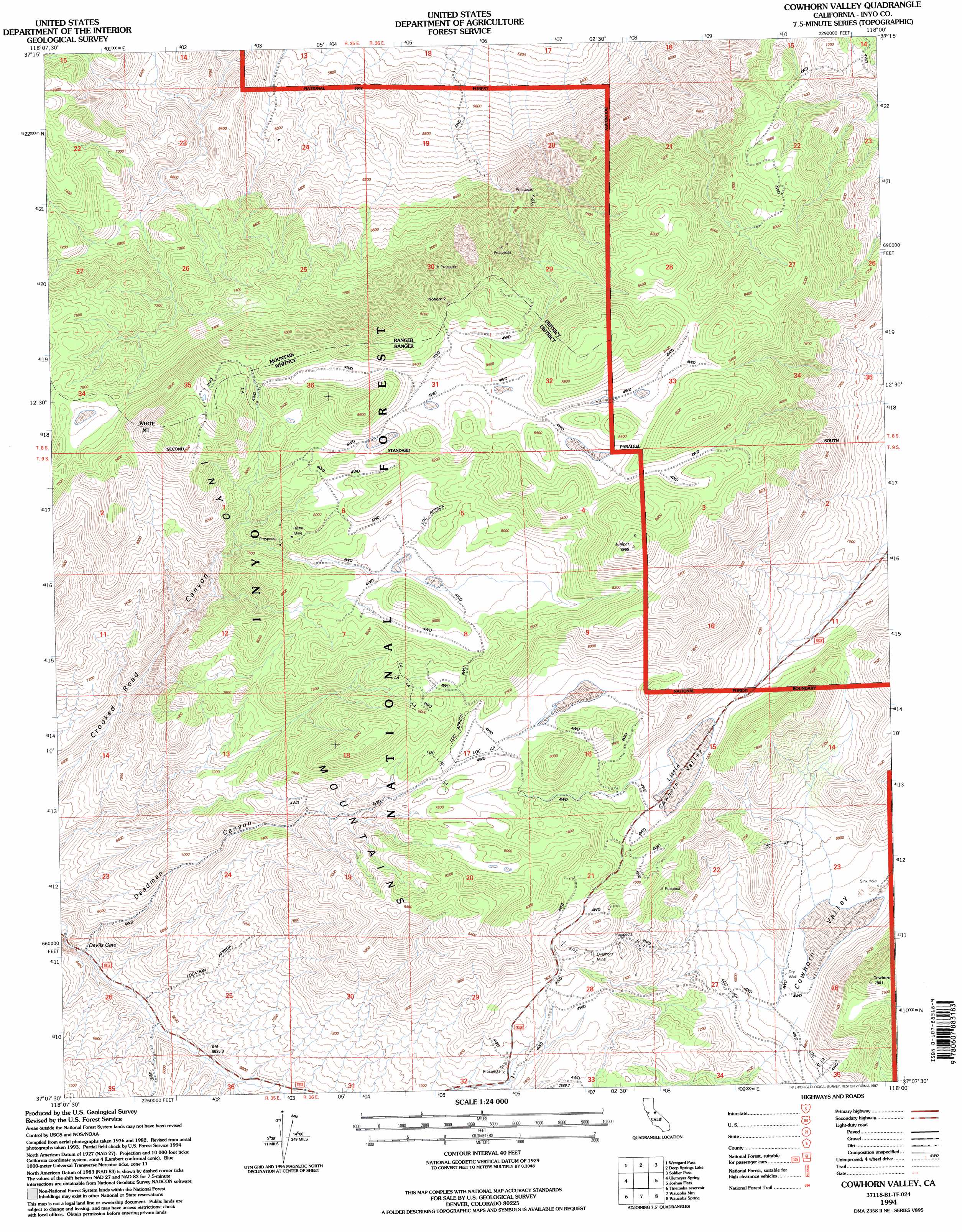
USGS Topo Quad 37118b1 - 1:24,000 scale
| Topo Map Name: | Cowhorn Valley |
| USGS Topo Quad ID: | 37118b1 |
| Print Size: | ca. 21 1/4" wide x 27" high |
| Southeast Coordinates: | 37.125° N latitude / 118° W longitude |
| Map Center Coordinates: | 37.1875° N latitude / 118.0625° W longitude |
| U.S. State: | CA |
| Filename: | o37118b1.jpg |
| Download Map JPG Image: | Cowhorn Valley topo map 1:24,000 scale |
| Map Type: | Topographic |
| Topo Series: | 7.5´ |
| Map Scale: | 1:24,000 |
| Source of Map Images: | United States Geological Survey (USGS) |
| Alternate Map Versions: |
Cowhorn Valley CA 1987, updated 1987 Download PDF Buy paper map Cowhorn Valley CA 1987, updated 1994 Download PDF Buy paper map Cowhorn Valley CA 1994, updated 1997 Download PDF Buy paper map Cowhorn Valley CA 2012 Download PDF Buy paper map Cowhorn Valley CA 2015 Download PDF Buy paper map |
| FStopo: | US Forest Service topo Cowhorn Valley is available: Download FStopo PDF Download FStopo TIF |
1:24,000 Topo Quads surrounding Cowhorn Valley
Laws |
Blanco Mountain |
Crooked Creek |
Chocolate Mountain |
Sylvania Canyon |
Poleta Canyon |
Westgard Pass |
Deep Springs Lake |
Soldier Pass |
Horse Thief Canyon |
Big Pine |
Uhlmeyer Spring |
Cowhorn Valley |
Joshua Flats |
East Of Joshua Flats |
Fish Springs |
Tinemaha Reservoir |
Waucoba Mountain |
Waucoba Spring |
East Of Waucoba Spring |
Aberdeen |
Blackrock |
Mazourka Peak |
Waucoba Canyon |
East Of Waucoba Canyon |
> Back to 37118a1 at 1:100,000 scale
> Back to 37118a1 at 1:250,000 scale
> Back to U.S. Topo Maps home
Cowhorn Valley topo map: Gazetteer
Cowhorn Valley: Flats
Haway Meadows (historical) elevation 2099m 6886′Little Cowhorn Valley elevation 2196m 7204′
Cowhorn Valley: Mines
Overholtz Mine elevation 2326m 7631′Riche Mine elevation 2419m 7936′
Cowhorn Valley: Valleys
Cowhorn Valley elevation 2072m 6797′Deadman Canyon elevation 1921m 6302′
Cowhorn Valley digital topo map on disk
Buy this Cowhorn Valley topo map showing relief, roads, GPS coordinates and other geographical features, as a high-resolution digital map file on DVD: