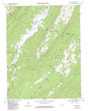
Burnsville Topo Map Virginia
To zoom in, hover over the map of Burnsville
USGS Topo Quad 38079b6 - 1:24,000 scale
| Topo Map Name: | Burnsville |
| USGS Topo Quad ID: | 38079b6 |
| Print Size: | ca. 21 1/4" wide x 27" high |
| Southeast Coordinates: | 38.125° N latitude / 79.625° W longitude |
| Map Center Coordinates: | 38.1875° N latitude / 79.6875° W longitude |
| U.S. State: | VA |
| Filename: | o38079b6.jpg |
| Download Map JPG Image: | Burnsville topo map 1:24,000 scale |
| Map Type: | Topographic |
| Topo Series: | 7.5´ |
| Map Scale: | 1:24,000 |
| Source of Map Images: | United States Geological Survey (USGS) |
| Alternate Map Versions: |
Burnsville VA 1969, updated 1970 Download PDF Buy paper map Burnsville VA 1969, updated 1980 Download PDF Buy paper map Burnsville VA 1969, updated 1986 Download PDF Buy paper map Burnsville VA 2011 Download PDF Buy paper map Burnsville VA 2013 Download PDF Buy paper map Burnsville VA 2016 Download PDF Buy paper map |
| FStopo: | US Forest Service topo Burnsville is available: Download FStopo PDF Download FStopo TIF |
1:24,000 Topo Quads surrounding Burnsville
> Back to 38079a1 at 1:100,000 scale
> Back to 38078a1 at 1:250,000 scale
> Back to U.S. Topo Maps home
Burnsville topo map: Gazetteer
Burnsville: Gaps
Bolar Gap elevation 704m 2309′Burnsville: Lakes
Big Pond elevation 775m 2542′Burnsville: Populated Places
Bethel elevation 812m 2664′Bolar elevation 682m 2237′
Burnsville elevation 725m 2378′
Burnsville: Ridges
Chestnut Ridge elevation 773m 2536′Duncan Ridge elevation 953m 3126′
Piney Ridge elevation 1033m 3389′
Rocky Ridge elevation 912m 2992′
Burnsville: Springs
Bolar Spring elevation 684m 2244′Burnsville: Streams
Barnetts Run elevation 607m 1991′Bolar Run elevation 636m 2086′
Cave Run elevation 591m 1938′
Givens Run elevation 619m 2030′
Gulley Run elevation 651m 2135′
Laurel Run elevation 717m 2352′
Little Valley Run elevation 679m 2227′
Mill Run elevation 609m 1998′
Morris Run elevation 626m 2053′
Paddy Bee Tree Run elevation 741m 2431′
Peak Run elevation 634m 2080′
Rocky Run elevation 592m 1942′
Stony Run elevation 633m 2076′
Burnsville: Summits
Duncan Knob elevation 1164m 3818′Gum Tree Mountain elevation 943m 3093′
Tower Hill Mountain elevation 989m 3244′
White Rock Mountain elevation 971m 3185′
Wilson Mountain elevation 926m 3038′
Burnsville: Trails
Fort Lewis Trail elevation 806m 2644′McGuffin Trail elevation 1046m 3431′
Tower Hill Mountain Trail elevation 943m 3093′
Burnsville: Valleys
Daggy Hollow elevation 717m 2352′Little Valley elevation 679m 2227′
Pritt Hollow elevation 633m 2076′
Stillhouse Hollow elevation 603m 1978′
Burnsville digital topo map on disk
Buy this Burnsville topo map showing relief, roads, GPS coordinates and other geographical features, as a high-resolution digital map file on DVD:
Western Virginia & Southern West Virginia
Buy digital topo maps: Western Virginia & Southern West Virginia


