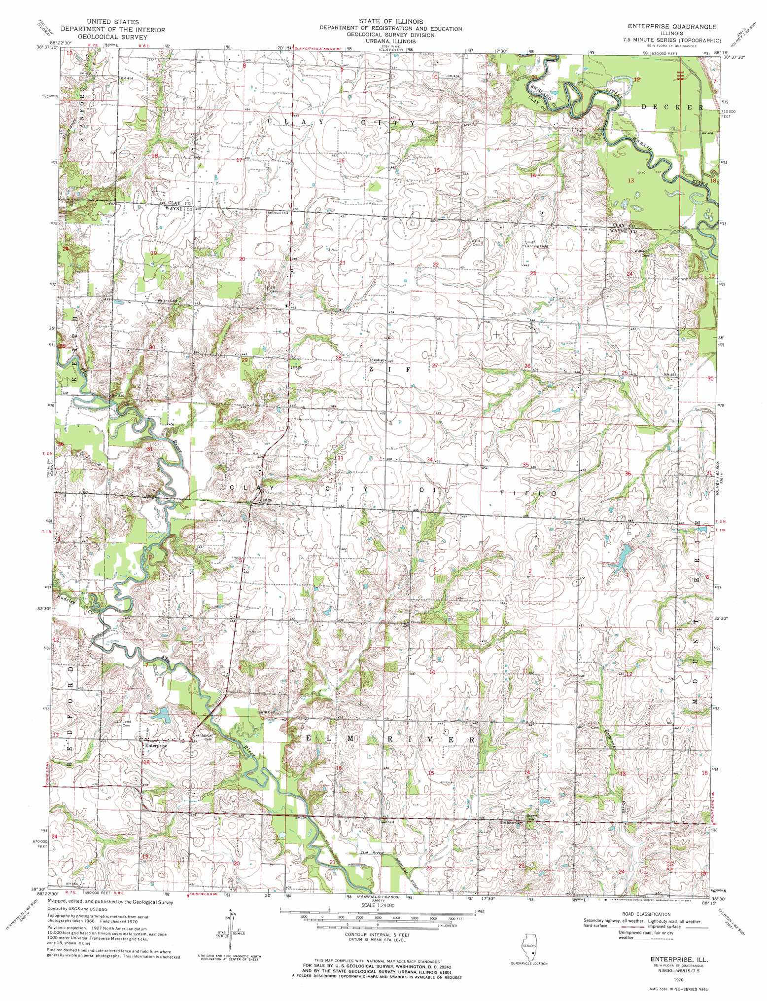
Enterprise Topo Map Illinois
To zoom in, hover over the map of Enterprise
USGS Topo Quad 38088e3 - 1:24,000 scale
| Topo Map Name: | Enterprise |
| USGS Topo Quad ID: | 38088e3 |
| Print Size: | ca. 21 1/4" wide x 27" high |
| Southeast Coordinates: | 38.5° N latitude / 88.25° W longitude |
| Map Center Coordinates: | 38.5625° N latitude / 88.3125° W longitude |
| U.S. State: | IL |
| Filename: | o38088e3.jpg |
| Download Map JPG Image: | Enterprise topo map 1:24,000 scale |
| Map Type: | Topographic |
| Topo Series: | 7.5´ |
| Map Scale: | 1:24,000 |
| Source of Map Images: | United States Geological Survey (USGS) |
| Alternate Map Versions: |
Enterprise IL 1970, updated 1971 Download PDF Buy paper map Enterprise IL 2012 Download PDF Buy paper map Enterprise IL 2015 Download PDF Buy paper map |
1:24,000 Topo Quads surrounding Enterprise
Louisville West |
Louisville East |
Sailor Springs |
Wakefield |
Dundas |
Xenia Ne |
Flora |
Clay City |
Noble |
Olney |
Johnsonville |
Cisne |
Enterprise |
Mount Erie |
West Salem |
Crisp |
Geff |
Fairfield |
Albion Nw |
Albion North |
Wayne City |
Boylestown |
Burnt Prairie |
Golden Gate |
Albion South |
> Back to 38088e1 at 1:100,000 scale
> Back to 38088a1 at 1:250,000 scale
> Back to U.S. Topo Maps home
Enterprise topo map: Gazetteer
Enterprise: Airports
Smith Landing Field elevation 134m 439′Enterprise: Dams
Robinson Lake Dam elevation 137m 449′Enterprise: Oilfields
Clay City Oil Field elevation 144m 472′Enterprise: Populated Places
Enterprise elevation 133m 436′Enterprise: Post Offices
Zif Post Office (historical) elevation 140m 459′Enterprise: Reservoirs
Robinson Lake elevation 137m 449′Enterprise: Streams
Endsley Creek elevation 120m 393′Hog Run Creek elevation 122m 400′
Enterprise digital topo map on disk
Buy this Enterprise topo map showing relief, roads, GPS coordinates and other geographical features, as a high-resolution digital map file on DVD: