Wayne City Topo Map Illinois
To zoom in, hover over the map of Wayne City
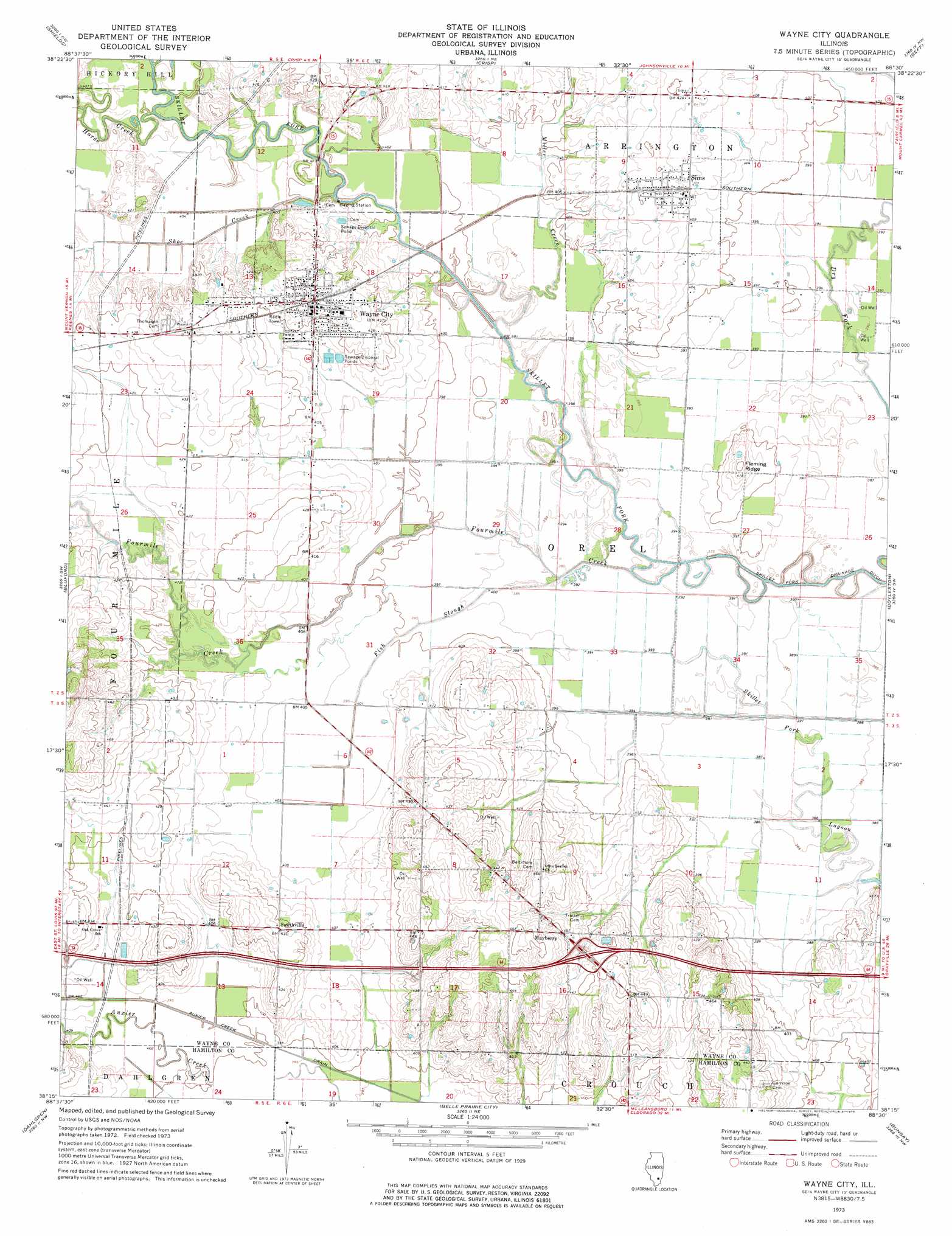
USGS Topo Quad 38088c5 - 1:24,000 scale
| Topo Map Name: | Wayne City |
| USGS Topo Quad ID: | 38088c5 |
| Print Size: | ca. 21 1/4" wide x 27" high |
| Southeast Coordinates: | 38.25° N latitude / 88.5° W longitude |
| Map Center Coordinates: | 38.3125° N latitude / 88.5625° W longitude |
| U.S. State: | IL |
| Filename: | o38088c5.jpg |
| Download Map JPG Image: | Wayne City topo map 1:24,000 scale |
| Map Type: | Topographic |
| Topo Series: | 7.5´ |
| Map Scale: | 1:24,000 |
| Source of Map Images: | United States Geological Survey (USGS) |
| Alternate Map Versions: |
Wayne City IL 1973, updated 1975 Download PDF Buy paper map Wayne City IL 2012 Download PDF Buy paper map Wayne City IL 2015 Download PDF Buy paper map |
1:24,000 Topo Quads surrounding Wayne City
Iuka |
Orchardville |
Johnsonville |
Cisne |
Enterprise |
Harmony |
Shields |
Crisp |
Geff |
Fairfield |
Opdyke |
Bluford |
Wayne City |
Boylestown |
Burnt Prairie |
Spring Garden |
Dahlgren |
Belle Prairie City |
Bungay |
Springerton |
Ewing |
Macedonia |
Mcleansboro |
Thackeray |
Enfield |
> Back to 38088a1 at 1:100,000 scale
> Back to 38088a1 at 1:250,000 scale
> Back to U.S. Topo Maps home
Wayne City topo map: Gazetteer
Wayne City: Airports
Skillet Fork Farm Airport elevation 129m 423′Wayne City: Crossings
Interchange 100 elevation 135m 442′Wayne City: Populated Places
Mayberry elevation 138m 452′Sims elevation 125m 410′
Smithville elevation 131m 429′
Wayne City elevation 132m 433′
Wayne City: Ridges
Fleming Ridge elevation 130m 426′Wayne City: Streams
Fish Slough elevation 116m 380′Fourmile Creek elevation 115m 377′
Horse Creek elevation 119m 390′
Miller Creek elevation 119m 390′
Shoe Creek elevation 120m 393′
Wayne City digital topo map on disk
Buy this Wayne City topo map showing relief, roads, GPS coordinates and other geographical features, as a high-resolution digital map file on DVD: