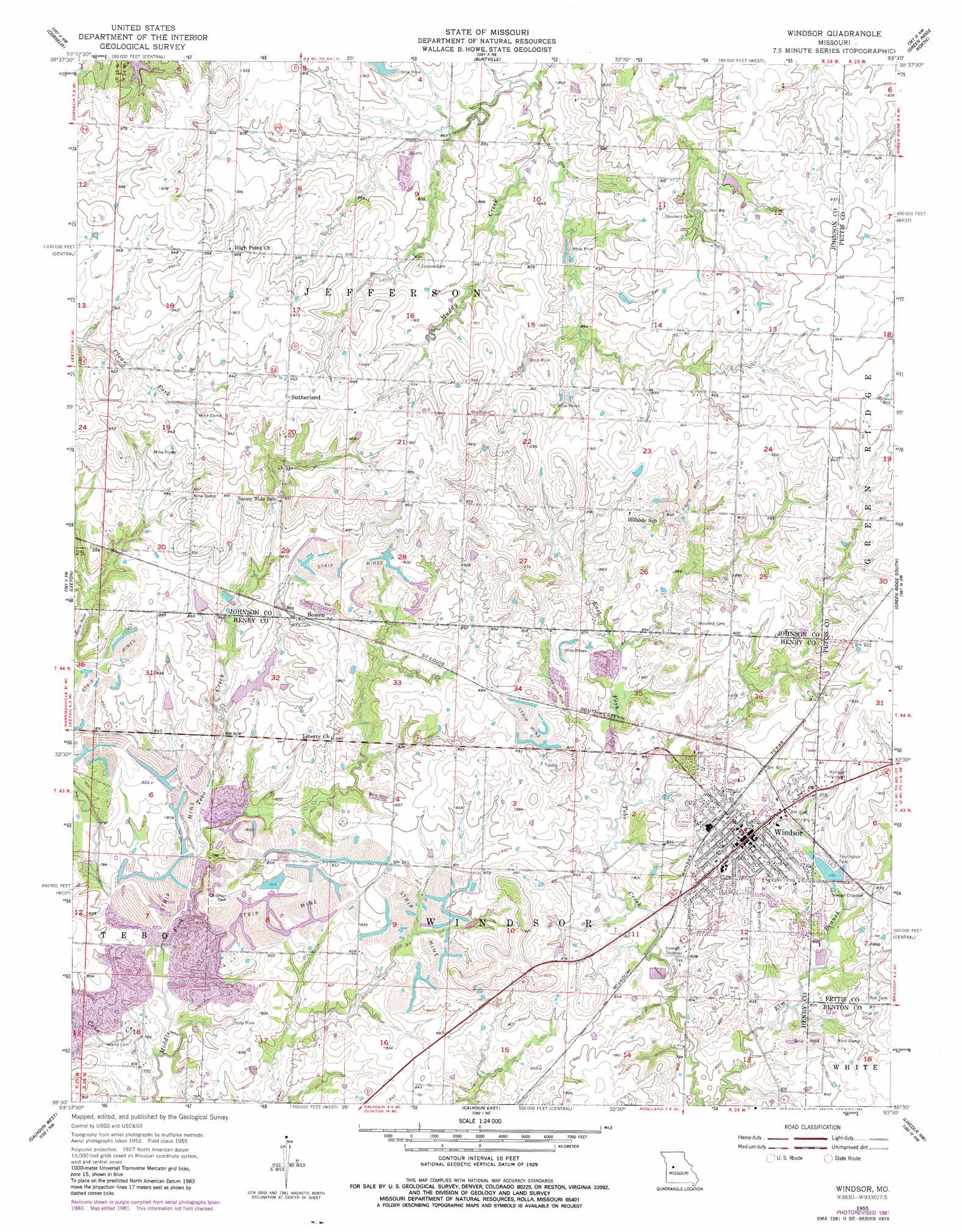
Windsor Topo Map Missouri
To zoom in, hover over the map of Windsor
USGS Topo Quad 38093e5 - 1:24,000 scale
| Topo Map Name: | Windsor |
| USGS Topo Quad ID: | 38093e5 |
| Print Size: | ca. 21 1/4" wide x 27" high |
| Southeast Coordinates: | 38.5° N latitude / 93.5° W longitude |
| Map Center Coordinates: | 38.5625° N latitude / 93.5625° W longitude |
| U.S. State: | MO |
| Filename: | o38093e5.jpg |
| Download Map JPG Image: | Windsor topo map 1:24,000 scale |
| Map Type: | Topographic |
| Topo Series: | 7.5´ |
| Map Scale: | 1:24,000 |
| Source of Map Images: | United States Geological Survey (USGS) |
| Alternate Map Versions: |
Windsor MO 1955, updated 1956 Download PDF Buy paper map Windsor MO 1955, updated 1982 Download PDF Buy paper map Windsor MO 2011 Download PDF Buy paper map Windsor MO 2014 Download PDF Buy paper map |
1:24,000 Topo Quads surrounding Windsor
Warrensburg West |
Warrensburg East |
Knob Noster |
La Monte |
Hughesville |
Centerview |
Cornelia |
Burtville |
Green Ridge North |
Sedalia West |
Chilhowee |
Leeton |
Windsor |
Green Ridge South |
Ionia |
Clinton North |
Calhoun West |
Calhoun East |
Lincoln Nw |
Lincoln |
Clinton South |
Gaines |
Leesville |
Shawnee Bend |
Lincoln Se |
> Back to 38093e1 at 1:100,000 scale
> Back to 38092a1 at 1:250,000 scale
> Back to U.S. Topo Maps home
Windsor topo map: Gazetteer
Windsor: Airports
Ferguson Farms Airport elevation 288m 944′Windsor Municipal Airport elevation 284m 931′
Windsor: Dams
Barber Lake Section 31 Dam elevation 252m 826′Barber Lake Section 32 Dam elevation 250m 820′
Callaway Lake Dam elevation 255m 836′
Netsch Lake Dam elevation 256m 839′
Windsor Farrington Park Lake Dam elevation 256m 839′
Young Lake Dam elevation 269m 882′
Windsor: Parks
Farrington Park elevation 262m 859′Windsor Fairground elevation 281m 921′
Windsor: Populated Places
Bowen elevation 258m 846′Henrietta elevation 287m 941′
Sutherland elevation 297m 974′
Windsor elevation 278m 912′
Windsor: Post Offices
Henrietta Post Office (historical) elevation 287m 941′Windsor: Reservoirs
Windsor Farrington Park Lake elevation 256m 839′Windsor: Streams
Coon Creek elevation 229m 751′Elm Branch elevation 240m 787′
Windsor digital topo map on disk
Buy this Windsor topo map showing relief, roads, GPS coordinates and other geographical features, as a high-resolution digital map file on DVD: