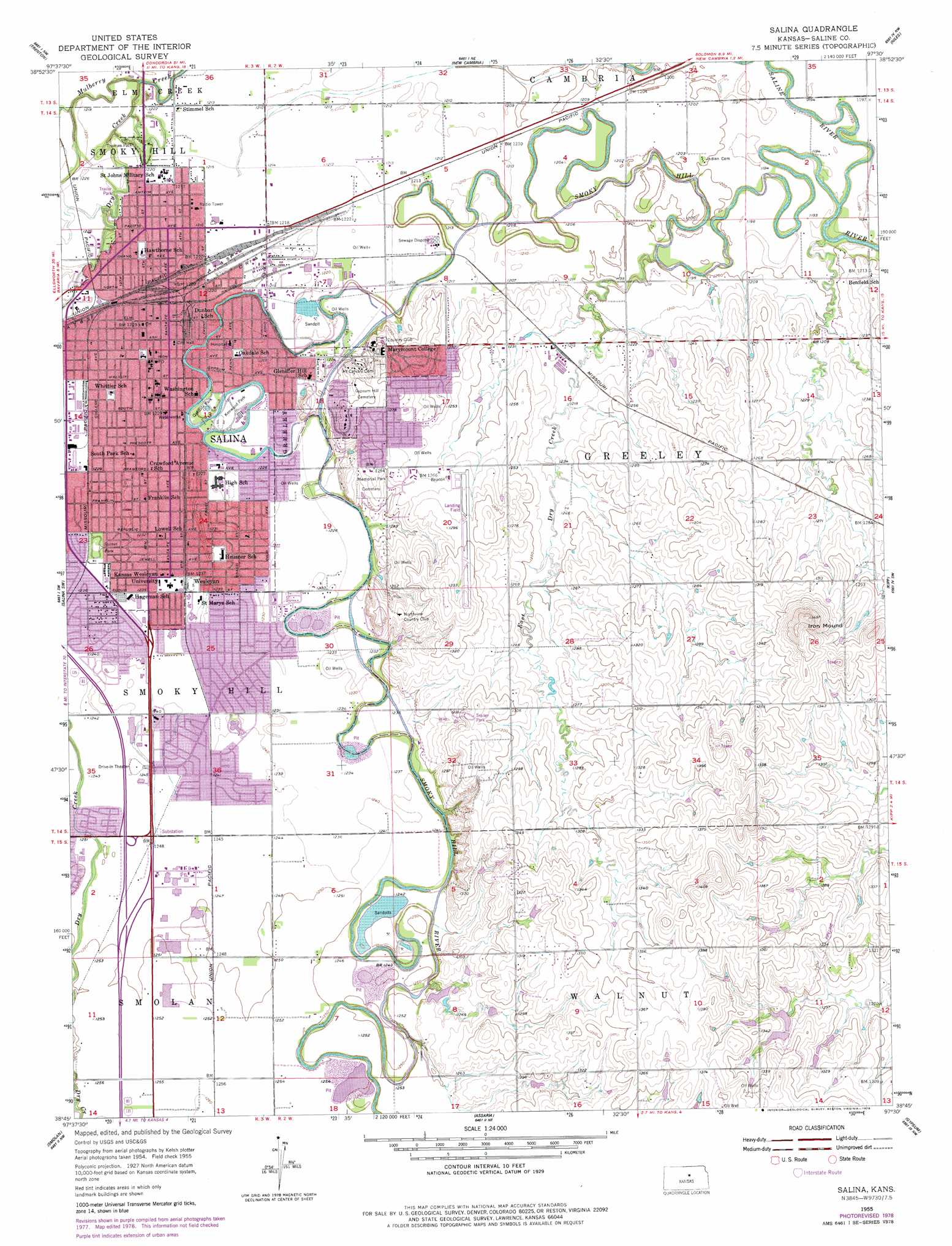
Salina Topo Map Kansas
To zoom in, hover over the map of Salina
USGS Topo Quad 38097g5 - 1:24,000 scale
| Topo Map Name: | Salina |
| USGS Topo Quad ID: | 38097g5 |
| Print Size: | ca. 21 1/4" wide x 27" high |
| Southeast Coordinates: | 38.75° N latitude / 97.5° W longitude |
| Map Center Coordinates: | 38.8125° N latitude / 97.5625° W longitude |
| U.S. State: | KS |
| Filename: | o38097g5.jpg |
| Download Map JPG Image: | Salina topo map 1:24,000 scale |
| Map Type: | Topographic |
| Topo Series: | 7.5´ |
| Map Scale: | 1:24,000 |
| Source of Map Images: | United States Geological Survey (USGS) |
| Alternate Map Versions: |
Salina KS 1955, updated 1956 Download PDF Buy paper map Salina KS 1955, updated 1978 Download PDF Buy paper map Salina KS 2009 Download PDF Buy paper map Salina KS 2012 Download PDF Buy paper map Salina KS 2015 Download PDF Buy paper map |
1:24,000 Topo Quads surrounding Salina
Tescott Se |
Minneapolis South |
Bennington |
Vine Creek |
Manchester |
Culver |
Trenton |
New Cambria |
Niles |
Solomon |
Brookville |
Salina Sw |
Salina |
Kipp |
Holland |
Falun |
Smolan |
Assaria |
Gypsum |
Carlton |
Marquette |
Lindsborg |
Lindsborg Se |
Roxbury |
Gypsum Se |
> Back to 38097e1 at 1:100,000 scale
> Back to 38096a1 at 1:250,000 scale
> Back to U.S. Topo Maps home
Salina topo map: Gazetteer
Salina: Airports
Salina Airport (historical) elevation 394m 1292′Silers Plane Valley Airport elevation 367m 1204′
Tamarack Landing Field elevation 366m 1200′
Salina: Parks
Kenwood Park elevation 372m 1220′Oakdale Park elevation 372m 1220′
Sunset Park elevation 376m 1233′
Thomas Park elevation 369m 1210′
Salina: Populated Places
Salina elevation 373m 1223′Salina: Streams
Dry Creek elevation 365m 1197′East Dry Creek elevation 360m 1181′
Saline River elevation 357m 1171′
Salina: Summits
Iron Mound elevation 454m 1489′Salina digital topo map on disk
Buy this Salina topo map showing relief, roads, GPS coordinates and other geographical features, as a high-resolution digital map file on DVD: