Holtwold Store Topo Map Colorado
To zoom in, hover over the map of Holtwold Store
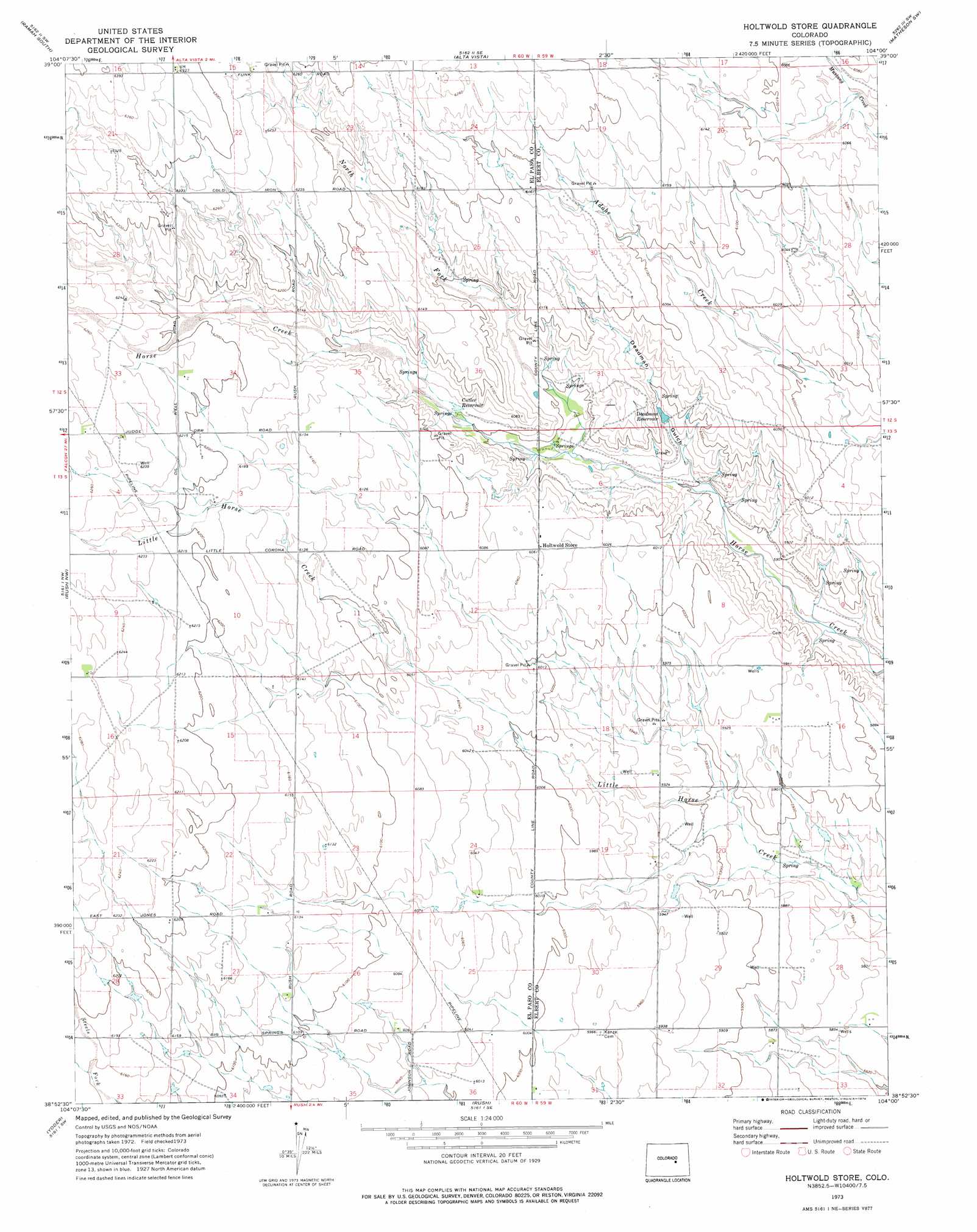
USGS Topo Quad 38104h1 - 1:24,000 scale
| Topo Map Name: | Holtwold Store |
| USGS Topo Quad ID: | 38104h1 |
| Print Size: | ca. 21 1/4" wide x 27" high |
| Southeast Coordinates: | 38.875° N latitude / 104° W longitude |
| Map Center Coordinates: | 38.9375° N latitude / 104.0625° W longitude |
| U.S. State: | CO |
| Filename: | o38104h1.jpg |
| Download Map JPG Image: | Holtwold Store topo map 1:24,000 scale |
| Map Type: | Topographic |
| Topo Series: | 7.5´ |
| Map Scale: | 1:24,000 |
| Source of Map Images: | United States Geological Survey (USGS) |
| Alternate Map Versions: |
Holtwold Store CO 1973, updated 1976 Download PDF Buy paper map Holtwold Store CO 2010 Download PDF Buy paper map Holtwold Store CO 2013 Download PDF Buy paper map Holtwold Store CO 2016 Download PDF Buy paper map |
1:24,000 Topo Quads surrounding Holtwold Store
Fondis |
Ramah North |
Simla |
Matheson |
Matheson Ne |
Calhan |
Ramah South |
Alta Vista |
Matheson Sw |
Matheson Se |
Holcolm Hills |
Rush Nw |
Holtwold Store |
Kutch Nw |
Kutch |
Big Springs Ranch |
Yoder |
Rush |
Kutch Sw |
Kutch Se |
Hanover Ne |
Truckton |
Truckton Ne |
Sanborn Reservoir |
Peace Valley |
> Back to 38104e1 at 1:100,000 scale
> Back to 38104a1 at 1:250,000 scale
> Back to U.S. Topo Maps home
Holtwold Store topo map: Gazetteer
Holtwold Store: Reservoirs
Cutler Reservoir elevation 1837m 6026′Deadman Reservoir elevation 1818m 5964′
Holtwold Store: Streams
North Fork Horse Creek elevation 1812m 5944′Holtwold Store: Valleys
Deadman Gulch elevation 1798m 5898′Holtwold Store digital topo map on disk
Buy this Holtwold Store topo map showing relief, roads, GPS coordinates and other geographical features, as a high-resolution digital map file on DVD: