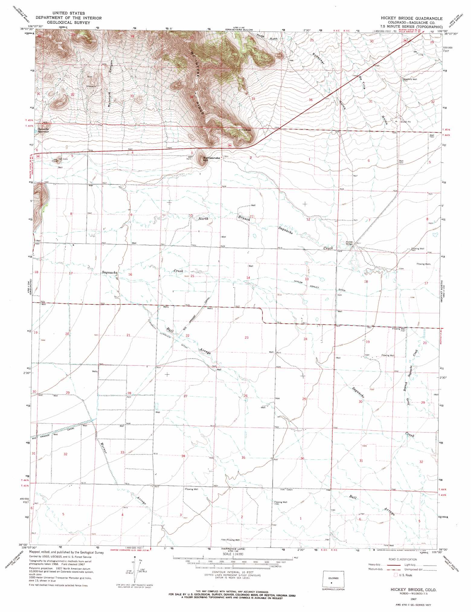
Hickey Bridge Topo Map Colorado
To zoom in, hover over the map of Hickey Bridge
USGS Topo Quad 38106a1 - 1:24,000 scale
| Topo Map Name: | Hickey Bridge |
| USGS Topo Quad ID: | 38106a1 |
| Print Size: | ca. 21 1/4" wide x 27" high |
| Southeast Coordinates: | 38° N latitude / 106° W longitude |
| Map Center Coordinates: | 38.0625° N latitude / 106.0625° W longitude |
| U.S. State: | CO |
| Filename: | o38106a1.jpg |
| Download Map JPG Image: | Hickey Bridge topo map 1:24,000 scale |
| Map Type: | Topographic |
| Topo Series: | 7.5´ |
| Map Scale: | 1:24,000 |
| Source of Map Images: | United States Geological Survey (USGS) |
| Alternate Map Versions: |
Hickey Bridge CO 1967, updated 1970 Download PDF Buy paper map Hickey Bridge CO 2010 Download PDF Buy paper map Hickey Bridge CO 2013 Download PDF Buy paper map Hickey Bridge CO 2016 Download PDF Buy paper map |
1:24,000 Topo Quads surrounding Hickey Bridge
Chester |
Bonanza |
Whale Hill |
Bushnell Peak |
Coaldale |
Lake Mountain Ne |
Klondike Mine |
Graveyard Gulch |
Villa Grove |
Valley View Hot Springs |
Laughlin Gulch |
Saguache |
Hickey Bridge |
Moffat North |
Mirage |
Lime Creek |
Swede Corners |
Harrence Lake |
Moffat South |
Sheds Camp |
Twin Mountains Se |
La Garita |
Center North |
Deadman Camp Sw |
Deadman Camp |
> Back to 38106a1 at 1:100,000 scale
> Back to 38106a1 at 1:250,000 scale
> Back to U.S. Topo Maps home
Hickey Bridge topo map: Gazetteer
Hickey Bridge: Bridges
Hickey Bridge elevation 2319m 7608′Hickey Bridge: Canals
Taylor Ashley Ditch elevation 2322m 7618′Turnbull Lunguen Ditch elevation 2327m 7634′
Hickey Bridge: Summits
Rattlesnake Hill elevation 2398m 7867′Hickey Bridge: Valleys
De Tilla Gulch elevation 2327m 7634′McIntyre Canyon elevation 2348m 7703′
Proffit Gulch elevation 2422m 7946′
Schecker Gulch elevation 2327m 7634′
Hickey Bridge: Wells
Woodard Well elevation 2363m 7752′Hickey Bridge digital topo map on disk
Buy this Hickey Bridge topo map showing relief, roads, GPS coordinates and other geographical features, as a high-resolution digital map file on DVD: