Frankfort Topo Map Ohio
To zoom in, hover over the map of Frankfort
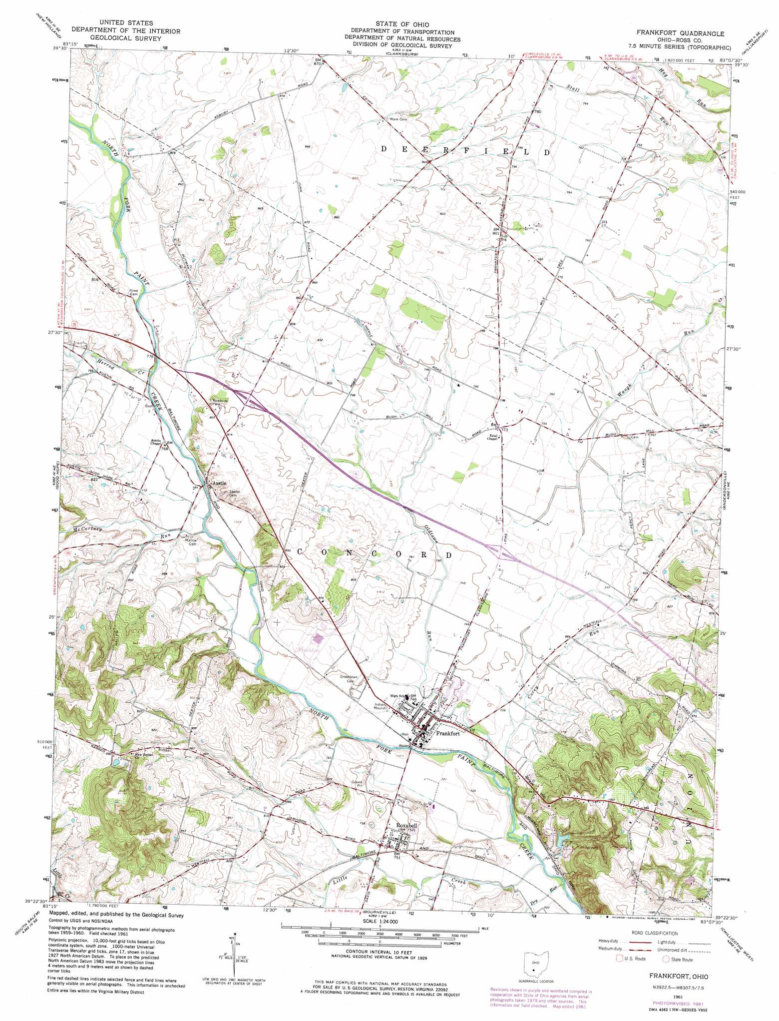
USGS Topo Quad 39083d2 - 1:24,000 scale
| Topo Map Name: | Frankfort |
| USGS Topo Quad ID: | 39083d2 |
| Print Size: | ca. 21 1/4" wide x 27" high |
| Southeast Coordinates: | 39.375° N latitude / 83.125° W longitude |
| Map Center Coordinates: | 39.4375° N latitude / 83.1875° W longitude |
| U.S. State: | OH |
| Filename: | o39083d2.jpg |
| Download Map JPG Image: | Frankfort topo map 1:24,000 scale |
| Map Type: | Topographic |
| Topo Series: | 7.5´ |
| Map Scale: | 1:24,000 |
| Source of Map Images: | United States Geological Survey (USGS) |
| Alternate Map Versions: |
Frankfort OH 1961, updated 1962 Download PDF Buy paper map Frankfort OH 1961, updated 1975 Download PDF Buy paper map Frankfort OH 1961, updated 1982 Download PDF Buy paper map Frankfort OH 2010 Download PDF Buy paper map Frankfort OH 2013 Download PDF Buy paper map Frankfort OH 2016 Download PDF Buy paper map |
1:24,000 Topo Quads surrounding Frankfort
Midway |
Mount Sterling |
Five Points |
Darbyville |
Ashville |
Washington Court House |
New Holland |
Clarksburg |
Williamsport |
Circleville |
New Martinsburg |
Good Hope |
Frankfort |
Andersonville |
Kingston |
Greenfield |
South Salem |
Bourneville |
Chillicothe West |
Chillicothe East |
Rainsboro |
Bainbridge |
Morgantown |
Summithill |
Waverly North |
> Back to 39083a1 at 1:100,000 scale
> Back to 39082a1 at 1:250,000 scale
> Back to U.S. Topo Maps home
Frankfort topo map: Gazetteer
Frankfort: Dams
Lake Hill Dam elevation 249m 816′Frankfort: Populated Places
Austin elevation 230m 754′Frankfort elevation 225m 738′
Roxabell elevation 229m 751′
Frankfort: Post Offices
Austin Post Office (historical) elevation 230m 754′Frankfort Post Office elevation 225m 738′
Roxabell Post Office (historical) elevation 229m 751′
Frankfort: Reservoirs
Lake Hill elevation 249m 816′Frankfort: Streams
Corey Run elevation 218m 715′Dewey Creek elevation 261m 856′
Dry Run elevation 216m 708′
Herrod Creek elevation 231m 757′
Little Creek elevation 217m 711′
McCortney Run elevation 228m 748′
Oldtown Run elevation 219m 718′
Frankfort digital topo map on disk
Buy this Frankfort topo map showing relief, roads, GPS coordinates and other geographical features, as a high-resolution digital map file on DVD:
 map DVD")