Bowersville Topo Map Ohio
To zoom in, hover over the map of Bowersville
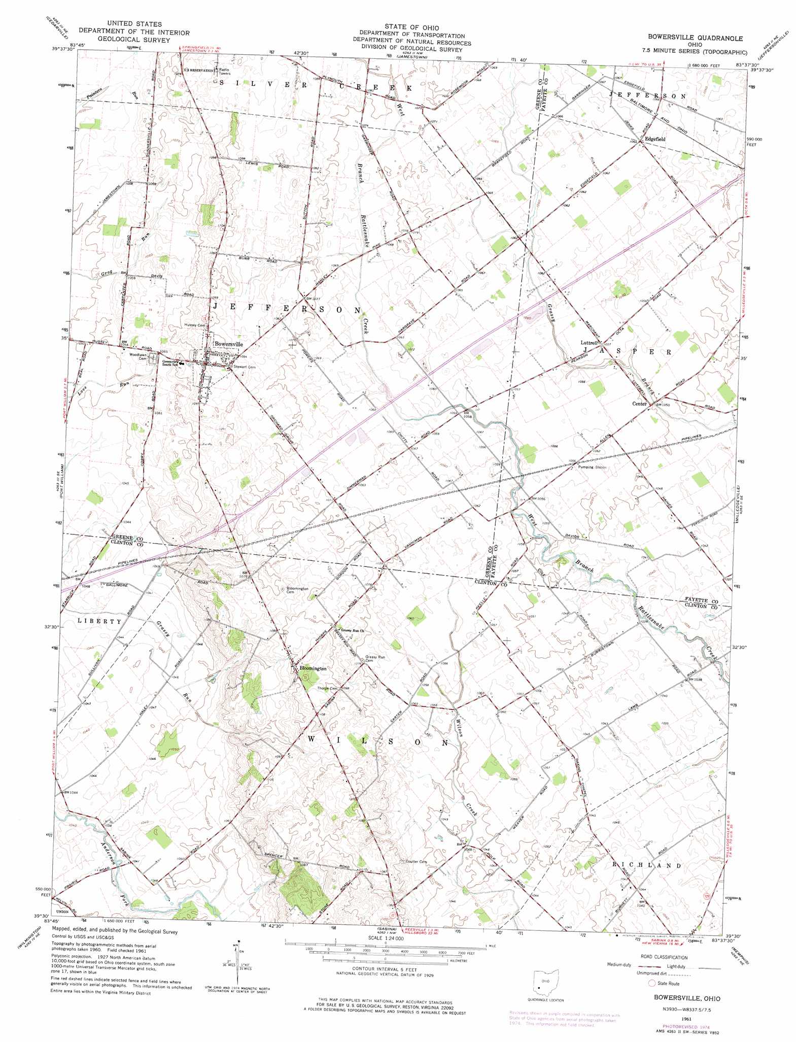
USGS Topo Quad 39083e6 - 1:24,000 scale
| Topo Map Name: | Bowersville |
| USGS Topo Quad ID: | 39083e6 |
| Print Size: | ca. 21 1/4" wide x 27" high |
| Southeast Coordinates: | 39.5° N latitude / 83.625° W longitude |
| Map Center Coordinates: | 39.5625° N latitude / 83.6875° W longitude |
| U.S. State: | OH |
| Filename: | o39083e6.jpg |
| Download Map JPG Image: | Bowersville topo map 1:24,000 scale |
| Map Type: | Topographic |
| Topo Series: | 7.5´ |
| Map Scale: | 1:24,000 |
| Source of Map Images: | United States Geological Survey (USGS) |
| Alternate Map Versions: |
Bowersville OH 1961, updated 1963 Download PDF Buy paper map Bowersville OH 1961, updated 1975 Download PDF Buy paper map Bowersville OH 2010 Download PDF Buy paper map Bowersville OH 2013 Download PDF Buy paper map Bowersville OH 2016 Download PDF Buy paper map |
1:24,000 Topo Quads surrounding Bowersville
Yellow Springs |
Clifton |
South Charleston |
Florence |
Walnut Run |
Xenia |
Cedarville |
Jamestown |
Jeffersonville |
Midway |
New Burlington |
Port William |
Bowersville |
Milledgeville |
Washington Court House |
Clarksville |
Wilmington |
Sabina |
Memphis |
New Martinsburg |
Blanchester |
Martinsville |
New Vienna |
Leesburg |
Greenfield |
> Back to 39083e1 at 1:100,000 scale
> Back to 39082a1 at 1:250,000 scale
> Back to U.S. Topo Maps home
Bowersville topo map: Gazetteer
Bowersville: Crossings
Interchange 58 elevation 331m 1085′Bowersville: Populated Places
Bloomington elevation 335m 1099′Bowersville elevation 332m 1089′
Edgefield elevation 324m 1062′
Luttrell elevation 321m 1053′
Pearsons (historical) elevation 323m 1059′
Bowersville: Post Offices
Bowersville Post Office elevation 332m 1089′Edgefield Post Office (historical) elevation 324m 1062′
Lutrell Post Office (historical) elevation 321m 1053′
Pearson Post Office (historical) elevation 323m 1059′
Bowersville digital topo map on disk
Buy this Bowersville topo map showing relief, roads, GPS coordinates and other geographical features, as a high-resolution digital map file on DVD:
 map DVD")