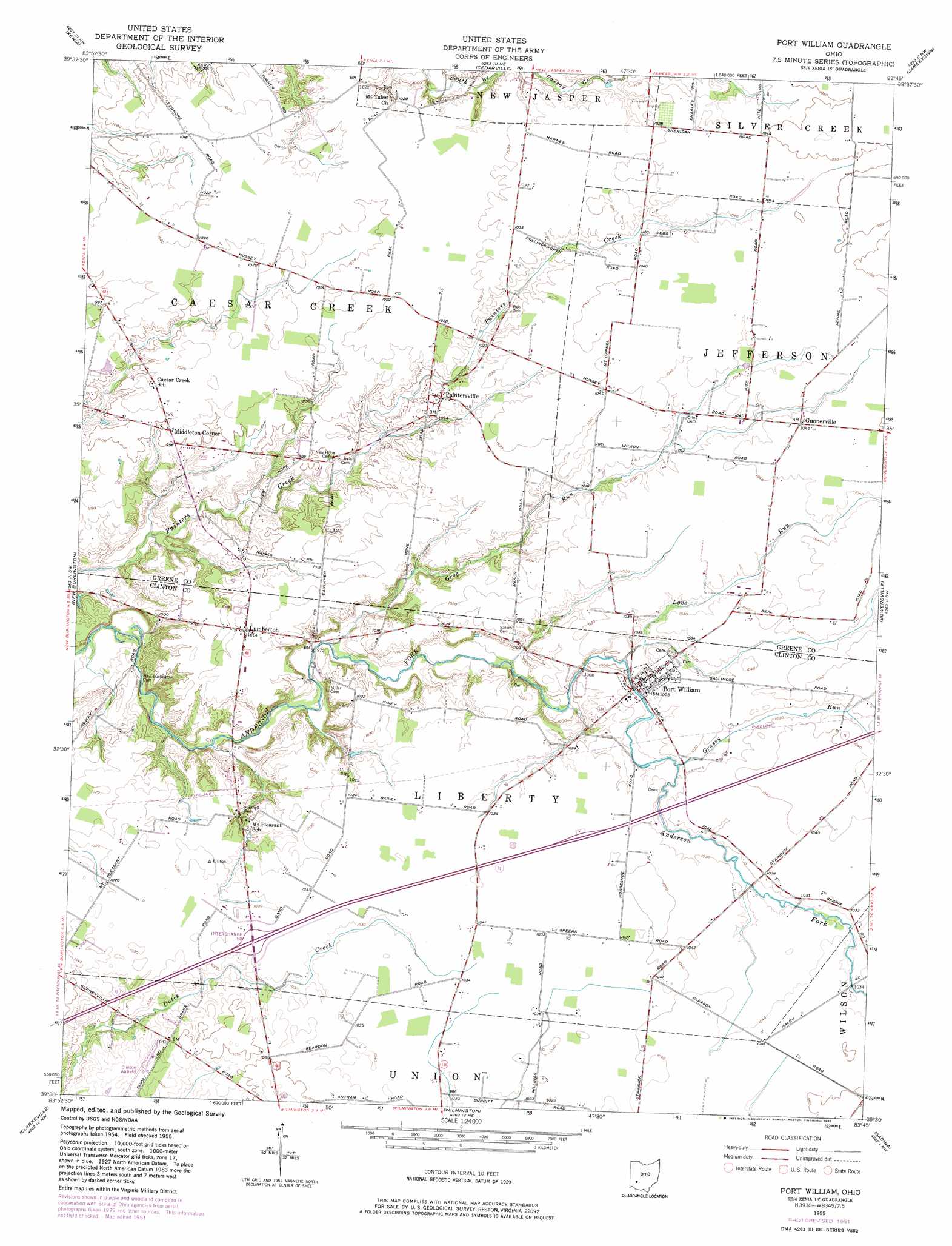
Port William Topo Map Ohio
To zoom in, hover over the map of Port William
USGS Topo Quad 39083e7 - 1:24,000 scale
| Topo Map Name: | Port William |
| USGS Topo Quad ID: | 39083e7 |
| Print Size: | ca. 21 1/4" wide x 27" high |
| Southeast Coordinates: | 39.5° N latitude / 83.75° W longitude |
| Map Center Coordinates: | 39.5625° N latitude / 83.8125° W longitude |
| U.S. State: | OH |
| Filename: | o39083e7.jpg |
| Download Map JPG Image: | Port William topo map 1:24,000 scale |
| Map Type: | Topographic |
| Topo Series: | 7.5´ |
| Map Scale: | 1:24,000 |
| Source of Map Images: | United States Geological Survey (USGS) |
| Alternate Map Versions: |
Port William OH 1955, updated 1956 Download PDF Buy paper map Port William OH 1955, updated 1968 Download PDF Buy paper map Port William OH 1955, updated 1982 Download PDF Buy paper map Port William OH 2010 Download PDF Buy paper map Port William OH 2013 Download PDF Buy paper map Port William OH 2016 Download PDF Buy paper map |
1:24,000 Topo Quads surrounding Port William
Fairborn |
Yellow Springs |
Clifton |
South Charleston |
Florence |
Bellbrook |
Xenia |
Cedarville |
Jamestown |
Jeffersonville |
Waynesville |
New Burlington |
Port William |
Bowersville |
Milledgeville |
Oregonia |
Clarksville |
Wilmington |
Sabina |
Memphis |
Pleasant Plain |
Blanchester |
Martinsville |
New Vienna |
Leesburg |
> Back to 39083e1 at 1:100,000 scale
> Back to 39082a1 at 1:250,000 scale
> Back to U.S. Topo Maps home
Port William topo map: Gazetteer
Port William: Airports
Clinton Field elevation 317m 1040′Liberty Township Heliport elevation 310m 1017′
Lumberton Airport elevation 307m 1007′
Port William: Crossings
Interchange 50 elevation 314m 1030′Port William: Populated Places
Gunnerville elevation 317m 1040′Lumberton elevation 308m 1010′
Middleton Corner elevation 308m 1010′
Mount Pleasant elevation 302m 990′
Ogles (historical) elevation 311m 1020′
Paintersville elevation 311m 1020′
Port William elevation 311m 1020′
Port William: Post Offices
Lumberton Post Office (historical) elevation 309m 1013′Morrisville Post Office (historical) elevation 314m 1030′
Paintersville Post Office (historical) elevation 310m 1017′
Port Williams Post Office elevation 311m 1020′
Port William: Streams
Grassy Run elevation 311m 1020′Grog Run elevation 292m 958′
Love Run elevation 305m 1000′
Port William digital topo map on disk
Buy this Port William topo map showing relief, roads, GPS coordinates and other geographical features, as a high-resolution digital map file on DVD:
 map DVD")