Humboldt Topo Map Illinois
To zoom in, hover over the map of Humboldt
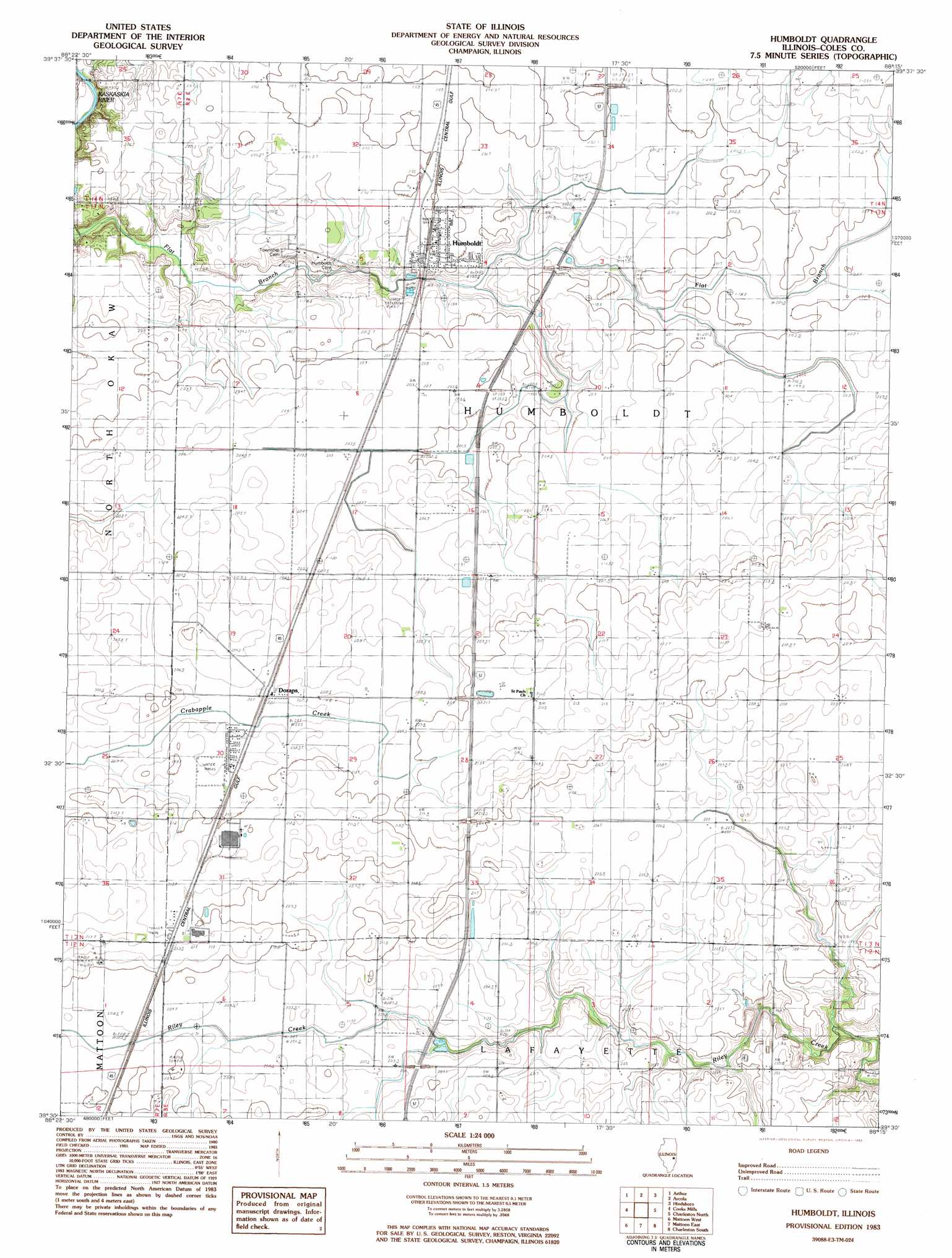
USGS Topo Quad 39088e3 - 1:24,000 scale
| Topo Map Name: | Humboldt |
| USGS Topo Quad ID: | 39088e3 |
| Print Size: | ca. 21 1/4" wide x 27" high |
| Southeast Coordinates: | 39.5° N latitude / 88.25° W longitude |
| Map Center Coordinates: | 39.5625° N latitude / 88.3125° W longitude |
| U.S. State: | IL |
| Filename: | o39088e3.jpg |
| Download Map JPG Image: | Humboldt topo map 1:24,000 scale |
| Map Type: | Topographic |
| Topo Series: | 7.5´ |
| Map Scale: | 1:24,000 |
| Source of Map Images: | United States Geological Survey (USGS) |
| Alternate Map Versions: |
Humboldt IL 1983, updated 1983 Download PDF Buy paper map Humboldt IL 1998, updated 2003 Download PDF Buy paper map Humboldt IL 2012 Download PDF Buy paper map Humboldt IL 2015 Download PDF Buy paper map |
1:24,000 Topo Quads surrounding Humboldt
Hammond |
Atwood |
Tuscola |
Villa Grove |
Murdock |
Cadwell |
Arthur |
Arcola |
Hindsburg |
Oakland |
Sullivan |
Cooksmill |
Humboldt |
Charleston North |
Ashmore |
Windsor |
Mattoon West |
Mattoon East |
Charleston South |
Westfield West |
Stewardson East |
Neoga |
Johnstown |
Toledo |
Union Center |
> Back to 39088e1 at 1:100,000 scale
> Back to 39088a1 at 1:250,000 scale
> Back to U.S. Topo Maps home
Humboldt topo map: Gazetteer
Humboldt: Populated Places
Dorans elevation 209m 685′Humboldt elevation 201m 659′
Humboldt: Post Offices
Humboldt Post Office elevation 203m 666′Humboldt digital topo map on disk
Buy this Humboldt topo map showing relief, roads, GPS coordinates and other geographical features, as a high-resolution digital map file on DVD:
Northern Illinois, Northern Indiana & Southwestern Michigan
Buy digital topo maps: Northern Illinois, Northern Indiana & Southwestern Michigan