Oakland Topo Map Illinois
To zoom in, hover over the map of Oakland
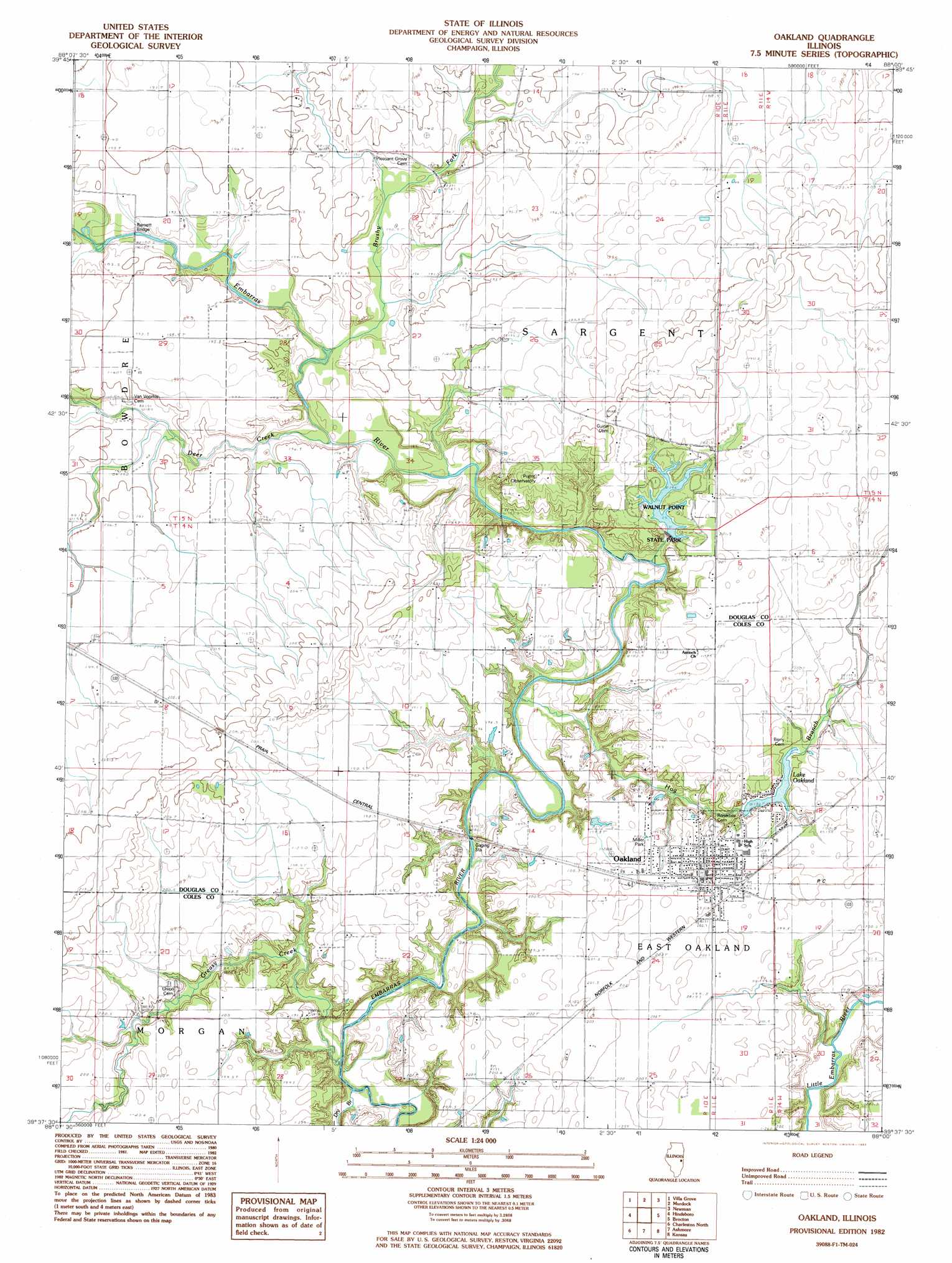
USGS Topo Quad 39088f1 - 1:24,000 scale
| Topo Map Name: | Oakland |
| USGS Topo Quad ID: | 39088f1 |
| Print Size: | ca. 21 1/4" wide x 27" high |
| Southeast Coordinates: | 39.625° N latitude / 88° W longitude |
| Map Center Coordinates: | 39.6875° N latitude / 88.0625° W longitude |
| U.S. State: | IL |
| Filename: | o39088f1.jpg |
| Download Map JPG Image: | Oakland topo map 1:24,000 scale |
| Map Type: | Topographic |
| Topo Series: | 7.5´ |
| Map Scale: | 1:24,000 |
| Source of Map Images: | United States Geological Survey (USGS) |
| Alternate Map Versions: |
Oakland IL 1982, updated 1983 Download PDF Buy paper map Oakland IL 1998, updated 2003 Download PDF Buy paper map Oakland IL 2012 Download PDF Buy paper map Oakland IL 2015 Download PDF Buy paper map |
1:24,000 Topo Quads surrounding Oakland
Tolono |
Villa Grove Nw |
Longview |
Allerton |
Sidell |
Tuscola |
Villa Grove |
Murdock |
Newman |
Hume |
Arcola |
Hindsburg |
Oakland |
Brocton |
Redmon |
Humboldt |
Charleston North |
Ashmore |
Kansas |
Grandview |
Mattoon East |
Charleston South |
Westfield West |
Westfield East |
Clarksville |
> Back to 39088e1 at 1:100,000 scale
> Back to 39088a1 at 1:250,000 scale
> Back to U.S. Topo Maps home
Oakland topo map: Gazetteer
Oakland: Bridges
Barnett Bridge elevation 188m 616′Oakland: Dams
Lake Oakland Dam elevation 195m 639′Miller Lake Dam elevation 196m 643′
Walnut Point State Park Lake Dam elevation 197m 646′
Oakland: Lakes
Lake Oakland elevation 195m 639′Oakland: Parks
Helen Parkes Old Tower Park elevation 201m 659′Howard Miller Memorial Park elevation 199m 652′
Oakland Centennial City Park elevation 201m 659′
Oakland Swimming Pool elevation 200m 656′
Upper Embarras Woods Nature Preserve elevation 196m 643′
Walnut Point State Park elevation 198m 649′
Watertower Park elevation 198m 649′
Oakland: Populated Places
Oakland elevation 201m 659′Oakland: Post Offices
Brushy Fork Post Office (historical) elevation 195m 639′Oakland: Reservoirs
Lake Oakland elevation 193m 633′Miller Lake elevation 196m 643′
Walnut Point State Park Lake elevation 197m 646′
Oakland: Streams
Brushy Fork elevation 185m 606′Deer Creek elevation 184m 603′
Dry Branch elevation 185m 606′
Greasy Creek elevation 183m 600′
Hog Branch elevation 183m 600′
Oakland digital topo map on disk
Buy this Oakland topo map showing relief, roads, GPS coordinates and other geographical features, as a high-resolution digital map file on DVD:
Northern Illinois, Northern Indiana & Southwestern Michigan
Buy digital topo maps: Northern Illinois, Northern Indiana & Southwestern Michigan