Columbus Topo Map Illinois
To zoom in, hover over the map of Columbus
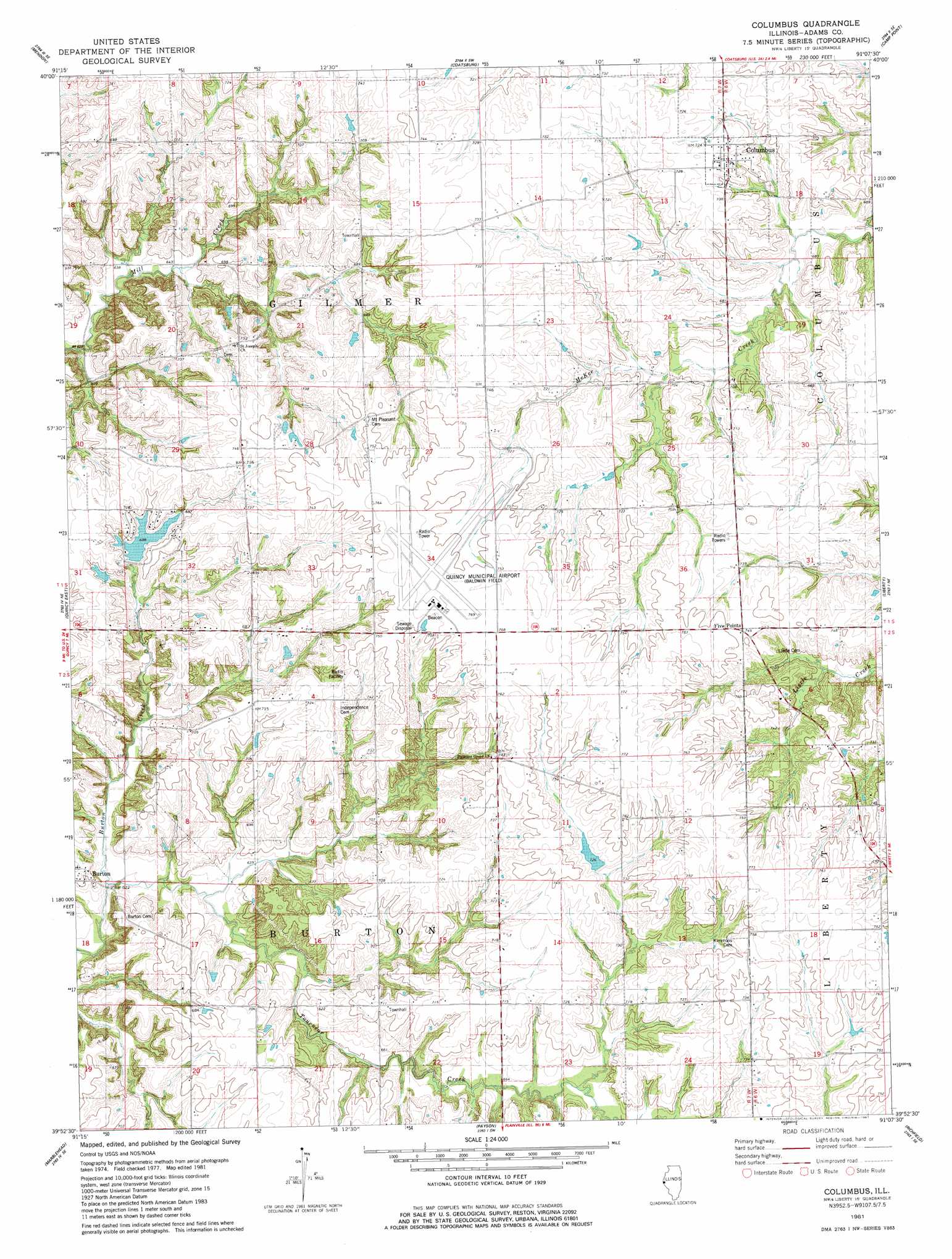
USGS Topo Quad 39091h2 - 1:24,000 scale
| Topo Map Name: | Columbus |
| USGS Topo Quad ID: | 39091h2 |
| Print Size: | ca. 21 1/4" wide x 27" high |
| Southeast Coordinates: | 39.875° N latitude / 91.125° W longitude |
| Map Center Coordinates: | 39.9375° N latitude / 91.1875° W longitude |
| U.S. State: | IL |
| Filename: | o39091h2.jpg |
| Download Map JPG Image: | Columbus topo map 1:24,000 scale |
| Map Type: | Topographic |
| Topo Series: | 7.5´ |
| Map Scale: | 1:24,000 |
| Source of Map Images: | United States Geological Survey (USGS) |
| Alternate Map Versions: |
Columbus IL 1981, updated 1981 Download PDF Buy paper map Columbus IL 1995, updated 1998 Download PDF Buy paper map Columbus IL 2012 Download PDF Buy paper map Columbus IL 2015 Download PDF Buy paper map |
1:24,000 Topo Quads surrounding Columbus
Lima |
Tioga |
Loraine |
Bowen |
Augusta |
Long Island |
Mendon |
Coatsburg |
Camp Point |
Clayton |
Quincy West |
Quincy East |
Columbus |
Liberty |
Kellerville |
Quincy Sw |
Marblehead |
Payson |
Richfield |
Fishhook |
Hannibal West |
Hannibal East |
Hull |
Barry |
Baylis |
> Back to 39091e1 at 1:100,000 scale
> Back to 39090a1 at 1:250,000 scale
> Back to U.S. Topo Maps home
Columbus topo map: Gazetteer
Columbus: Airports
Quincy Municipal Airport elevation 231m 757′Columbus: Dams
Lakeshore Hills Lake Dam elevation 205m 672′Columbus: Parks
Burton Cave Nature Preserve elevation 208m 682′Columbus: Populated Places
Burton elevation 200m 656′Columbus elevation 220m 721′
Columbus: Reservoirs
Lakeshore Hills Lake elevation 205m 672′Columbus: Streams
Tournear Creek elevation 187m 613′Columbus digital topo map on disk
Buy this Columbus topo map showing relief, roads, GPS coordinates and other geographical features, as a high-resolution digital map file on DVD: