Kellerville Topo Map Illinois
To zoom in, hover over the map of Kellerville
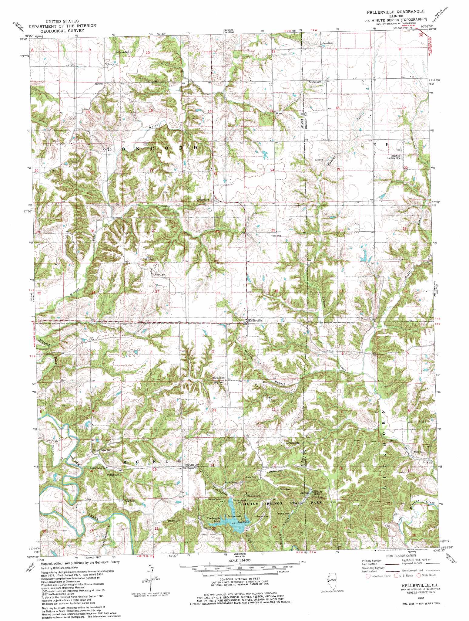
USGS Topo Quad 39090h8 - 1:24,000 scale
| Topo Map Name: | Kellerville |
| USGS Topo Quad ID: | 39090h8 |
| Print Size: | ca. 21 1/4" wide x 27" high |
| Southeast Coordinates: | 39.875° N latitude / 90.875° W longitude |
| Map Center Coordinates: | 39.9375° N latitude / 90.9375° W longitude |
| U.S. State: | IL |
| Filename: | o39090h8.jpg |
| Download Map JPG Image: | Kellerville topo map 1:24,000 scale |
| Map Type: | Topographic |
| Topo Series: | 7.5´ |
| Map Scale: | 1:24,000 |
| Source of Map Images: | United States Geological Survey (USGS) |
| Alternate Map Versions: |
Kellerville IL 1981, updated 1981 Download PDF Buy paper map Kellerville IL 2012 Download PDF Buy paper map Kellerville IL 2015 Download PDF Buy paper map |
1:24,000 Topo Quads surrounding Kellerville
Loraine |
Bowen |
Augusta |
Camden |
Erwin |
Coatsburg |
Camp Point |
Clayton |
Lake Mount Sterling |
Ripley |
Columbus |
Liberty |
Kellerville |
Mount Sterling |
Versailles |
Payson |
Richfield |
Fishhook |
Perry West |
Perry East |
Hull |
Barry |
Baylis |
New Salem |
Griggsville |
> Back to 39090e1 at 1:100,000 scale
> Back to 39090a1 at 1:250,000 scale
> Back to U.S. Topo Maps home
Kellerville topo map: Gazetteer
Kellerville: Airports
Mayfield Landing Strip elevation 223m 731′Kellerville: Dams
Siloam Springs Lake Dam elevation 189m 620′Kellerville: Parks
Siloam Springs State Park elevation 203m 666′Kellerville: Populated Places
Kellerville elevation 220m 721′Siloam elevation 186m 610′
Spring Valley elevation 184m 603′
Kellerville: Reservoirs
Crabapple Lake elevation 186m 610′Siloam Springs Lake elevation 189m 620′
Kellerville: Springs
Siloam Springs elevation 193m 633′Kellerville: Streams
Coal Creek elevation 173m 567′Durbin Branch elevation 197m 646′
Grindstone Creek elevation 172m 564′
Purpus Creek elevation 187m 613′
Wells Fork elevation 187m 613′
Kellerville: Trails
Crabapple Trail elevation 191m 626′Deer Run Trail elevation 206m 675′
Hoot Owl Trail elevation 221m 725′
Old Village Trail elevation 221m 725′
Prairie Bluff Trail elevation 202m 662′
Red Oak Backpack Trail elevation 213m 698′
Kellerville digital topo map on disk
Buy this Kellerville topo map showing relief, roads, GPS coordinates and other geographical features, as a high-resolution digital map file on DVD: