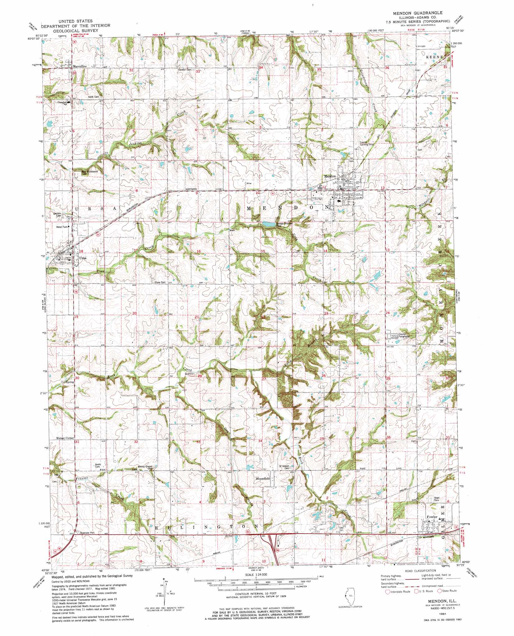
Mendon Topo Map Illinois
To zoom in, hover over the map of Mendon
USGS Topo Quad 40091a3 - 1:24,000 scale
| Topo Map Name: | Mendon |
| USGS Topo Quad ID: | 40091a3 |
| Print Size: | ca. 21 1/4" wide x 27" high |
| Southeast Coordinates: | 40° N latitude / 91.25° W longitude |
| Map Center Coordinates: | 40.0625° N latitude / 91.3125° W longitude |
| U.S. State: | IL |
| Filename: | o40091a3.jpg |
| Download Map JPG Image: | Mendon topo map 1:24,000 scale |
| Map Type: | Topographic |
| Topo Series: | 7.5´ |
| Map Scale: | 1:24,000 |
| Source of Map Images: | United States Geological Survey (USGS) |
| Alternate Map Versions: |
Mendon IL 1981, updated 1981 Download PDF Buy paper map Mendon IL 1995, updated 1998 Download PDF Buy paper map Mendon IL 2012 Download PDF Buy paper map Mendon IL 2015 Download PDF Buy paper map |
1:24,000 Topo Quads surrounding Mendon
Kahoka Se |
Warsaw |
Sutter |
West Point |
Bentley |
Canton |
Lima |
Tioga |
Loraine |
Bowen |
La Grange |
Long Island |
Mendon |
Coatsburg |
Camp Point |
Maywood |
Quincy West |
Quincy East |
Columbus |
Liberty |
Palmyra |
Quincy Sw |
Marblehead |
Payson |
Richfield |
> Back to 40091a1 at 1:100,000 scale
> Back to 40090a1 at 1:250,000 scale
> Back to U.S. Topo Maps home
Mendon topo map: Gazetteer
Mendon: Airports
Cramm Landing Area elevation 226m 741′Mendon: Dams
Jug Lake Dam elevation 218m 715′Mendon: Parks
Adams County Fairground elevation 238m 780′Mendon: Populated Places
Bloomfield elevation 223m 731′Fowler elevation 223m 731′
Marcelline elevation 189m 620′
Mendon elevation 232m 761′
Ursa elevation 186m 610′
Mendon: Post Offices
Fowler Post Office elevation 222m 728′Mendon: Reservoirs
Jug Lake elevation 218m 715′Mendon: Streams
Dry Branch elevation 177m 580′Sand Branch elevation 186m 610′
Mendon digital topo map on disk
Buy this Mendon topo map showing relief, roads, GPS coordinates and other geographical features, as a high-resolution digital map file on DVD: