Lancaster Topo Map Kansas
To zoom in, hover over the map of Lancaster
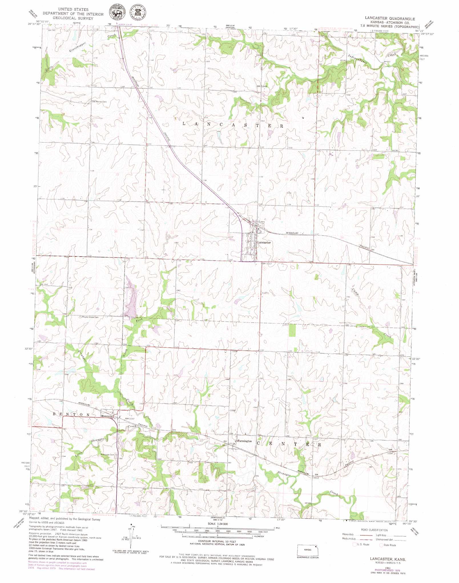
USGS Topo Quad 39095e3 - 1:24,000 scale
| Topo Map Name: | Lancaster |
| USGS Topo Quad ID: | 39095e3 |
| Print Size: | ca. 21 1/4" wide x 27" high |
| Southeast Coordinates: | 39.5° N latitude / 95.25° W longitude |
| Map Center Coordinates: | 39.5625° N latitude / 95.3125° W longitude |
| U.S. State: | KS |
| Filename: | o39095e3.jpg |
| Download Map JPG Image: | Lancaster topo map 1:24,000 scale |
| Map Type: | Topographic |
| Topo Series: | 7.5´ |
| Map Scale: | 1:24,000 |
| Source of Map Images: | United States Geological Survey (USGS) |
| Alternate Map Versions: |
Lancaster KS 1961, updated 1962 Download PDF Buy paper map Lancaster KS 1961, updated 1979 Download PDF Buy paper map Lancaster KS 2009 Download PDF Buy paper map Lancaster KS 2012 Download PDF Buy paper map Lancaster KS 2015 Download PDF Buy paper map |
1:24,000 Topo Quads surrounding Lancaster
Hiawatha |
Robinson |
Highland |
Sparks |
Troy |
Horton |
Everest |
Denton |
Bendena |
Atchison Ne |
Whiting |
Effingham |
Lancaster |
Atchison West |
Atchison East |
Arrington |
Half Mound |
Nortonville |
Potter |
Oak Mills |
Holton Se |
Valley Falls |
Winchester |
Easton Sw |
Easton |
> Back to 39095e1 at 1:100,000 scale
> Back to 39094a1 at 1:250,000 scale
> Back to U.S. Topo Maps home
Lancaster topo map: Gazetteer
Lancaster: Populated Places
Farmington elevation 314m 1030′Lancaster elevation 353m 1158′
Monrovia elevation 316m 1036′
Lancaster: Streams
Little Stranger Creek elevation 302m 990′North Fork Stranger Creek elevation 307m 1007′
Lancaster digital topo map on disk
Buy this Lancaster topo map showing relief, roads, GPS coordinates and other geographical features, as a high-resolution digital map file on DVD: