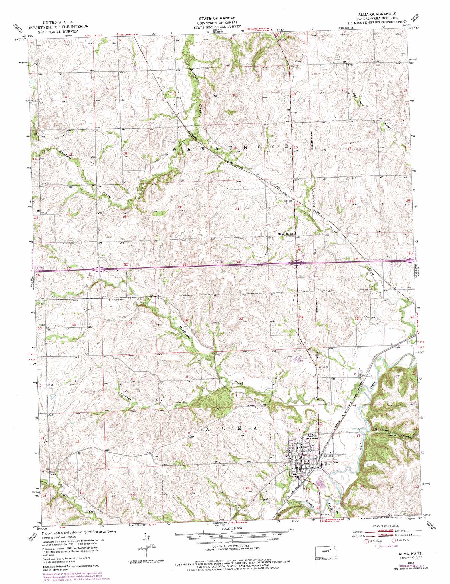
Alma Topo Map Kansas
To zoom in, hover over the map of Alma
USGS Topo Quad 39096a3 - 1:24,000 scale
| Topo Map Name: | Alma |
| USGS Topo Quad ID: | 39096a3 |
| Print Size: | ca. 21 1/4" wide x 27" high |
| Southeast Coordinates: | 39° N latitude / 96.25° W longitude |
| Map Center Coordinates: | 39.0625° N latitude / 96.3125° W longitude |
| U.S. State: | KS |
| Filename: | o39096a3.jpg |
| Download Map JPG Image: | Alma topo map 1:24,000 scale |
| Map Type: | Topographic |
| Topo Series: | 7.5´ |
| Map Scale: | 1:24,000 |
| Source of Map Images: | United States Geological Survey (USGS) |
| Alternate Map Versions: |
Alma KS 1954, updated 1955 Download PDF Buy paper map Alma KS 1954, updated 1978 Download PDF Buy paper map Alma KS 2009 Download PDF Buy paper map Alma KS 2012 Download PDF Buy paper map Alma KS 2016 Download PDF Buy paper map |
1:24,000 Topo Quads surrounding Alma
Tuttle Creek Dam |
Flush |
Louisville |
Laclede |
Emmett |
Manhattan |
Saint George |
Wamego |
Belvue |
Saint Marys |
Swede Creek |
Wamego Sw |
Alma |
Mcfarland |
Maple Hill |
White City Ne |
Volland |
Allendorph |
Hessdale |
Keene |
Dwight |
Alta Vista |
Alta Vista Se |
Lake Wabaunsee |
Eskridge |
> Back to 39096a1 at 1:100,000 scale
> Back to 39096a1 at 1:250,000 scale
> Back to U.S. Topo Maps home
Alma topo map: Gazetteer
Alma: Populated Places
Alma elevation 337m 1105′Alma: Streams
Hendricks Creek elevation 307m 1007′Phillips Creek elevation 326m 1069′
South Branch Mill Creek elevation 313m 1026′
West Branch Mill Creek elevation 313m 1026′
Alma: Valleys
Clapboard Canyon elevation 312m 1023′Alma digital topo map on disk
Buy this Alma topo map showing relief, roads, GPS coordinates and other geographical features, as a high-resolution digital map file on DVD: