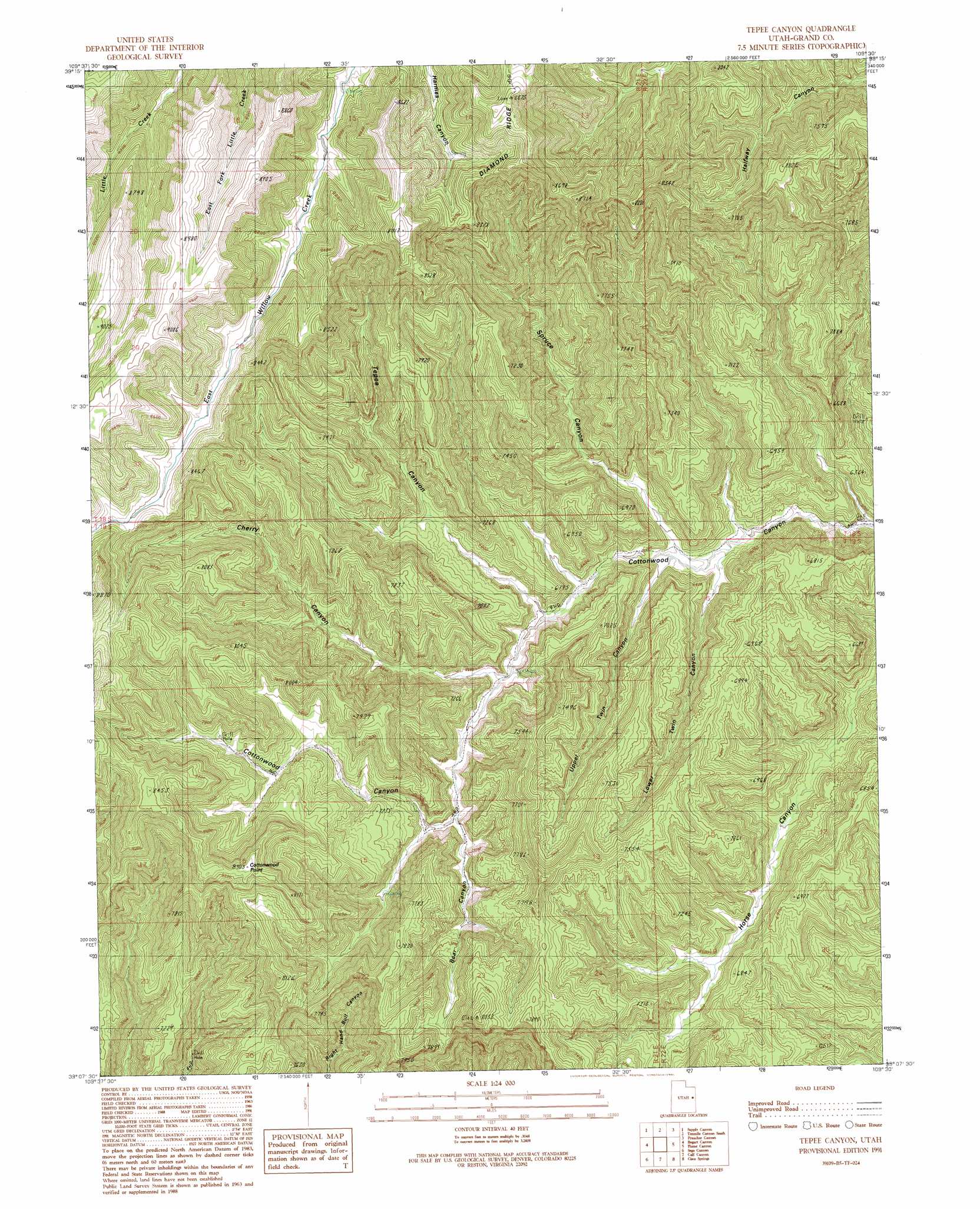
Tepee Canyon Topo Map Utah
To zoom in, hover over the map of Tepee Canyon
USGS Topo Quad 39109b5 - 1:24,000 scale
| Topo Map Name: | Tepee Canyon |
| USGS Topo Quad ID: | 39109b5 |
| Print Size: | ca. 21 1/4" wide x 27" high |
| Southeast Coordinates: | 39.125° N latitude / 109.5° W longitude |
| Map Center Coordinates: | 39.1875° N latitude / 109.5625° W longitude |
| U.S. State: | UT |
| Filename: | o39109b5.jpg |
| Download Map JPG Image: | Tepee Canyon topo map 1:24,000 scale |
| Map Type: | Topographic |
| Topo Series: | 7.5´ |
| Map Scale: | 1:24,000 |
| Source of Map Images: | United States Geological Survey (USGS) |
| Alternate Map Versions: |
Tepee Canyon UT 1991, updated 1991 Download PDF Buy paper map Tepee Canyon UT 2011 Download PDF Buy paper map Tepee Canyon UT 2014 Download PDF Buy paper map |
1:24,000 Topo Quads surrounding Tepee Canyon
Chicken Fork |
Black Knolls |
Tenmile Canyon North |
Cedar Camp Canyon |
P R Spring |
Walker Point |
Supply Canyon |
Tenmile Canyon South |
Preacher Canyon |
Dry Canyon |
Floy Canyon North |
Bogart Canyon |
Tepee Canyon |
Flume Canyon |
Antone Canyon |
Floy Canyon South |
Sego Canyon |
Calf Canyon |
Cisco Springs |
Danish Flat |
Crescent Junction |
Thompson |
Sagers Flat |
White House |
Cisco |
> Back to 39109a1 at 1:100,000 scale
> Back to 39108a1 at 1:250,000 scale
> Back to U.S. Topo Maps home
Tepee Canyon topo map: Gazetteer
Tepee Canyon: Summits
Cottonwood Point elevation 2532m 8307′Tepee Canyon: Valleys
Bear Canyon elevation 2064m 6771′Cherry Canyon elevation 2003m 6571′
Lower Twin Canyon elevation 1880m 6167′
Spruce Canyon elevation 1885m 6184′
Tepee Canyon elevation 1958m 6423′
Upper Twin Canyon elevation 1894m 6213′
Tepee Canyon digital topo map on disk
Buy this Tepee Canyon topo map showing relief, roads, GPS coordinates and other geographical features, as a high-resolution digital map file on DVD: