P R Spring Topo Map Utah
To zoom in, hover over the map of P R Spring
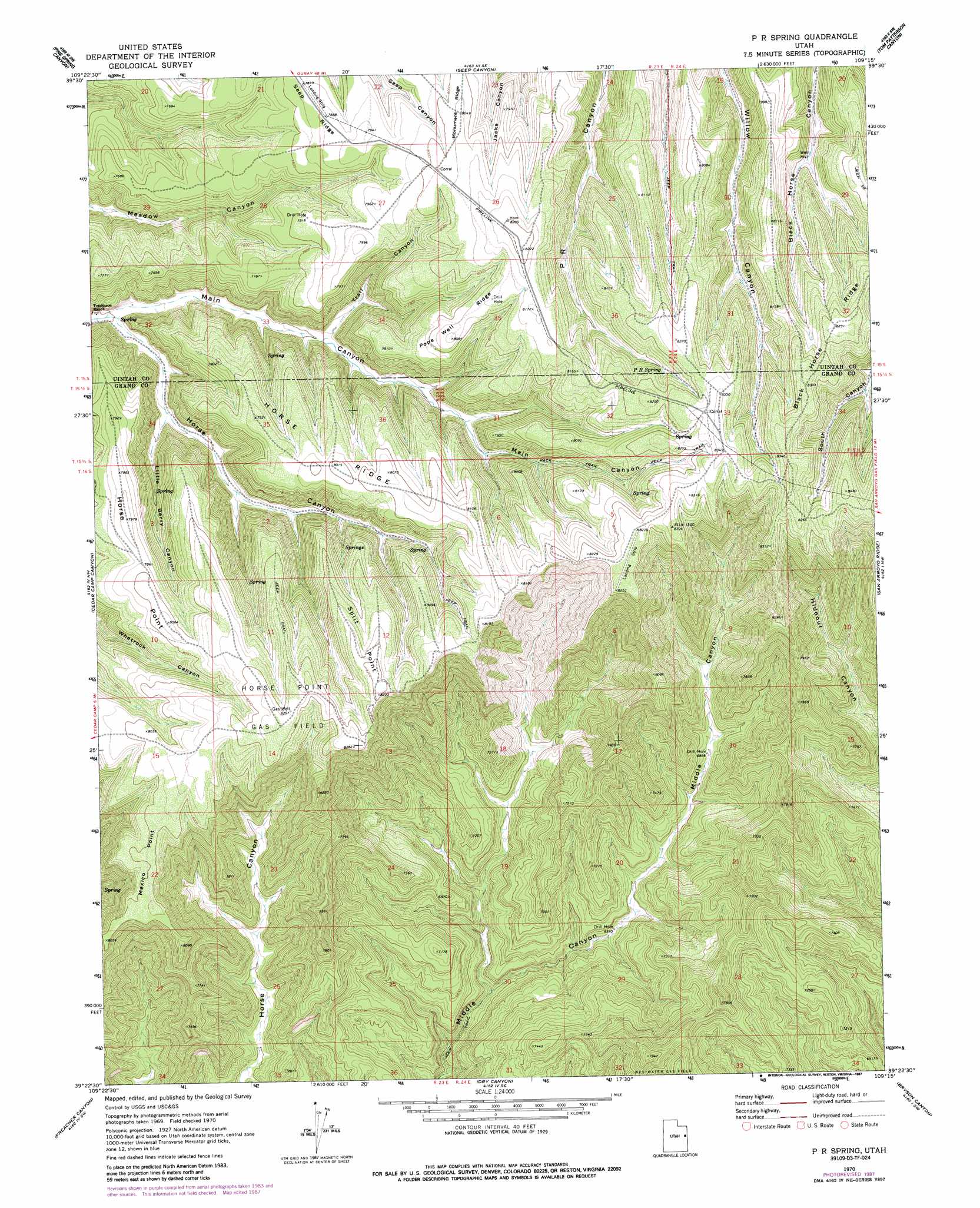
USGS Topo Quad 39109d3 - 1:24,000 scale
| Topo Map Name: | P R Spring |
| USGS Topo Quad ID: | 39109d3 |
| Print Size: | ca. 21 1/4" wide x 27" high |
| Southeast Coordinates: | 39.375° N latitude / 109.25° W longitude |
| Map Center Coordinates: | 39.4375° N latitude / 109.3125° W longitude |
| U.S. State: | UT |
| Filename: | o39109d3.jpg |
| Download Map JPG Image: | P R Spring topo map 1:24,000 scale |
| Map Type: | Topographic |
| Topo Series: | 7.5´ |
| Map Scale: | 1:24,000 |
| Source of Map Images: | United States Geological Survey (USGS) |
| Alternate Map Versions: |
P R Spring UT 1970, updated 1973 Download PDF Buy paper map P R Spring UT 1970, updated 1987 Download PDF Buy paper map P R Spring UT 2011 Download PDF Buy paper map P R Spring UT 2014 Download PDF Buy paper map |
1:24,000 Topo Quads surrounding P R Spring
Agency Draw Ne |
Bates Knolls |
Cooper Canyon |
Burnt Timber Canyon |
Davis Canyon |
Wolf Point |
Pine Spring Canyon |
Seep Canyon |
Tom Patterson Canyon |
Rat Hole Ridge |
Tenmile Canyon North |
Cedar Camp Canyon |
P R Spring |
San Arroyo Ridge |
Jim Canyon |
Tenmile Canyon South |
Preacher Canyon |
Dry Canyon |
Bryson Canyon |
Bar X Wash |
Tepee Canyon |
Flume Canyon |
Antone Canyon |
Harley Dome |
Bitter Creek Well |
> Back to 39109a1 at 1:100,000 scale
> Back to 39108a1 at 1:250,000 scale
> Back to U.S. Topo Maps home
P R Spring topo map: Gazetteer
P R Spring: Capes
Horse Point elevation 2429m 7969′Mexico Point elevation 2444m 8018′
Split Point elevation 2458m 8064′
P R Spring: Oilfields
Horse Point Gas Field elevation 2507m 8225′P R Spring: Ridges
Black Horse Ridge elevation 2501m 8205′Horse Ridge elevation 2424m 7952′
Pope Well Ridge elevation 2456m 8057′
P R Spring: Springs
P R Spring elevation 2452m 8044′P R Spring: Valleys
Horse Canyon elevation 2138m 7014′Little Berry Canyon elevation 2177m 7142′
Trail Canyon elevation 2216m 7270′
P R Spring digital topo map on disk
Buy this P R Spring topo map showing relief, roads, GPS coordinates and other geographical features, as a high-resolution digital map file on DVD: