Dugway Range Sw Topo Map Utah
To zoom in, hover over the map of Dugway Range Sw
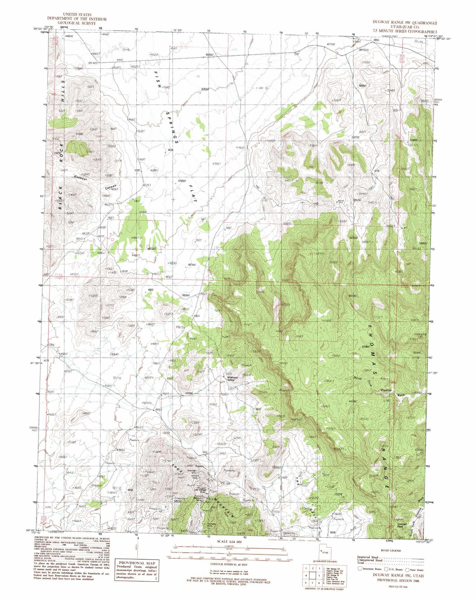
USGS Topo Quad 39113g2 - 1:24,000 scale
| Topo Map Name: | Dugway Range Sw |
| USGS Topo Quad ID: | 39113g2 |
| Print Size: | ca. 21 1/4" wide x 27" high |
| Southeast Coordinates: | 39.75° N latitude / 113.125° W longitude |
| Map Center Coordinates: | 39.8125° N latitude / 113.1875° W longitude |
| U.S. State: | UT |
| Filename: | o39113g2.jpg |
| Download Map JPG Image: | Dugway Range Sw topo map 1:24,000 scale |
| Map Type: | Topographic |
| Topo Series: | 7.5´ |
| Map Scale: | 1:24,000 |
| Source of Map Images: | United States Geological Survey (USGS) |
| Alternate Map Versions: |
Dugway Range SW UT 1988, updated 1989 Download PDF Buy paper map Dugway Range SW UT 2010 Download PDF Buy paper map Dugway Range SW UT 2014 Download PDF Buy paper map |
1:24,000 Topo Quads surrounding Dugway Range Sw
Granite Peak Sw |
Granite Peak Se |
Dugway Proving Ground Sw |
Dugway Proving Ground Se |
Camels Back Ridge Sw |
Fish Springs Nw |
Fish Springs Ne |
Dugway Range Nw |
Dugway Range Ne |
Table Mountain |
Fish Springs Sw |
Fish Springs Se |
Dugway Range Sw |
Dugway Pass |
Keg Pass |
Sand Pass Nw |
Sand Pass Ne |
Topaz Mountain West |
Topaz Mountain East |
Picture Rock Hills |
Sand Pass |
Sand Pass Se |
Topaz Mountain Sw |
Lady Laird Peak |
Drum Mountains Well |
> Back to 39113e1 at 1:100,000 scale
> Back to 39112a1 at 1:250,000 scale
> Back to U.S. Topo Maps home
Dugway Range Sw topo map: Gazetteer
Dugway Range Sw: Gaps
Colored Pass elevation 1931m 6335′Dugway Range Sw: Mines
Blowout Mine elevation 1720m 5643′Hilltop Mine elevation 1697m 5567′
Oversight Mine elevation 1727m 5666′
Thursday Mine elevation 1668m 5472′
Dugway Range Sw: Ridges
Thomas Ridge elevation 1984m 6509′Dugway Range Sw: Springs
Hangrock Spring elevation 1922m 6305′Wildhorse Spring elevation 1609m 5278′
Dugway Range Sw: Valleys
Goshoot Canyon elevation 1496m 4908′Dugway Range Sw digital topo map on disk
Buy this Dugway Range Sw topo map showing relief, roads, GPS coordinates and other geographical features, as a high-resolution digital map file on DVD: