Dixie Valley Se Topo Map Nevada
To zoom in, hover over the map of Dixie Valley Se
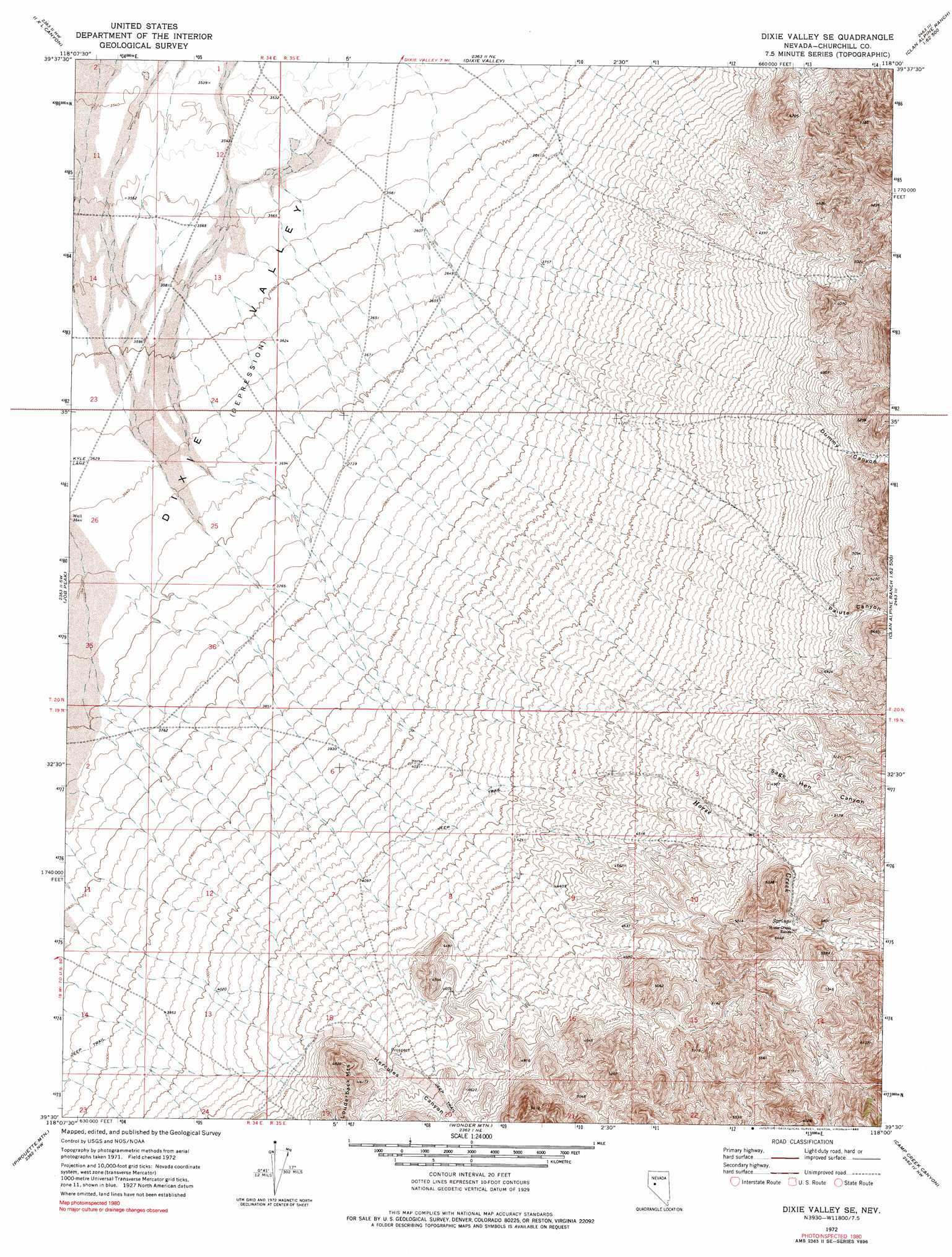
USGS Topo Quad 39118e1 - 1:24,000 scale
| Topo Map Name: | Dixie Valley Se |
| USGS Topo Quad ID: | 39118e1 |
| Print Size: | ca. 21 1/4" wide x 27" high |
| Southeast Coordinates: | 39.5° N latitude / 118° W longitude |
| Map Center Coordinates: | 39.5625° N latitude / 118.0625° W longitude |
| U.S. State: | NV |
| Filename: | o39118e1.jpg |
| Download Map JPG Image: | Dixie Valley Se topo map 1:24,000 scale |
| Map Type: | Topographic |
| Topo Series: | 7.5´ |
| Map Scale: | 1:24,000 |
| Source of Map Images: | United States Geological Survey (USGS) |
| Alternate Map Versions: |
Dixie Valley SE NV 1972, updated 1975 Download PDF Buy paper map Dixie Valley SE NV 1972, updated 1990 Download PDF Buy paper map Dixie Valley SE NV 2011 Download PDF Buy paper map Dixie Valley SE NV 2014 Download PDF Buy paper map |
1:24,000 Topo Quads surrounding Dixie Valley Se
Lone Rock Se |
Fondaway Canyon |
Dixie Hot Springs |
Humboldt Salt Marsh |
Bernice Canyon |
Cox Canyon |
I X L Canyon |
Dixie Valley |
Cow Canyon |
Byers Canyon |
Table Mountain |
Job Peak |
Dixie Valley Se |
Mount Augusta |
Clan Alpine Ranch |
La Plata Canyon |
Pirouette Mountain |
Wonder Mountain |
Camp Creek Canyon |
Cold Springs |
Frenchman |
Drumm Summit |
West Gate |
Eastgate |
Desatoya Peak |
> Back to 39118e1 at 1:100,000 scale
> Back to 39118a1 at 1:250,000 scale
> Back to U.S. Topo Maps home
Dixie Valley Se topo map: Gazetteer
Dixie Valley Se: Streams
Horse Creek elevation 1255m 4117′Sagehen Creek elevation 1337m 4386′
Dixie Valley Se: Summits
Black Butte elevation 1755m 5757′Dixie Valley Se: Valleys
Dummy Canyon elevation 1368m 4488′Hercules Canyon elevation 1280m 4199′
Paiute Canyon elevation 1458m 4783′
Sage Hen Canyon elevation 1438m 4717′
Dixie Valley Se digital topo map on disk
Buy this Dixie Valley Se topo map showing relief, roads, GPS coordinates and other geographical features, as a high-resolution digital map file on DVD: