Dixie Hot Springs Topo Map Nevada
To zoom in, hover over the map of Dixie Hot Springs
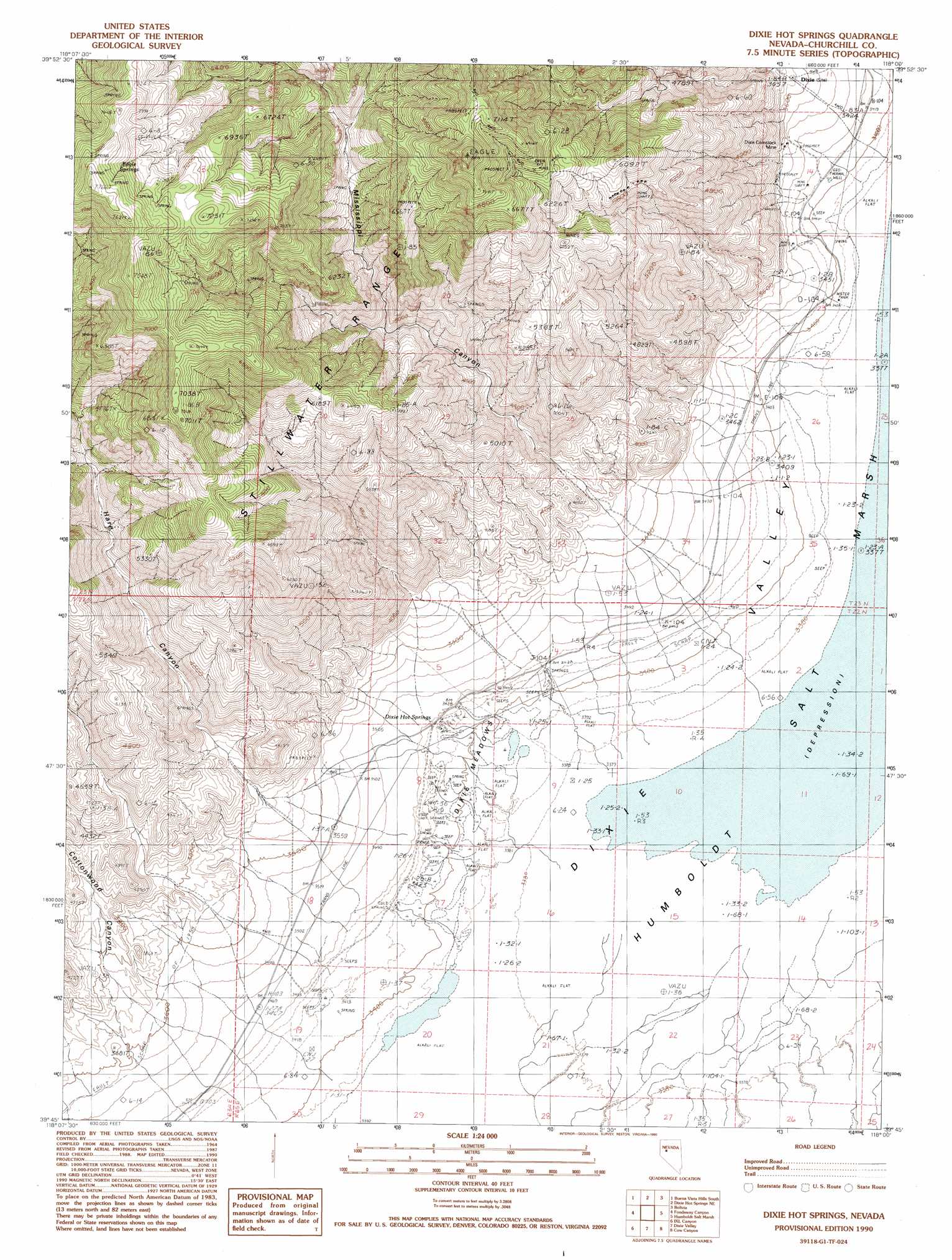
USGS Topo Quad 39118g1 - 1:24,000 scale
| Topo Map Name: | Dixie Hot Springs |
| USGS Topo Quad ID: | 39118g1 |
| Print Size: | ca. 21 1/4" wide x 27" high |
| Southeast Coordinates: | 39.75° N latitude / 118° W longitude |
| Map Center Coordinates: | 39.8125° N latitude / 118.0625° W longitude |
| U.S. State: | NV |
| Filename: | o39118g1.jpg |
| Download Map JPG Image: | Dixie Hot Springs topo map 1:24,000 scale |
| Map Type: | Topographic |
| Topo Series: | 7.5´ |
| Map Scale: | 1:24,000 |
| Source of Map Images: | United States Geological Survey (USGS) |
| Alternate Map Versions: |
Dixie Hot Springs NV 1990, updated 1990 Download PDF Buy paper map Dixie Hot Springs NV 2011 Download PDF Buy paper map Dixie Hot Springs NV 2015 Download PDF Buy paper map |
1:24,000 Topo Quads surrounding Dixie Hot Springs
Wildhorse Spring |
Buena Vista Hills North |
Cornish Peak |
Logan Peak |
Fencemaker Pass |
Lone Rock |
Buena Vista Hills South |
Dixie Hot Springs Ne |
Bolivia |
Boyer Ranch |
Lone Rock Se |
Fondaway Canyon |
Dixie Hot Springs |
Humboldt Salt Marsh |
Bernice Canyon |
Cox Canyon |
I X L Canyon |
Dixie Valley |
Cow Canyon |
Byers Canyon |
Table Mountain |
Job Peak |
Dixie Valley Se |
Mount Augusta |
Clan Alpine Ranch |
> Back to 39118e1 at 1:100,000 scale
> Back to 39118a1 at 1:250,000 scale
> Back to U.S. Topo Maps home
Dixie Hot Springs topo map: Gazetteer
Dixie Hot Springs: Mines
Dixie Comstock Mine elevation 1046m 3431′Dixie Hot Springs: Populated Places
Dixie elevation 1112m 3648′Dixie Hot Springs: Ranges
Stillwater Range elevation 2209m 7247′Dixie Hot Springs: Ridges
Fault Scarp of 1954 elevation 1080m 3543′Dixie Hot Springs: Springs
Cold Springs elevation 1040m 3412′Dixie Hot Springs elevation 1043m 3421′
Eagle Springs elevation 2290m 7513′
Dixie Hot Springs: Summits
Star Peak elevation 2280m 7480′Dixie Hot Springs: Swamps
Dixie Meadows elevation 1039m 3408′Dixie Hot Springs: Valleys
Cottonwood Canyon elevation 1173m 3848′Fork Mississippi Canyon elevation 1539m 5049′
Hare Canyon elevation 2240m 7349′
Mississippi Canyon elevation 1134m 3720′
North Fork Mississippi Canyon elevation 1707m 5600′
Dixie Hot Springs digital topo map on disk
Buy this Dixie Hot Springs topo map showing relief, roads, GPS coordinates and other geographical features, as a high-resolution digital map file on DVD: