Stillwater Ne Topo Map Nevada
To zoom in, hover over the map of Stillwater Ne
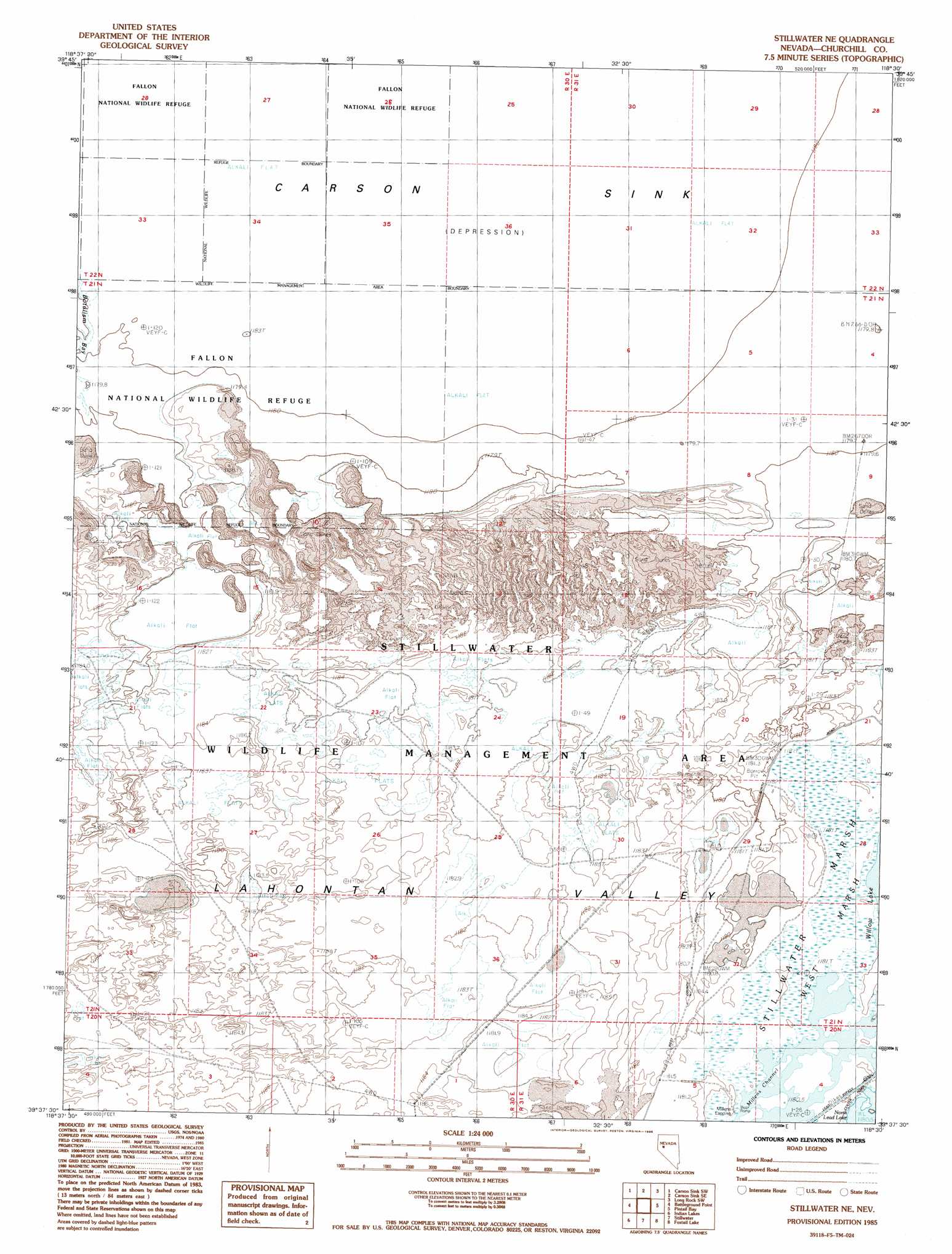
USGS Topo Quad 39118f5 - 1:24,000 scale
| Topo Map Name: | Stillwater Ne |
| USGS Topo Quad ID: | 39118f5 |
| Print Size: | ca. 21 1/4" wide x 27" high |
| Southeast Coordinates: | 39.625° N latitude / 118.5° W longitude |
| Map Center Coordinates: | 39.6875° N latitude / 118.5625° W longitude |
| U.S. State: | NV |
| Filename: | o39118f5.jpg |
| Download Map JPG Image: | Stillwater Ne topo map 1:24,000 scale |
| Map Type: | Topographic |
| Topo Series: | 7.5´ |
| Map Scale: | 1:24,000 |
| Source of Map Images: | United States Geological Survey (USGS) |
| Alternate Map Versions: |
Stillwater NE NV 1985, updated 1985 Download PDF Buy paper map Stillwater NE NV 2011 Download PDF Buy paper map Stillwater NE NV 2014 Download PDF Buy paper map |
1:24,000 Topo Quads surrounding Stillwater Ne
White Plains |
Ocala |
Lovelock Indian Caves |
Lone Rock Nw |
Lone Rock |
Parran |
Carson Sink Sw |
Carson Sink Se |
Lone Rock Sw |
Lone Rock Se |
Upsal Hogback |
Battleground Point |
Stillwater Ne |
Pintail Bay |
Cox Canyon |
Soda Lake East |
Indian Lakes |
Stillwater |
Foxtail Lake |
Table Mountain |
Fallon |
Grimes Point |
Lahontan Mountains |
Diamond Canyon |
La Plata Canyon |
> Back to 39118e1 at 1:100,000 scale
> Back to 39118a1 at 1:250,000 scale
> Back to U.S. Topo Maps home
Stillwater Ne topo map: Gazetteer
Stillwater Ne: Channels
Millens Channel elevation 1182m 3877′Stillwater Ne: Swamps
West Marsh elevation 1182m 3877′Stillwater Ne digital topo map on disk
Buy this Stillwater Ne topo map showing relief, roads, GPS coordinates and other geographical features, as a high-resolution digital map file on DVD: