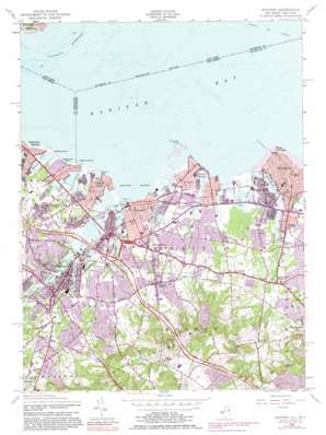
Keyport Topo Map New Jersey
To zoom in, hover over the map of Keyport
USGS Topo Quad 40074d2 - 1:24,000 scale
| Topo Map Name: | Keyport |
| USGS Topo Quad ID: | 40074d2 |
| Print Size: | ca. 21 1/4" wide x 27" high |
| Southeast Coordinates: | 40.375° N latitude / 74.125° W longitude |
| Map Center Coordinates: | 40.4375° N latitude / 74.1875° W longitude |
| U.S. States: | NJ, NY |
| Filename: | o40074d2.jpg |
| Download Map JPG Image: | Keyport topo map 1:24,000 scale |
| Map Type: | Topographic |
| Topo Series: | 7.5´ |
| Map Scale: | 1:24,000 |
| Source of Map Images: | United States Geological Survey (USGS) |
| Alternate Map Versions: |
Keyport NJ 1947 Download PDF Buy paper map Keyport NJ 1954, updated 1956 Download PDF Buy paper map Keyport NJ 1954, updated 1962 Download PDF Buy paper map Keyport NJ 1954, updated 1972 Download PDF Buy paper map Keyport NJ 1954, updated 1981 Download PDF Buy paper map Keyport NJ 1995, updated 2000 Download PDF Buy paper map Keyport NJ 2011 Download PDF Buy paper map Keyport NJ 2014 Download PDF Buy paper map Keyport NJ 2016 Download PDF Buy paper map |
1:24,000 Topo Quads surrounding Keyport
> Back to 40074a1 at 1:100,000 scale
> Back to 40074a1 at 1:250,000 scale
> Back to U.S. Topo Maps home
Keyport topo map: Gazetteer
Keyport: Airports
Hazlet Township Police Heliport elevation 9m 29′IFF Research and Development Heliport elevation 0m 0′
State Police Holmdel Helispot elevation 89m 291′
Keyport: Bays
Keyport Harbor elevation 0m 0′Raritan Bay elevation 0m 0′
Raritan Bay elevation 0m 0′
Keyport: Beaches
Belvedero Beach elevation 0m 0′Cliffwood Beach elevation 0m 0′
Laurence Harbor Beach elevation 0m 0′
Raritan Bay Beach elevation 0m 0′
Seidler Beach elevation 0m 0′
Keyport: Bends
Ward Point Bend elevation 0m 0′Keyport: Canals
Ward Point Secondary Channel elevation 0m 0′Keyport: Capes
Conaskonk Point elevation 0m 0′Matawan Point elevation 1m 3′
Point Comfort elevation 0m 0′
Keyport: Channels
Red Bank Reach elevation 0m 0′Keyport: Crossings
Interchange 116 elevation 68m 223′Interchange 117 elevation 6m 19′
Keyport: Dams
Lake Lefferts Dam elevation 3m 9′Keyport: Guts
Marquis Creek elevation 3m 9′Keyport: Lakes
Natco Lake elevation -3m -10′Treasure Lake elevation 0m 0′
Keyport: Parks
Allocco Park elevation 10m 32′Bob Roggy Field elevation 45m 147′
Cliffwood Beach Park elevation 1m 3′
Conference House Park elevation 0m 0′
Deep Cut County Park elevation 52m 170′
Dorsett Park elevation 18m 59′
Holmdel County Park elevation 82m 269′
Labbe Park elevation 16m 52′
Memorial Park elevation 6m 19′
Old Bridge Waterfront Park elevation 0m 0′
Tatum County Park elevation 38m 124′
Telegraph Hill Park elevation 68m 223′
Veterans Park elevation 12m 39′
Keyport: Populated Places
Centerville elevation 19m 62′Cliffwood elevation 18m 59′
Cliffwood Beach elevation 16m 52′
Crawford Corners elevation 59m 193′
Freneau elevation 24m 78′
Hazlet elevation 24m 78′
Hendrickson Corners elevation 13m 42′
Holland elevation 38m 124′
Keansburg elevation 3m 9′
Keyport elevation 8m 26′
Laurence Harbor elevation 8m 26′
Matawan elevation 15m 49′
Mechanicsville elevation 10m 32′
Morganville elevation 48m 157′
Morrell Corners elevation 26m 85′
Natco elevation 1m 3′
North Centerville elevation 11m 36′
Philips Mills elevation 7m 22′
Red Hill elevation 70m 229′
Strathmore elevation 43m 141′
Tiltons Corners elevation 5m 16′
Union Beach elevation 1m 3′
Van Marters Corner elevation 6m 19′
West Keansburg elevation 2m 6′
Keyport: Post Offices
Keansburg Post Office elevation 2m 6′Keyport Post Office elevation 5m 16′
Matawan Post Office elevation 16m 52′
Keyport: Ranges
Mount Pleasant Hills elevation 85m 278′Keyport: Reservoirs
Lake Lefferts elevation 4m 13′Lake Matawan elevation 6m 19′
Keyport: Streams
Birch Swamp Brook elevation 7m 22′Chingarora Creek elevation 0m 0′
East Creek elevation 1m 3′
Flat Creek elevation 3m 9′
Gravelly Brook elevation 6m 19′
Lappatatong Creek elevation 0m 0′
Long Neck Creek elevation 5m 16′
Luppatatong Creek elevation 0m 0′
Mahoras Brook elevation 6m 19′
Matawan Creek elevation 0m 0′
Mohingson Creek elevation 4m 13′
Thornes Creek elevation 0m 0′
Waackaack Creek elevation 0m 0′
Whale Creek elevation 0m 0′
Keyport: Summits
Beacon Hill elevation 82m 269′Crawford Hill elevation 120m 393′
Telegraph Hill elevation 106m 347′
Keyport digital topo map on disk
Buy this Keyport topo map showing relief, roads, GPS coordinates and other geographical features, as a high-resolution digital map file on DVD:
Atlantic Coast (NY, NJ, PA, DE, MD, VA, NC)
Buy digital topo maps: Atlantic Coast (NY, NJ, PA, DE, MD, VA, NC)


