Westfield Topo Map Indiana
To zoom in, hover over the map of Westfield
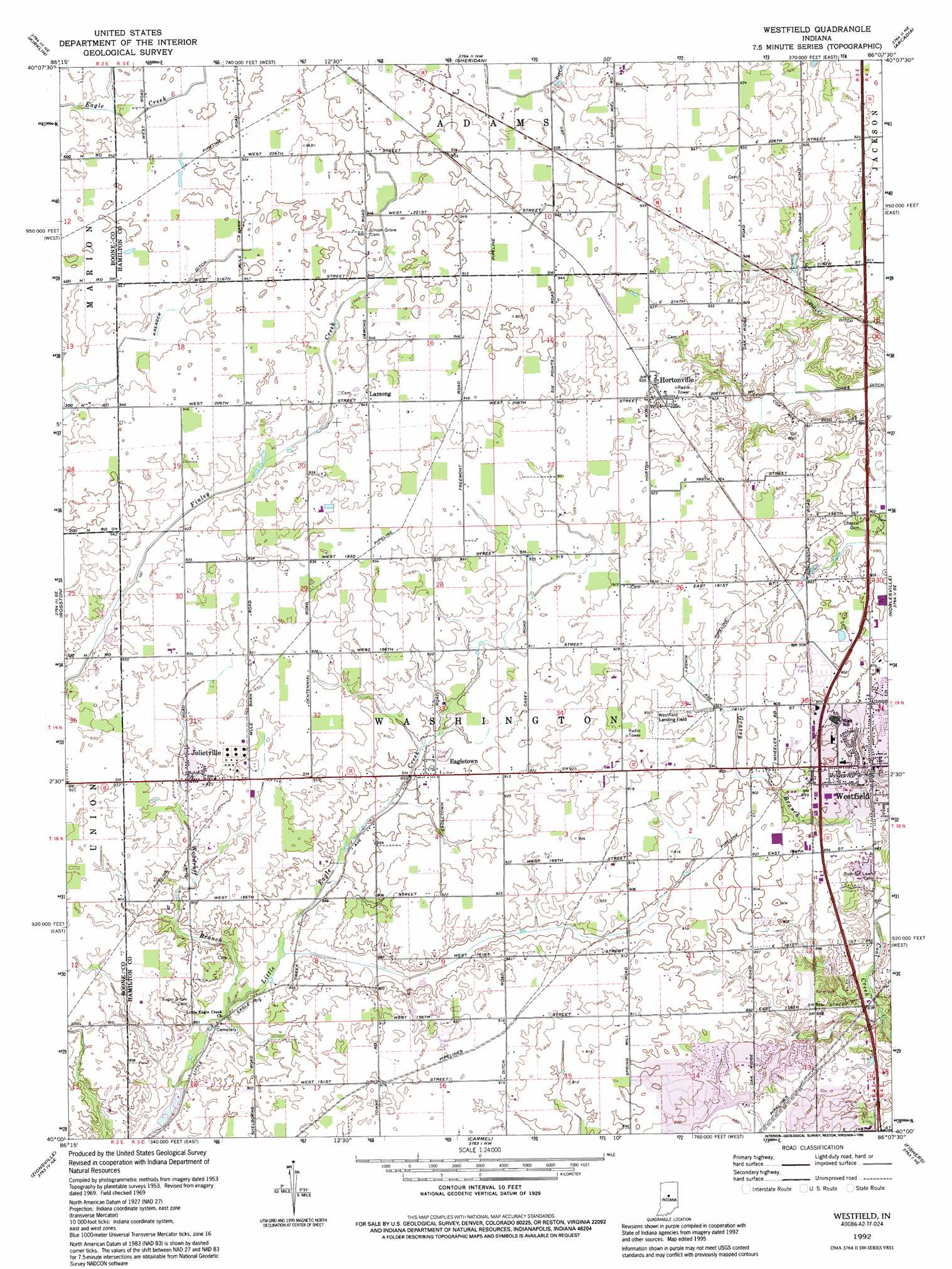
USGS Topo Quad 40086a2 - 1:24,000 scale
| Topo Map Name: | Westfield |
| USGS Topo Quad ID: | 40086a2 |
| Print Size: | ca. 21 1/4" wide x 27" high |
| Southeast Coordinates: | 40° N latitude / 86.125° W longitude |
| Map Center Coordinates: | 40.0625° N latitude / 86.1875° W longitude |
| U.S. State: | IN |
| Filename: | o40086a2.jpg |
| Download Map JPG Image: | Westfield topo map 1:24,000 scale |
| Map Type: | Topographic |
| Topo Series: | 7.5´ |
| Map Scale: | 1:24,000 |
| Source of Map Images: | United States Geological Survey (USGS) |
| Alternate Map Versions: |
Westfield IN 1953, updated 1954 Download PDF Buy paper map Westfield IN 1969, updated 1971 Download PDF Buy paper map Westfield IN 1969, updated 1987 Download PDF Buy paper map Westfield IN 1992, updated 1995 Download PDF Buy paper map Westfield IN 2010 Download PDF Buy paper map Westfield IN 2013 Download PDF Buy paper map Westfield IN 2016 Download PDF Buy paper map |
1:24,000 Topo Quads surrounding Westfield
Michigantown |
Hillisburg |
Kempton |
Tipton |
Windfall |
Mechanicsburg |
Kirklin |
Sheridan |
Arcadia |
Omega |
Lebanon |
Rosston |
Westfield |
Noblesville |
Riverwood |
Fayette |
Zionsville |
Carmel |
Fishers |
Mccordsville |
Brownsburg |
Clermont |
Indianapolis West |
Indianapolis East |
Cumberland |
> Back to 40086a1 at 1:100,000 scale
> Back to 40086a1 at 1:250,000 scale
> Back to U.S. Topo Maps home
Westfield topo map: Gazetteer
Westfield: Airports
Helicopter Airways of Indiana elevation 257m 843′Pace Airport elevation 268m 879′
Westfield Airport elevation 281m 921′
Wilderness Field elevation 276m 905′
Westfield: Canals
Jay Ditch elevation 284m 931′Lindley Ditch elevation 274m 898′
Westfield: Parks
West Side Park elevation 270m 885′Westfield: Populated Places
Eagletown elevation 275m 902′Hortonville elevation 287m 941′
Jolietville elevation 281m 921′
Lamong elevation 288m 944′
Pleasant View (historical) elevation 281m 921′
Westfield elevation 270m 885′
Westfield: Post Offices
Westfield Post Office elevation 276m 905′Westfield: Streams
Bear Creek elevation 262m 859′Woodruff Branch elevation 264m 866′
Westfield digital topo map on disk
Buy this Westfield topo map showing relief, roads, GPS coordinates and other geographical features, as a high-resolution digital map file on DVD:
Northern Illinois, Northern Indiana & Southwestern Michigan
Buy digital topo maps: Northern Illinois, Northern Indiana & Southwestern Michigan