Attica Topo Map Indiana
To zoom in, hover over the map of Attica
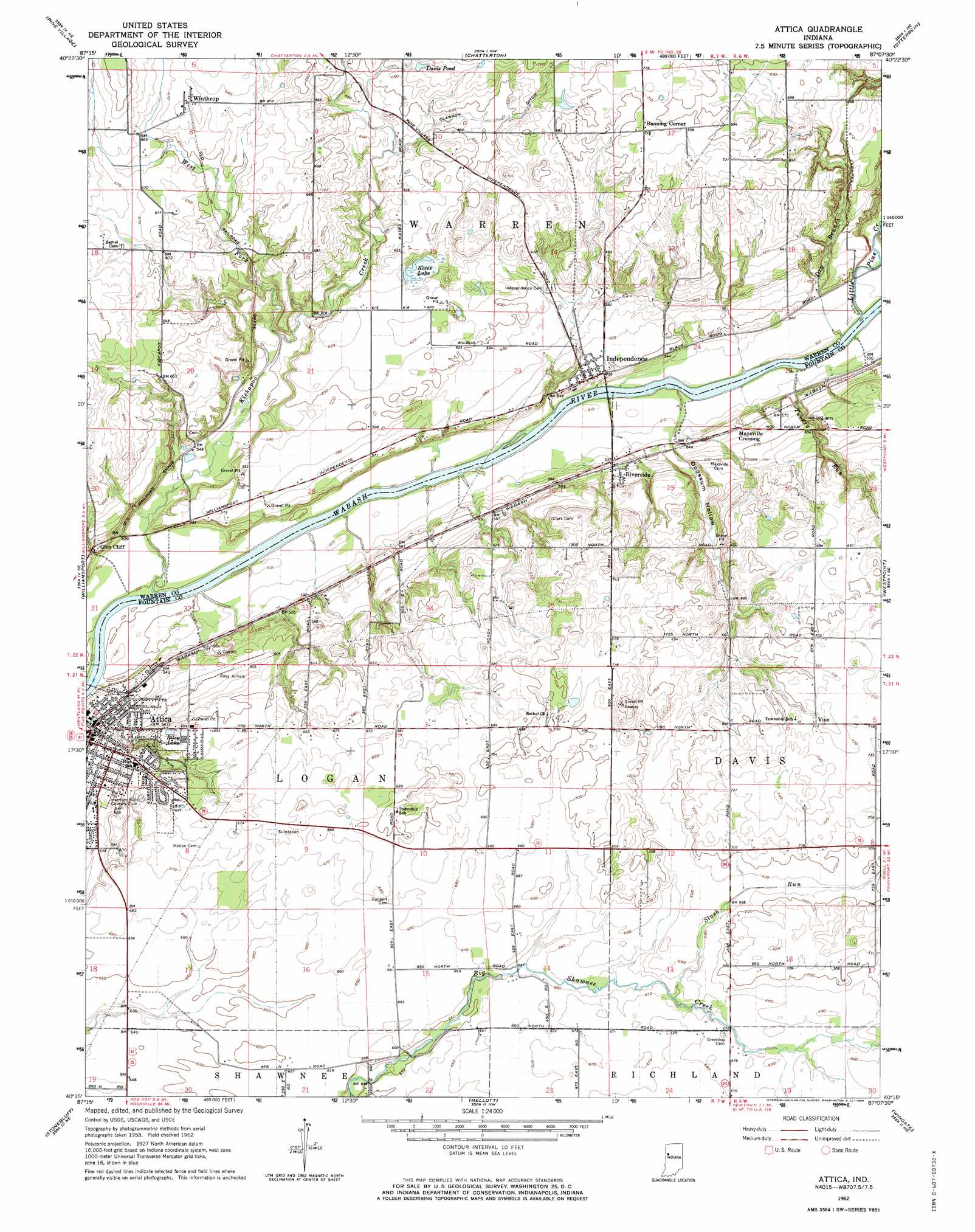
USGS Topo Quad 40087c2 - 1:24,000 scale
| Topo Map Name: | Attica |
| USGS Topo Quad ID: | 40087c2 |
| Print Size: | ca. 21 1/4" wide x 27" high |
| Southeast Coordinates: | 40.25° N latitude / 87.125° W longitude |
| Map Center Coordinates: | 40.3125° N latitude / 87.1875° W longitude |
| U.S. State: | IN |
| Filename: | o40087c2.jpg |
| Download Map JPG Image: | Attica topo map 1:24,000 scale |
| Map Type: | Topographic |
| Topo Series: | 7.5´ |
| Map Scale: | 1:24,000 |
| Source of Map Images: | United States Geological Survey (USGS) |
| Alternate Map Versions: |
Attica IN 1962, updated 1964 Download PDF Buy paper map Attica IN 1962, updated 1964 Download PDF Buy paper map Attica IN 2010 Download PDF Buy paper map Attica IN 2013 Download PDF Buy paper map Attica IN 2016 Download PDF Buy paper map |
1:24,000 Topo Quads surrounding Attica
Boswell |
Fowler |
Templeton |
Round Grove |
Brookston Sw |
Tab |
Pine Village |
Chatterton |
Otterbein |
Lafayette West |
West Lebanon |
Williamsport |
Attica |
Westpoint |
Romney |
Covington |
Stone Bluff |
Mellott |
Wingate |
Linden |
Perrysville |
Veedersburg |
Hillsboro |
Waynetown |
Crawfordsville |
> Back to 40087a1 at 1:100,000 scale
> Back to 40086a1 at 1:250,000 scale
> Back to U.S. Topo Maps home
Attica topo map: Gazetteer
Attica: Airports
Riley Field elevation 202m 662′Attica: Canals
Clawson Ditch elevation 200m 656′Attica: Lakes
Kates Lake elevation 185m 606′Attica: Parks
Ravine Park elevation 192m 629′Attica: Populated Places
Attica elevation 165m 541′Banning Corner elevation 218m 715′
Glen Cliff elevation 175m 574′
Independence elevation 171m 561′
Maysville Crossing elevation 172m 564′
Riverside elevation 173m 567′
Vine elevation 218m 715′
Winthrop elevation 209m 685′
Attica: Reservoirs
Davis Pond elevation 203m 666′Riley Lake elevation 198m 649′
Attica: Streams
Dry Branch elevation 153m 501′Grindstone Creek elevation 154m 505′
Kickapoo Creek elevation 153m 501′
Little Pine Creek elevation 154m 505′
Slush Run elevation 203m 666′
Turkey Run elevation 151m 495′
West Fork Kickapoo Creek elevation 170m 557′
Attica: Valleys
Opossum Hollow elevation 169m 554′Attica digital topo map on disk
Buy this Attica topo map showing relief, roads, GPS coordinates and other geographical features, as a high-resolution digital map file on DVD:
Northern Illinois, Northern Indiana & Southwestern Michigan
Buy digital topo maps: Northern Illinois, Northern Indiana & Southwestern Michigan