Wellington Topo Map Illinois
To zoom in, hover over the map of Wellington
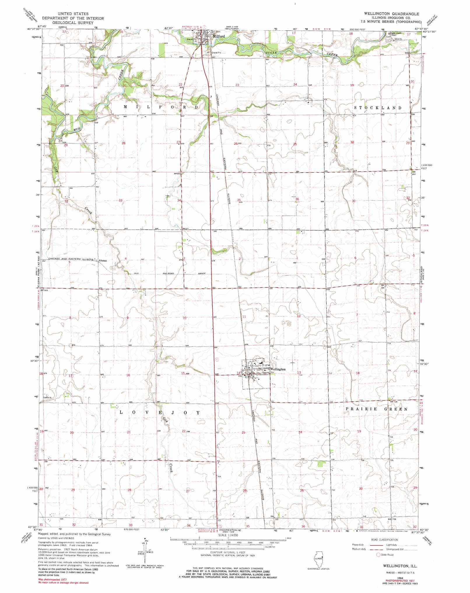
USGS Topo Quad 40087e6 - 1:24,000 scale
| Topo Map Name: | Wellington |
| USGS Topo Quad ID: | 40087e6 |
| Print Size: | ca. 21 1/4" wide x 27" high |
| Southeast Coordinates: | 40.5° N latitude / 87.625° W longitude |
| Map Center Coordinates: | 40.5625° N latitude / 87.6875° W longitude |
| U.S. State: | IL |
| Filename: | o40087e6.jpg |
| Download Map JPG Image: | Wellington topo map 1:24,000 scale |
| Map Type: | Topographic |
| Topo Series: | 7.5´ |
| Map Scale: | 1:24,000 |
| Source of Map Images: | United States Geological Survey (USGS) |
| Alternate Map Versions: |
Wellington IL 1964, updated 1965 Download PDF Buy paper map Wellington IL 1964, updated 1981 Download PDF Buy paper map Wellington IL 2012 Download PDF Buy paper map Wellington IL 2015 Download PDF Buy paper map |
1:24,000 Topo Quads surrounding Wellington
Gilman |
Crescent |
Watseka |
Sheldon |
Kentland |
Onarga East |
Woodworth |
Milford |
Darrow |
Earl Park |
Cissna Park |
Claytonville |
Wellington |
Stockland |
Boswell |
Rankin |
East Lynn |
Hoopeston |
Ambia |
Tab |
Penfield |
Potomac |
Henning |
Bismarck |
West Lebanon |
> Back to 40087e1 at 1:100,000 scale
> Back to 40086a1 at 1:250,000 scale
> Back to U.S. Topo Maps home
Wellington topo map: Gazetteer
Wellington: Populated Places
Alonzo elevation 204m 669′Wellington elevation 213m 698′
Wellington: Streams
Gay Creek elevation 193m 633′Wellington digital topo map on disk
Buy this Wellington topo map showing relief, roads, GPS coordinates and other geographical features, as a high-resolution digital map file on DVD:
Northern Illinois, Northern Indiana & Southwestern Michigan
Buy digital topo maps: Northern Illinois, Northern Indiana & Southwestern Michigan