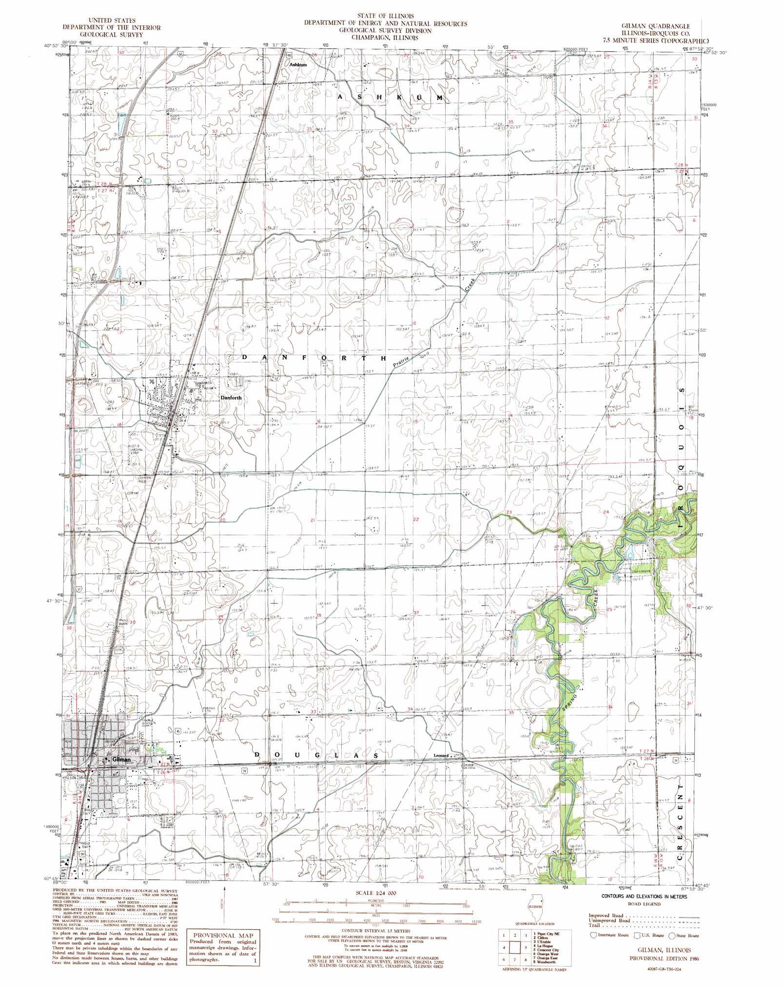
Gilman Topo Map Illinois
To zoom in, hover over the map of Gilman
USGS Topo Quad 40087g8 - 1:24,000 scale
| Topo Map Name: | Gilman |
| USGS Topo Quad ID: | 40087g8 |
| Print Size: | ca. 21 1/4" wide x 27" high |
| Southeast Coordinates: | 40.75° N latitude / 87.875° W longitude |
| Map Center Coordinates: | 40.8125° N latitude / 87.9375° W longitude |
| U.S. State: | IL |
| Filename: | o40087g8.jpg |
| Download Map JPG Image: | Gilman topo map 1:24,000 scale |
| Map Type: | Topographic |
| Topo Series: | 7.5´ |
| Map Scale: | 1:24,000 |
| Source of Map Images: | United States Geological Survey (USGS) |
| Alternate Map Versions: |
Gilman IL 1986, updated 1986 Download PDF Buy paper map Gilman IL 2012 Download PDF Buy paper map Gilman IL 2015 Download PDF Buy paper map |
1:24,000 Topo Quads surrounding Gilman
Buckingham |
Herscher |
West Kankakee |
Kankakee |
Saint Anne |
Cabery |
Piper City Ne |
Clifton |
L'Erable |
Beaverville |
Piper City |
La Hogue |
Gilman |
Crescent |
Watseka |
Buckley Nw |
Onarga West |
Onarga East |
Woodworth |
Milford |
Melvin East |
Buckley |
Cissna Park |
Claytonville |
Wellington |
> Back to 40087e1 at 1:100,000 scale
> Back to 40086a1 at 1:250,000 scale
> Back to U.S. Topo Maps home
Gilman topo map: Gazetteer
Gilman: Airports
Classen Field RLA Airport elevation 198m 649′Gilman: Populated Places
Danforth elevation 199m 652′Gilman elevation 198m 649′
Leonard elevation 192m 629′
Gilman: Post Offices
Danforth Post Office elevation 199m 652′Gilman Post Office elevation 198m 649′
Gilman: Reservoirs
Fish Lake elevation 189m 620′Gilman: Streams
Prairie Creek elevation 192m 629′Gilman digital topo map on disk
Buy this Gilman topo map showing relief, roads, GPS coordinates and other geographical features, as a high-resolution digital map file on DVD:
Northern Illinois, Northern Indiana & Southwestern Michigan
Buy digital topo maps: Northern Illinois, Northern Indiana & Southwestern Michigan