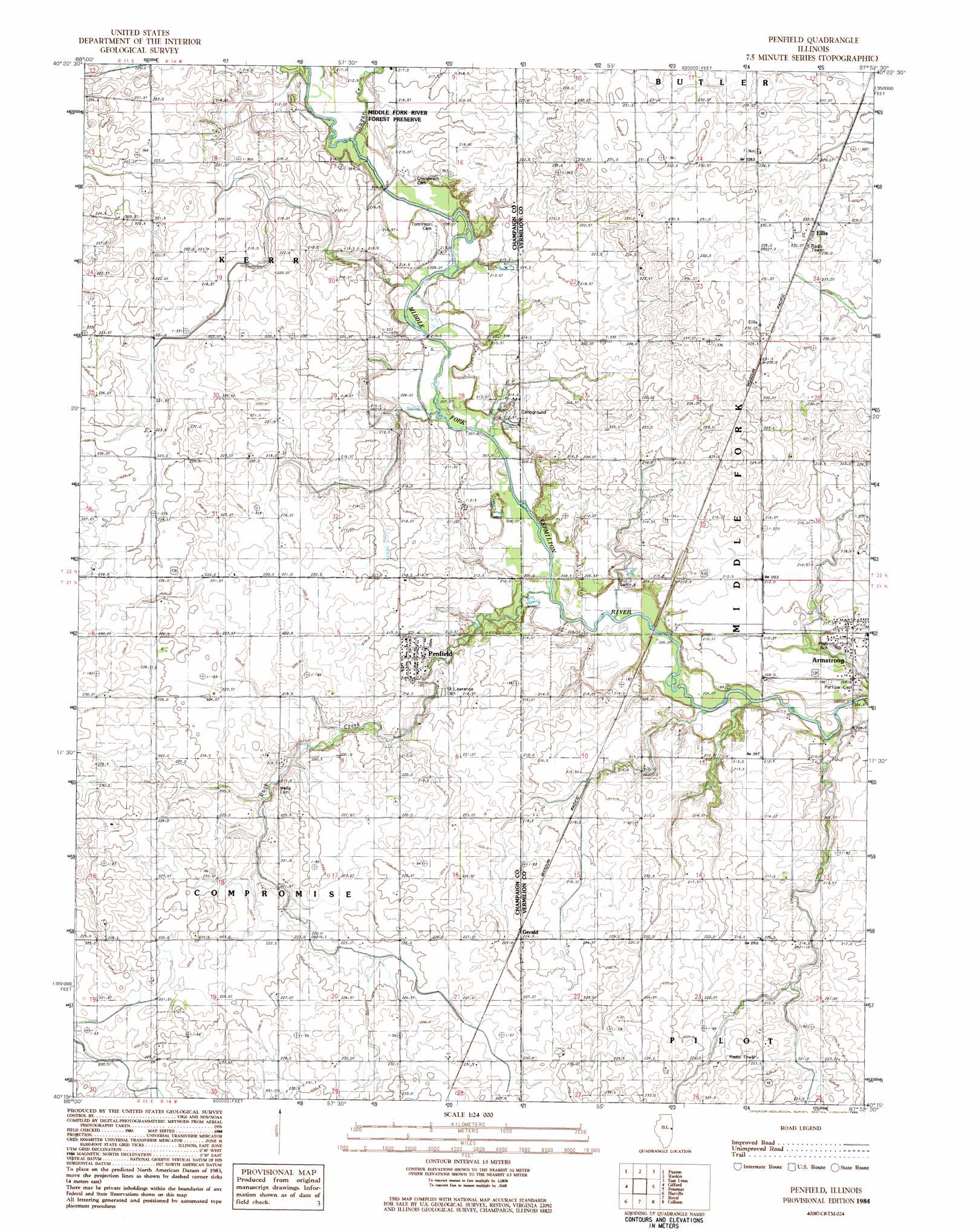
Penfield Topo Map Illinois
To zoom in, hover over the map of Penfield
USGS Topo Quad 40087c8 - 1:24,000 scale
| Topo Map Name: | Penfield |
| USGS Topo Quad ID: | 40087c8 |
| Print Size: | ca. 21 1/4" wide x 27" high |
| Southeast Coordinates: | 40.25° N latitude / 87.875° W longitude |
| Map Center Coordinates: | 40.3125° N latitude / 87.9375° W longitude |
| U.S. State: | IL |
| Filename: | o40087c8.jpg |
| Download Map JPG Image: | Penfield topo map 1:24,000 scale |
| Map Type: | Topographic |
| Topo Series: | 7.5´ |
| Map Scale: | 1:24,000 |
| Source of Map Images: | United States Geological Survey (USGS) |
| Alternate Map Versions: |
Penfield IL 1984, updated 1985 Download PDF Buy paper map Penfield IL 2012 Download PDF Buy paper map Penfield IL 2015 Download PDF Buy paper map |
1:24,000 Topo Quads surrounding Penfield
Melvin East |
Buckley |
Cissna Park |
Claytonville |
Wellington |
Perdueville |
Paxton |
Rankin |
East Lynn |
Hoopeston |
Rantoul |
Gifford |
Penfield |
Potomac |
Henning |
Thomasboro |
Flatville |
Royal |
Collison |
Danville Nw |
Urbana |
Saint Joseph |
Homer |
Oakwood |
Danville Sw |
> Back to 40087a1 at 1:100,000 scale
> Back to 40086a1 at 1:250,000 scale
> Back to U.S. Topo Maps home
Penfield topo map: Gazetteer
Penfield: Parks
Tomlinson Pioneer Cemetery Prairie Nature Preserve elevation 214m 702′Penfield: Populated Places
Armstrong elevation 212m 695′Ellis elevation 230m 754′
Gerald elevation 223m 731′
Penfield elevation 217m 711′
Penfield: Post Offices
Armstrong Post Office elevation 211m 692′Circle Post Office (historical) elevation 232m 761′
Penfield Post Office elevation 218m 715′
Penfield: Streams
Buck Creek elevation 205m 672′Sugar Creek elevation 209m 685′
Penfield digital topo map on disk
Buy this Penfield topo map showing relief, roads, GPS coordinates and other geographical features, as a high-resolution digital map file on DVD:
Northern Illinois, Northern Indiana & Southwestern Michigan
Buy digital topo maps: Northern Illinois, Northern Indiana & Southwestern Michigan