Merna Topo Map Illinois
To zoom in, hover over the map of Merna
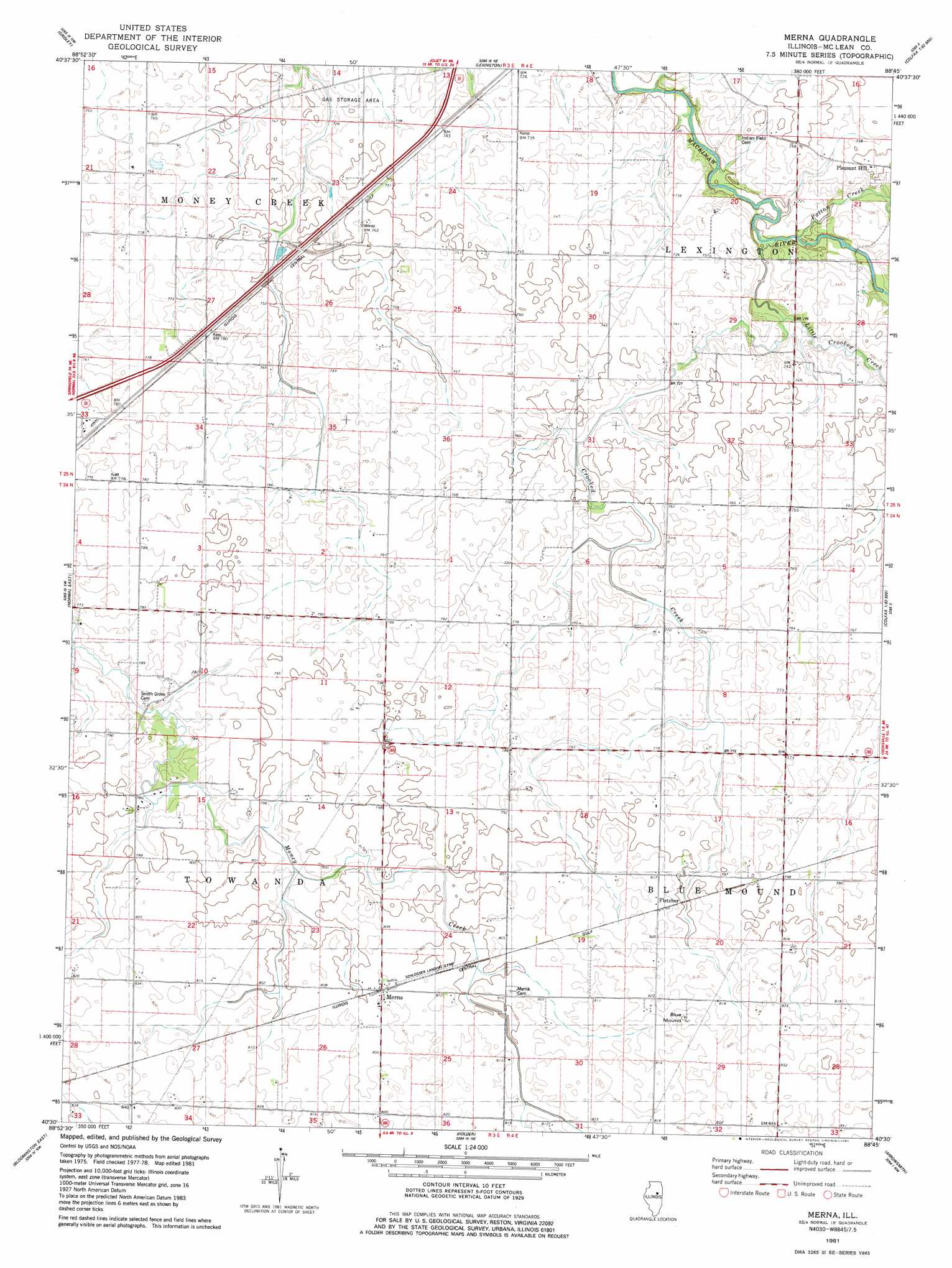
USGS Topo Quad 40088e7 - 1:24,000 scale
| Topo Map Name: | Merna |
| USGS Topo Quad ID: | 40088e7 |
| Print Size: | ca. 21 1/4" wide x 27" high |
| Southeast Coordinates: | 40.5° N latitude / 88.75° W longitude |
| Map Center Coordinates: | 40.5625° N latitude / 88.8125° W longitude |
| U.S. State: | IL |
| Filename: | o40088e7.jpg |
| Download Map JPG Image: | Merna topo map 1:24,000 scale |
| Map Type: | Topographic |
| Topo Series: | 7.5´ |
| Map Scale: | 1:24,000 |
| Source of Map Images: | United States Geological Survey (USGS) |
| Alternate Map Versions: |
Merna IL 1981, updated 1981 Download PDF Buy paper map Merna IL 2012 Download PDF Buy paper map Merna IL 2015 Download PDF Buy paper map |
1:24,000 Topo Quads surrounding Merna
Benson |
Flanagan Sw |
Flanagan South |
Southwest Pontiac |
Southeast Pontiac |
El Paso |
Gridley |
Lexington |
Chenoa |
Fairbury |
Normal West |
Normal East |
Merna |
Cooksville |
Colfax |
Bloomington West |
Bloomington East |
Holder |
Arrowsmith |
Saybrook |
Funks Grove |
Heyworth |
Le Roy |
Farmer City North |
Belleflower |
> Back to 40088e1 at 1:100,000 scale
> Back to 40088a1 at 1:250,000 scale
> Back to U.S. Topo Maps home
Merna topo map: Gazetteer
Merna: Airports
Schlosser Airport elevation 245m 803′Snow RLA Airport elevation 244m 800′
Merna: Populated Places
Fletcher elevation 247m 810′Merna elevation 247m 810′
Merna: Streams
Crooked Creek elevation 216m 708′Crooked Creek elevation 223m 731′
Little Crooked Creek elevation 213m 698′
Patton Creek elevation 213m 698′
Merna: Summits
Blue Mound elevation 258m 846′Merna digital topo map on disk
Buy this Merna topo map showing relief, roads, GPS coordinates and other geographical features, as a high-resolution digital map file on DVD:
Northern Illinois, Northern Indiana & Southwestern Michigan
Buy digital topo maps: Northern Illinois, Northern Indiana & Southwestern Michigan