Heyworth Topo Map Illinois
To zoom in, hover over the map of Heyworth
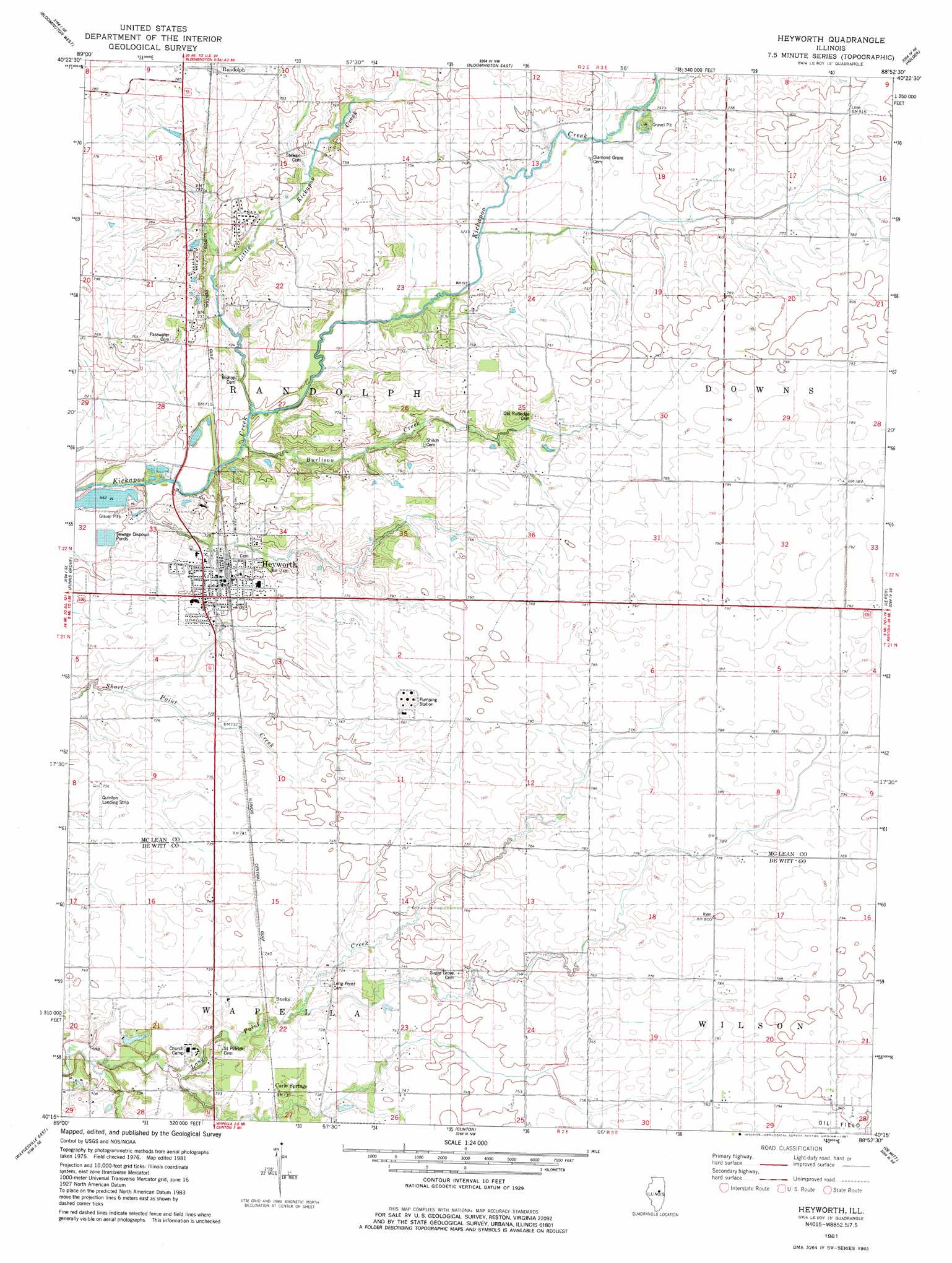
USGS Topo Quad 40088c8 - 1:24,000 scale
| Topo Map Name: | Heyworth |
| USGS Topo Quad ID: | 40088c8 |
| Print Size: | ca. 21 1/4" wide x 27" high |
| Southeast Coordinates: | 40.25° N latitude / 88.875° W longitude |
| Map Center Coordinates: | 40.3125° N latitude / 88.9375° W longitude |
| U.S. State: | IL |
| Filename: | o40088c8.jpg |
| Download Map JPG Image: | Heyworth topo map 1:24,000 scale |
| Map Type: | Topographic |
| Topo Series: | 7.5´ |
| Map Scale: | 1:24,000 |
| Source of Map Images: | United States Geological Survey (USGS) |
| Alternate Map Versions: |
Heyworth IL 1981, updated 1981 Download PDF Buy paper map Heyworth IL 1998, updated 2000 Download PDF Buy paper map Heyworth IL 2012 Download PDF Buy paper map Heyworth IL 2015 Download PDF Buy paper map |
1:24,000 Topo Quads surrounding Heyworth
Danvers |
Normal West |
Normal East |
Merna |
Cooksville |
Stanford |
Bloomington West |
Bloomington East |
Holder |
Arrowsmith |
Mclean |
Funks Grove |
Heyworth |
Le Roy |
Farmer City North |
Waynesville West |
Waynesville East |
Clinton |
De Witt |
Farmer City South |
Chestnut |
Kenney |
Maroa |
Weldon West |
Weldon East |
> Back to 40088a1 at 1:100,000 scale
> Back to 40088a1 at 1:250,000 scale
> Back to U.S. Topo Maps home
Heyworth topo map: Gazetteer
Heyworth: Airports
Hamlow RLA Airport elevation 235m 770′Lytleville Orchard Airport elevation 239m 784′
Quinton Landing Strip elevation 222m 728′
Heyworth: Populated Places
Bucks elevation 225m 738′Carle Springs elevation 223m 731′
Heyworth elevation 230m 754′
Littleville (historical) elevation 224m 734′
Heyworth: Streams
Burlison Creek elevation 211m 692′Little Kickapoo Creek elevation 223m 731′
Little Kickapoo Creek elevation 211m 692′
Heyworth digital topo map on disk
Buy this Heyworth topo map showing relief, roads, GPS coordinates and other geographical features, as a high-resolution digital map file on DVD:
Northern Illinois, Northern Indiana & Southwestern Michigan
Buy digital topo maps: Northern Illinois, Northern Indiana & Southwestern Michigan