Onarga West Topo Map Illinois
To zoom in, hover over the map of Onarga West
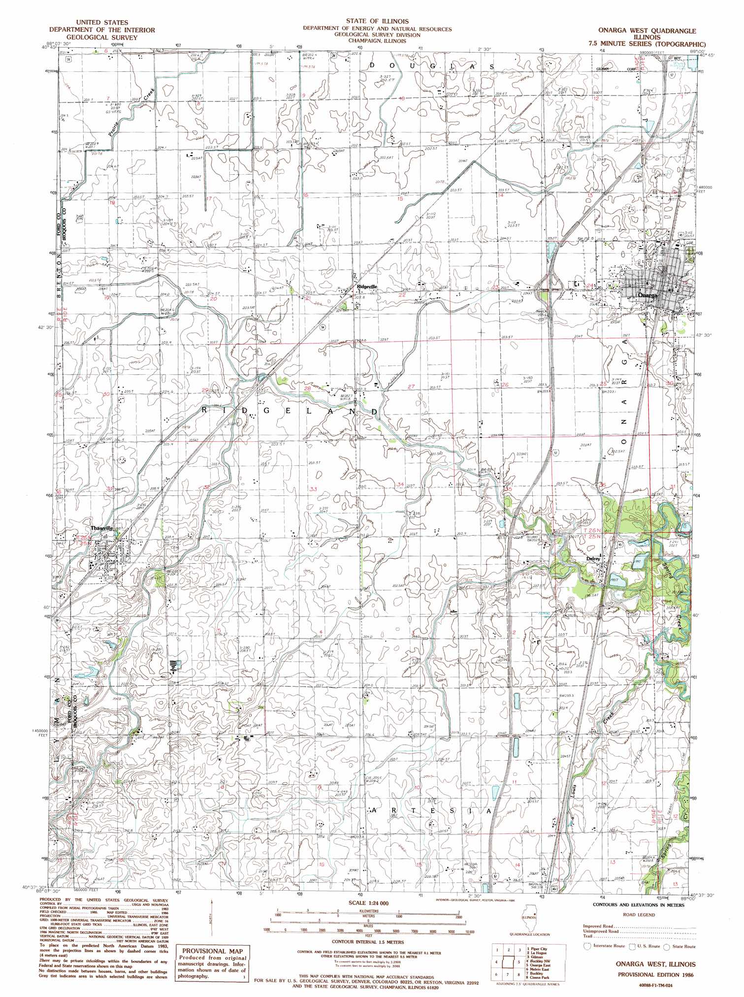
USGS Topo Quad 40088f1 - 1:24,000 scale
| Topo Map Name: | Onarga West |
| USGS Topo Quad ID: | 40088f1 |
| Print Size: | ca. 21 1/4" wide x 27" high |
| Southeast Coordinates: | 40.625° N latitude / 88° W longitude |
| Map Center Coordinates: | 40.6875° N latitude / 88.0625° W longitude |
| U.S. State: | IL |
| Filename: | o40088f1.jpg |
| Download Map JPG Image: | Onarga West topo map 1:24,000 scale |
| Map Type: | Topographic |
| Topo Series: | 7.5´ |
| Map Scale: | 1:24,000 |
| Source of Map Images: | United States Geological Survey (USGS) |
| Alternate Map Versions: |
Onarga West IL 1986, updated 1986 Download PDF Buy paper map Onarga West IL 2012 Download PDF Buy paper map Onarga West IL 2015 Download PDF Buy paper map |
1:24,000 Topo Quads surrounding Onarga West
Cullom |
Cabery |
Piper City Ne |
Clifton |
L'Erable |
Chatsworth North |
Piper City |
La Hogue |
Gilman |
Crescent |
Chatsworth South |
Buckley Nw |
Onarga West |
Onarga East |
Woodworth |
Melvin West |
Melvin East |
Buckley |
Cissna Park |
Claytonville |
Gibson City East |
Perdueville |
Paxton |
Rankin |
East Lynn |
> Back to 40088e1 at 1:100,000 scale
> Back to 40088a1 at 1:250,000 scale
> Back to U.S. Topo Maps home
Onarga West topo map: Gazetteer
Onarga West: Crossings
Interchange 280 elevation 207m 679′Onarga West: Populated Places
Delrey elevation 202m 662′Onarga elevation 204m 669′
Ridgeville elevation 205m 672′
Thawville elevation 210m 688′
Onarga West: Post Offices
Onarga Post Office elevation 207m 679′Onarga West digital topo map on disk
Buy this Onarga West topo map showing relief, roads, GPS coordinates and other geographical features, as a high-resolution digital map file on DVD:
Northern Illinois, Northern Indiana & Southwestern Michigan
Buy digital topo maps: Northern Illinois, Northern Indiana & Southwestern Michigan