La Hogue Topo Map Illinois
To zoom in, hover over the map of La Hogue
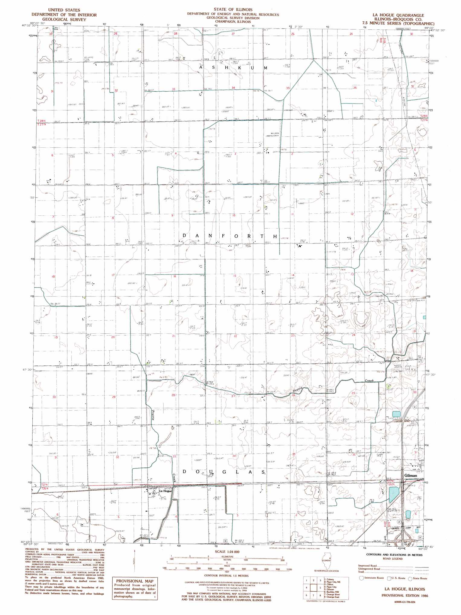
USGS Topo Quad 40088g1 - 1:24,000 scale
| Topo Map Name: | La Hogue |
| USGS Topo Quad ID: | 40088g1 |
| Print Size: | ca. 21 1/4" wide x 27" high |
| Southeast Coordinates: | 40.75° N latitude / 88° W longitude |
| Map Center Coordinates: | 40.8125° N latitude / 88.0625° W longitude |
| U.S. State: | IL |
| Filename: | o40088g1.jpg |
| Download Map JPG Image: | La Hogue topo map 1:24,000 scale |
| Map Type: | Topographic |
| Topo Series: | 7.5´ |
| Map Scale: | 1:24,000 |
| Source of Map Images: | United States Geological Survey (USGS) |
| Alternate Map Versions: |
La Hogue IL 1986, updated 1986 Download PDF Buy paper map La Hogue IL 1998, updated 2003 Download PDF Buy paper map La Hogue IL 2012 Download PDF Buy paper map La Hogue IL 2015 Download PDF Buy paper map |
1:24,000 Topo Quads surrounding La Hogue
Campus |
Buckingham |
Herscher |
West Kankakee |
Kankakee |
Cullom |
Cabery |
Piper City Ne |
Clifton |
L'Erable |
Chatsworth North |
Piper City |
La Hogue |
Gilman |
Crescent |
Chatsworth South |
Buckley Nw |
Onarga West |
Onarga East |
Woodworth |
Melvin West |
Melvin East |
Buckley |
Cissna Park |
Claytonville |
> Back to 40088e1 at 1:100,000 scale
> Back to 40088a1 at 1:250,000 scale
> Back to U.S. Topo Maps home
La Hogue topo map: Gazetteer
La Hogue: Airports
Kuiper Landing Strip elevation 198m 649′Wilken Airport elevation 200m 656′
La Hogue: Crossings
Interchange 283 elevation 204m 669′La Hogue: Populated Places
La Hogue elevation 202m 662′La Hogue: Post Offices
Lahogue Post Office (historical) elevation 202m 662′La Hogue digital topo map on disk
Buy this La Hogue topo map showing relief, roads, GPS coordinates and other geographical features, as a high-resolution digital map file on DVD:
Northern Illinois, Northern Indiana & Southwestern Michigan
Buy digital topo maps: Northern Illinois, Northern Indiana & Southwestern Michigan