Stronghurst Topo Map Illinois
To zoom in, hover over the map of Stronghurst
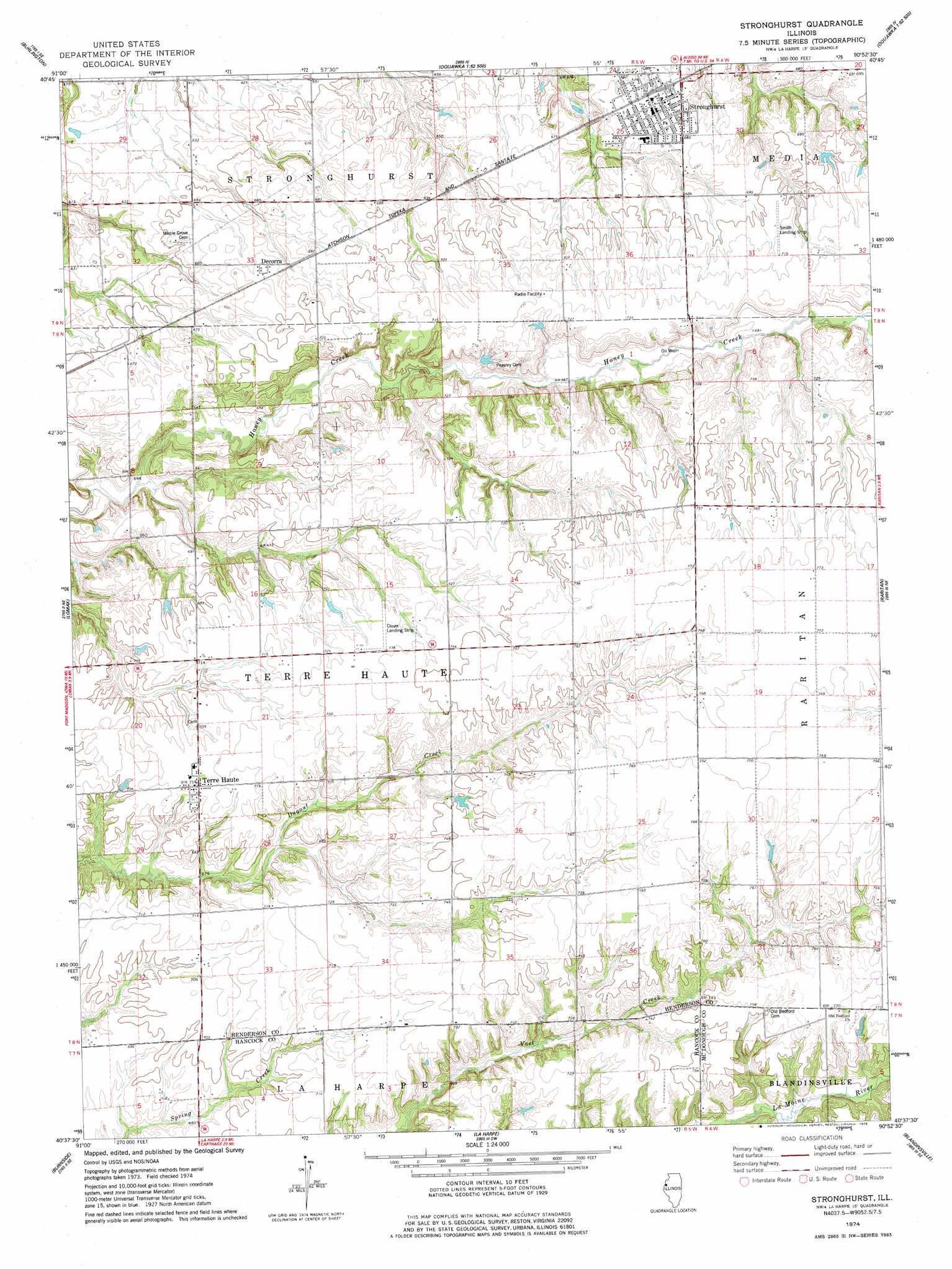
USGS Topo Quad 40090f8 - 1:24,000 scale
| Topo Map Name: | Stronghurst |
| USGS Topo Quad ID: | 40090f8 |
| Print Size: | ca. 21 1/4" wide x 27" high |
| Southeast Coordinates: | 40.625° N latitude / 90.875° W longitude |
| Map Center Coordinates: | 40.6875° N latitude / 90.9375° W longitude |
| U.S. State: | IL |
| Filename: | o40090f8.jpg |
| Download Map JPG Image: | Stronghurst topo map 1:24,000 scale |
| Map Type: | Topographic |
| Topo Series: | 7.5´ |
| Map Scale: | 1:24,000 |
| Source of Map Images: | United States Geological Survey (USGS) |
| Alternate Map Versions: |
Stronghurst IL 1974, updated 1978 Download PDF Buy paper map Stronghurst IL 2012 Download PDF Buy paper map Stronghurst IL 2015 Download PDF Buy paper map |
1:24,000 Topo Quads surrounding Stronghurst
Sperry |
Kingston |
Oquawka |
Rozetta |
Monmouth |
West Burlington |
Burlington |
Gladstone |
Kirkwood West |
Kirkwood East |
Dallas City |
Lomax |
Stronghurst |
Raritan |
Roseville |
Colusa |
Burnside |
La Harpe |
Blandinsville |
Good Hope |
Carthage West |
Carthage East |
Fountain Green |
Colchester |
Macomb |
> Back to 40090e1 at 1:100,000 scale
> Back to 40090a1 at 1:250,000 scale
> Back to U.S. Topo Maps home
Stronghurst topo map: Gazetteer
Stronghurst: Airports
Clover Landing Strip elevation 224m 734′Neff Airport elevation 216m 708′
Stronghurst: Populated Places
Decorra elevation 207m 679′Stronghurst elevation 206m 675′
Terre Haute elevation 216m 708′
Stronghurst digital topo map on disk
Buy this Stronghurst topo map showing relief, roads, GPS coordinates and other geographical features, as a high-resolution digital map file on DVD: