Farmington Topo Map Iowa
To zoom in, hover over the map of Farmington
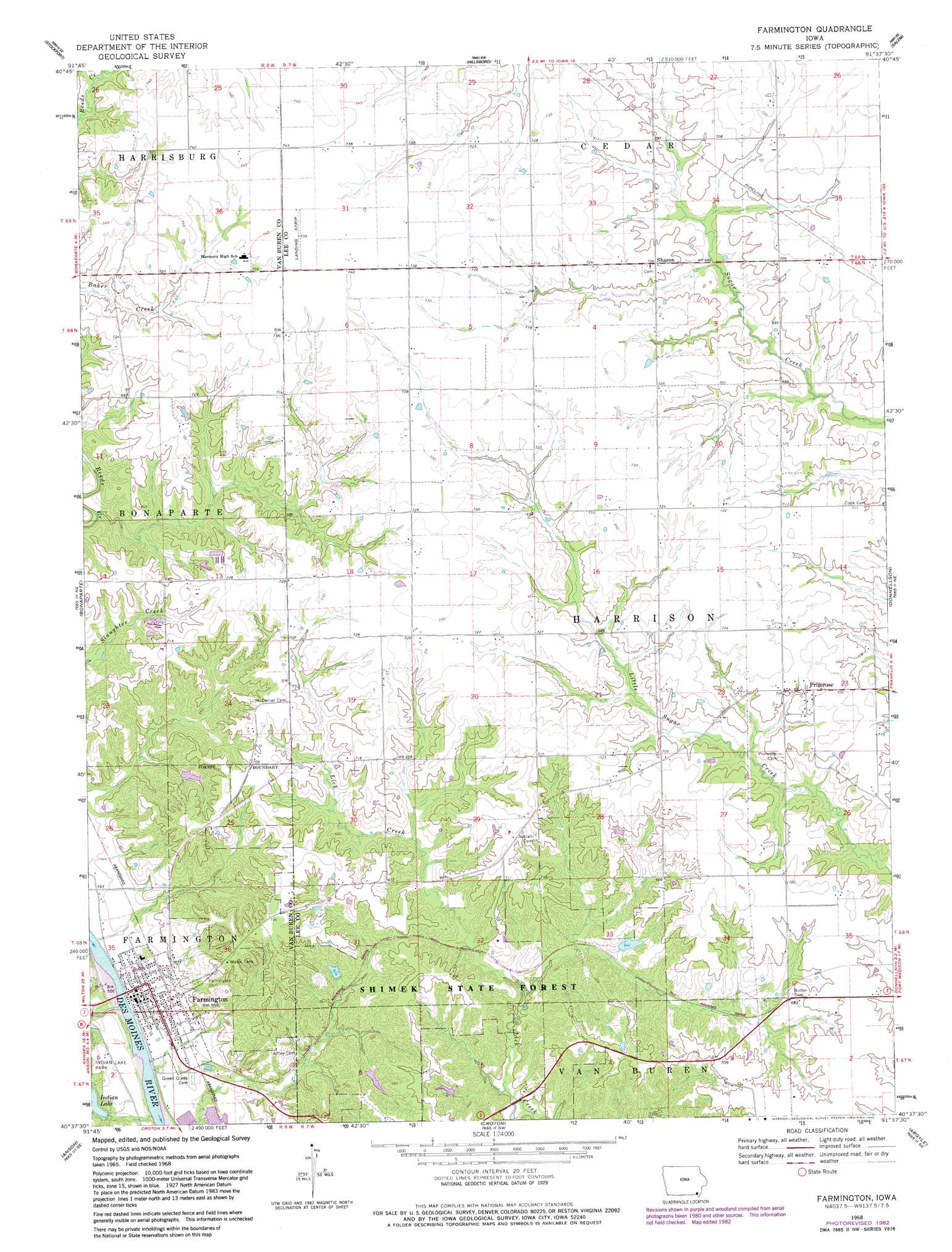
USGS Topo Quad 40091f6 - 1:24,000 scale
| Topo Map Name: | Farmington |
| USGS Topo Quad ID: | 40091f6 |
| Print Size: | ca. 21 1/4" wide x 27" high |
| Southeast Coordinates: | 40.625° N latitude / 91.625° W longitude |
| Map Center Coordinates: | 40.6875° N latitude / 91.6875° W longitude |
| U.S. State: | IA |
| Filename: | o40091f6.jpg |
| Download Map JPG Image: | Farmington topo map 1:24,000 scale |
| Map Type: | Topographic |
| Topo Series: | 7.5´ |
| Map Scale: | 1:24,000 |
| Source of Map Images: | United States Geological Survey (USGS) |
| Alternate Map Versions: |
Farmington IA 1968, updated 1970 Download PDF Buy paper map Farmington IA 1968, updated 1983 Download PDF Buy paper map Farmington IA 2010 Download PDF Buy paper map Farmington IA 2013 Download PDF Buy paper map Farmington IA 2015 Download PDF Buy paper map |
1:24,000 Topo Quads surrounding Farmington
Fairfield South |
Lockridge West |
Lockridge East |
Mount Pleasant |
New London |
Mount Zion |
Stockport |
Hillsboro |
Salem |
Lowell |
Keosauqua |
Bonaparte |
Farmington |
Donnellson |
West Point |
Mount Sterling |
Anson |
Croton |
Argyle |
Nauvoo |
Wyaconda |
Medill |
Kahoka |
Wayland |
Keokuk |
> Back to 40091e1 at 1:100,000 scale
> Back to 40090a1 at 1:250,000 scale
> Back to U.S. Topo Maps home
Farmington topo map: Gazetteer
Farmington: Dams
Shimek Forest Dam Three elevation 195m 639′Farmington: Parks
George Perkins Historical Marker elevation 216m 708′Shimek State Forest Wildlife Management Area - Donnellson Unit elevation 187m 613′
Shimek State Forest Wildlife Management Area - Farmington Unit elevation 207m 679′
Farmington: Populated Places
Farmington elevation 167m 547′Keteban Switch (historical) elevation 209m 685′
Plymouth elevation 173m 567′
Primrose elevation 216m 708′
Sharon elevation 216m 708′
Farmington: Post Offices
Farmington Post Office elevation 166m 544′Primrose Post Office (historical) elevation 216m 708′
Farmington: Reservoirs
Shimek Forest Pond Two elevation 195m 639′Farmington: Streams
Big Indian Creek elevation 162m 531′Farmington: Trails
Indian Lake Park Trail elevation 171m 561′Shimek Forest Trail elevation 191m 626′
Farmington digital topo map on disk
Buy this Farmington topo map showing relief, roads, GPS coordinates and other geographical features, as a high-resolution digital map file on DVD: