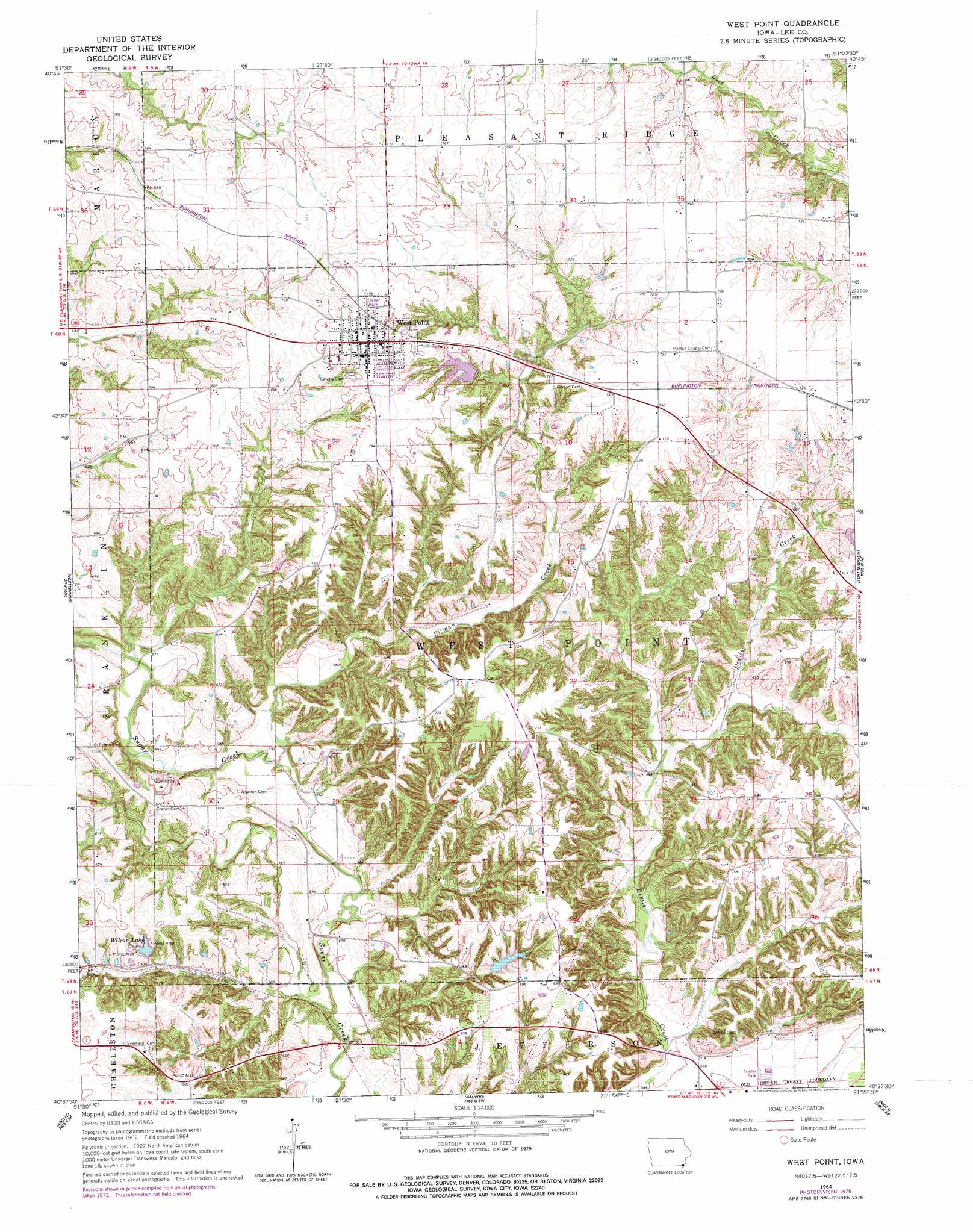
West Point Topo Map Iowa
To zoom in, hover over the map of West Point
USGS Topo Quad 40091f4 - 1:24,000 scale
| Topo Map Name: | West Point |
| USGS Topo Quad ID: | 40091f4 |
| Print Size: | ca. 21 1/4" wide x 27" high |
| Southeast Coordinates: | 40.625° N latitude / 91.375° W longitude |
| Map Center Coordinates: | 40.6875° N latitude / 91.4375° W longitude |
| U.S. State: | IA |
| Filename: | o40091f4.jpg |
| Download Map JPG Image: | West Point topo map 1:24,000 scale |
| Map Type: | Topographic |
| Topo Series: | 7.5´ |
| Map Scale: | 1:24,000 |
| Source of Map Images: | United States Geological Survey (USGS) |
| Alternate Map Versions: |
West Point IA 1964, updated 1965 Download PDF Buy paper map West Point IA 1964, updated 1977 Download PDF Buy paper map West Point IA 2010 Download PDF Buy paper map West Point IA 2013 Download PDF Buy paper map West Point IA 2015 Download PDF Buy paper map |
1:24,000 Topo Quads surrounding West Point
Lockridge East |
Mount Pleasant |
New London |
Pleasant Grove |
Sperry |
Hillsboro |
Salem |
Lowell |
Danville |
West Burlington |
Farmington |
Donnellson |
West Point |
Fort Madison |
Dallas City |
Croton |
Argyle |
Nauvoo |
Niota |
Colusa |
Kahoka |
Wayland |
Keokuk |
Hamilton |
Carthage West |
> Back to 40091e1 at 1:100,000 scale
> Back to 40090a1 at 1:250,000 scale
> Back to U.S. Topo Maps home
West Point topo map: Gazetteer
West Point: Dams
Pollimer Park Lake Dam elevation 213m 698′West Point: Lakes
Wilson Lake elevation 198m 649′West Point: Parks
Wilson Lake Park elevation 205m 672′West Point: Populated Places
West Point elevation 234m 767′West Point: Post Offices
West Point Post Office elevation 234m 767′West Point: Reservoirs
Pollimer Park Lake elevation 213m 698′West Point: Streams
Pitman Creek elevation 168m 551′West Point: Trails
Pollmiller Park Trail elevation 217m 711′West Point digital topo map on disk
Buy this West Point topo map showing relief, roads, GPS coordinates and other geographical features, as a high-resolution digital map file on DVD: