Fairfield South Topo Map Iowa
To zoom in, hover over the map of Fairfield South
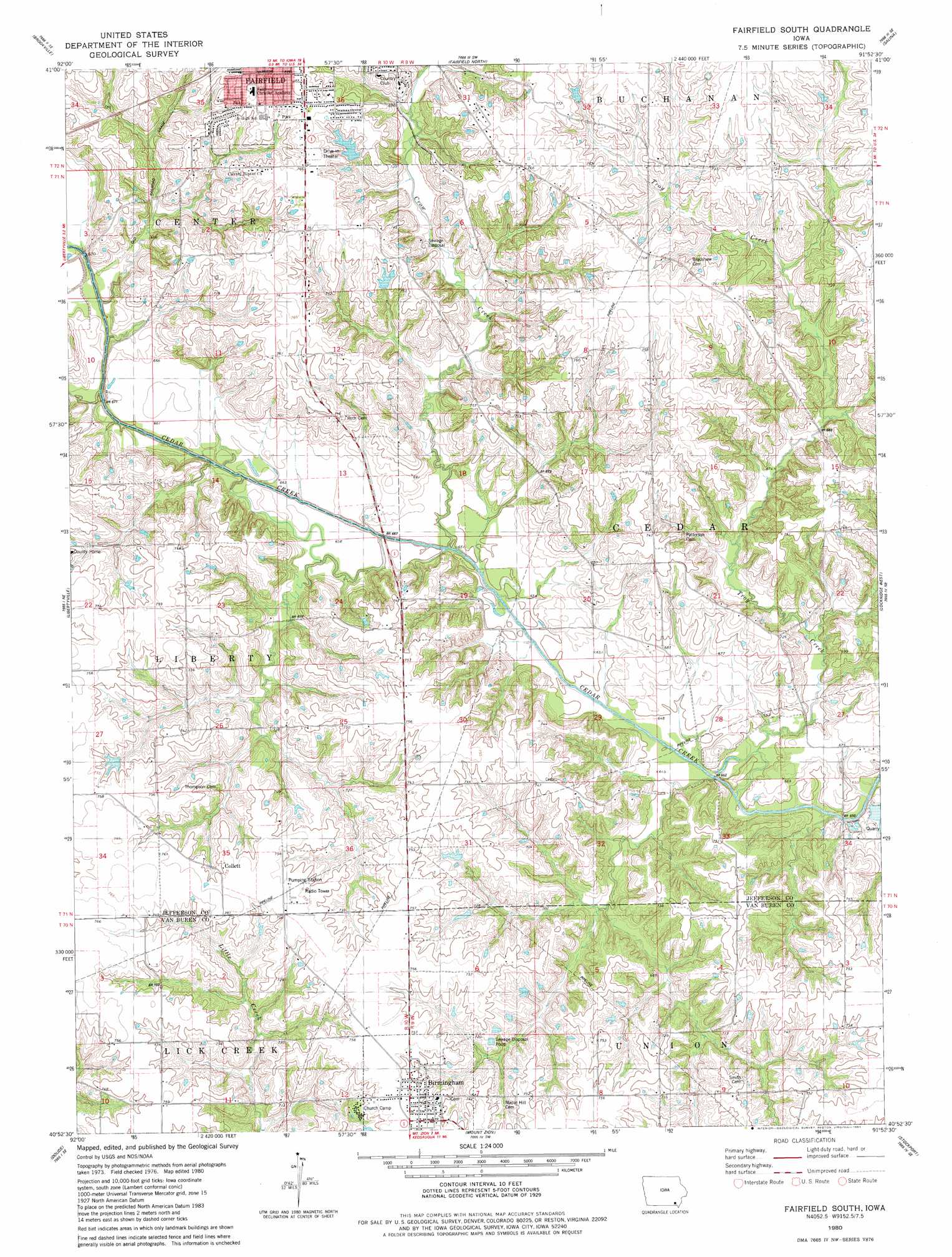
USGS Topo Quad 40091h8 - 1:24,000 scale
| Topo Map Name: | Fairfield South |
| USGS Topo Quad ID: | 40091h8 |
| Print Size: | ca. 21 1/4" wide x 27" high |
| Southeast Coordinates: | 40.875° N latitude / 91.875° W longitude |
| Map Center Coordinates: | 40.9375° N latitude / 91.9375° W longitude |
| U.S. State: | IA |
| Filename: | o40091h8.jpg |
| Download Map JPG Image: | Fairfield South topo map 1:24,000 scale |
| Map Type: | Topographic |
| Topo Series: | 7.5´ |
| Map Scale: | 1:24,000 |
| Source of Map Images: | United States Geological Survey (USGS) |
| Alternate Map Versions: |
Fairfield South IA 1980, updated 1981 Download PDF Buy paper map Fairfield South IA 2010 Download PDF Buy paper map Fairfield South IA 2013 Download PDF Buy paper map Fairfield South IA 2015 Download PDF Buy paper map |
1:24,000 Topo Quads surrounding Fairfield South
Pekin |
Ollie |
Richland |
Brighton |
Wayland |
Abingdon |
Brookville |
Fairfield North |
Salina |
Trenton |
Eldon |
Libertyville |
Fairfield South |
Lockridge West |
Lockridge East |
Selma |
Douds |
Mount Zion |
Stockport |
Hillsboro |
Milton |
Cantril |
Keosauqua |
Bonaparte |
Farmington |
> Back to 40091e1 at 1:100,000 scale
> Back to 40090a1 at 1:250,000 scale
> Back to U.S. Topo Maps home
Fairfield South topo map: Gazetteer
Fairfield South: Parks
Jefferson County Park elevation 211m 692′Lamson Woods State Preserve elevation 221m 725′
Lewis Bonnett Historical Marker elevation 223m 731′
O B Nelson Park elevation 233m 764′
Southwood Park elevation 223m 731′
Turkey Run Wildlife Area elevation 229m 751′
Wilson Park elevation 235m 770′
Zillman's Hickory Hills Recreation Area elevation 231m 757′
Fairfield South: Populated Places
Birmingham elevation 230m 754′Collett elevation 228m 748′
Fairfield South: Post Offices
Birmingham Post Office elevation 230m 754′Collett Post Office (historical) elevation 228m 748′
Harmony Post Office (historical) elevation 233m 764′
Fairfield South: Streams
Crow Creek elevation 198m 649′Troy Creek elevation 194m 636′
Fairfield South: Trails
Jefferson County Park Trail elevation 211m 692′Fairfield South digital topo map on disk
Buy this Fairfield South topo map showing relief, roads, GPS coordinates and other geographical features, as a high-resolution digital map file on DVD: