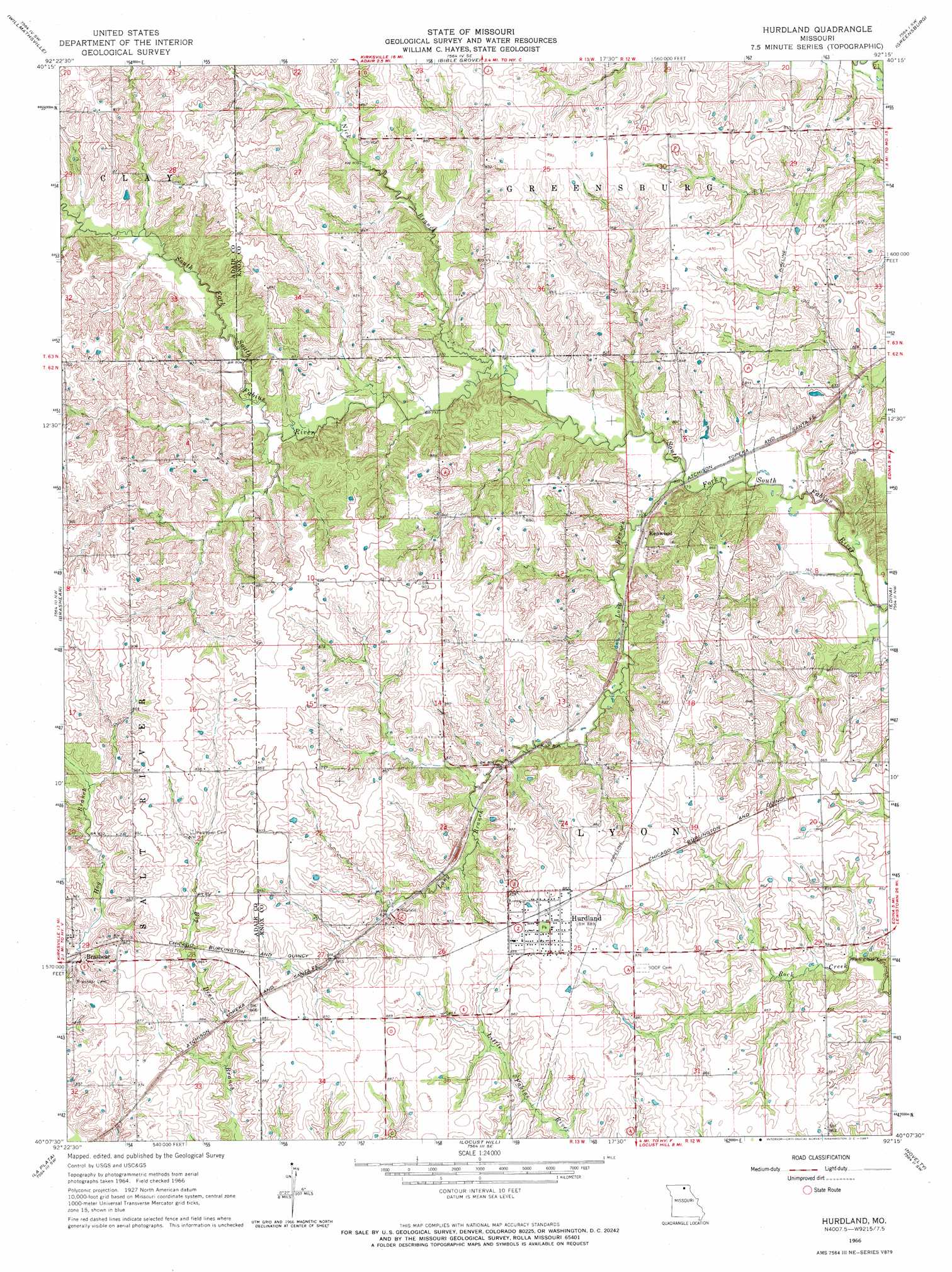
Hurdland Topo Map Missouri
To zoom in, hover over the map of Hurdland
USGS Topo Quad 40092b3 - 1:24,000 scale
| Topo Map Name: | Hurdland |
| USGS Topo Quad ID: | 40092b3 |
| Print Size: | ca. 21 1/4" wide x 27" high |
| Southeast Coordinates: | 40.125° N latitude / 92.25° W longitude |
| Map Center Coordinates: | 40.1875° N latitude / 92.3125° W longitude |
| U.S. State: | MO |
| Filename: | o40092b3.jpg |
| Download Map JPG Image: | Hurdland topo map 1:24,000 scale |
| Map Type: | Topographic |
| Topo Series: | 7.5´ |
| Map Scale: | 1:24,000 |
| Source of Map Images: | United States Geological Survey (USGS) |
| Alternate Map Versions: |
Hurdland MO 1966, updated 1967 Download PDF Buy paper map Hurdland MO 2012 Download PDF Buy paper map Hurdland MO 2015 Download PDF Buy paper map |
1:24,000 Topo Quads surrounding Hurdland
Queen City |
Downing Nw |
Downing |
Memphis |
Arbela |
Greentop |
Willmathsville |
Bible Grove |
Greensburg |
Rutledge |
Kirksville |
Brashear |
Hurdland |
Edina |
Knox City |
Millard |
La Plata |
Locust Hill |
Novelty |
Edina Se |
Barnesville |
Atlanta |
Sue City |
Leonard |
Bethel |
> Back to 40092a1 at 1:100,000 scale
> Back to 40092a1 at 1:250,000 scale
> Back to U.S. Topo Maps home
Hurdland topo map: Gazetteer
Hurdland: Airports
Hunziker Airport elevation 267m 875′Hurdland: Dams
James Lake Dam elevation 250m 820′Parsons Lake Dam elevation 256m 839′
Rock Creek Branch Dam elevation 247m 810′
Taylor Lake Dam elevation 268m 879′
Hurdland: Populated Places
Hurdland elevation 270m 885′Kenwood elevation 238m 780′
Paultown elevation 272m 892′
Hurdland: Reservoirs
Colonial Knoll Lake elevation 247m 810′James Lake elevation 250m 820′
Parsons Lake elevation 256m 839′
Taylor Lake elevation 268m 879′
Hurdland: Streams
Long Branch elevation 232m 761′Nick Branch elevation 237m 777′
Hurdland digital topo map on disk
Buy this Hurdland topo map showing relief, roads, GPS coordinates and other geographical features, as a high-resolution digital map file on DVD: