Garden Grove Topo Map Iowa
To zoom in, hover over the map of Garden Grove
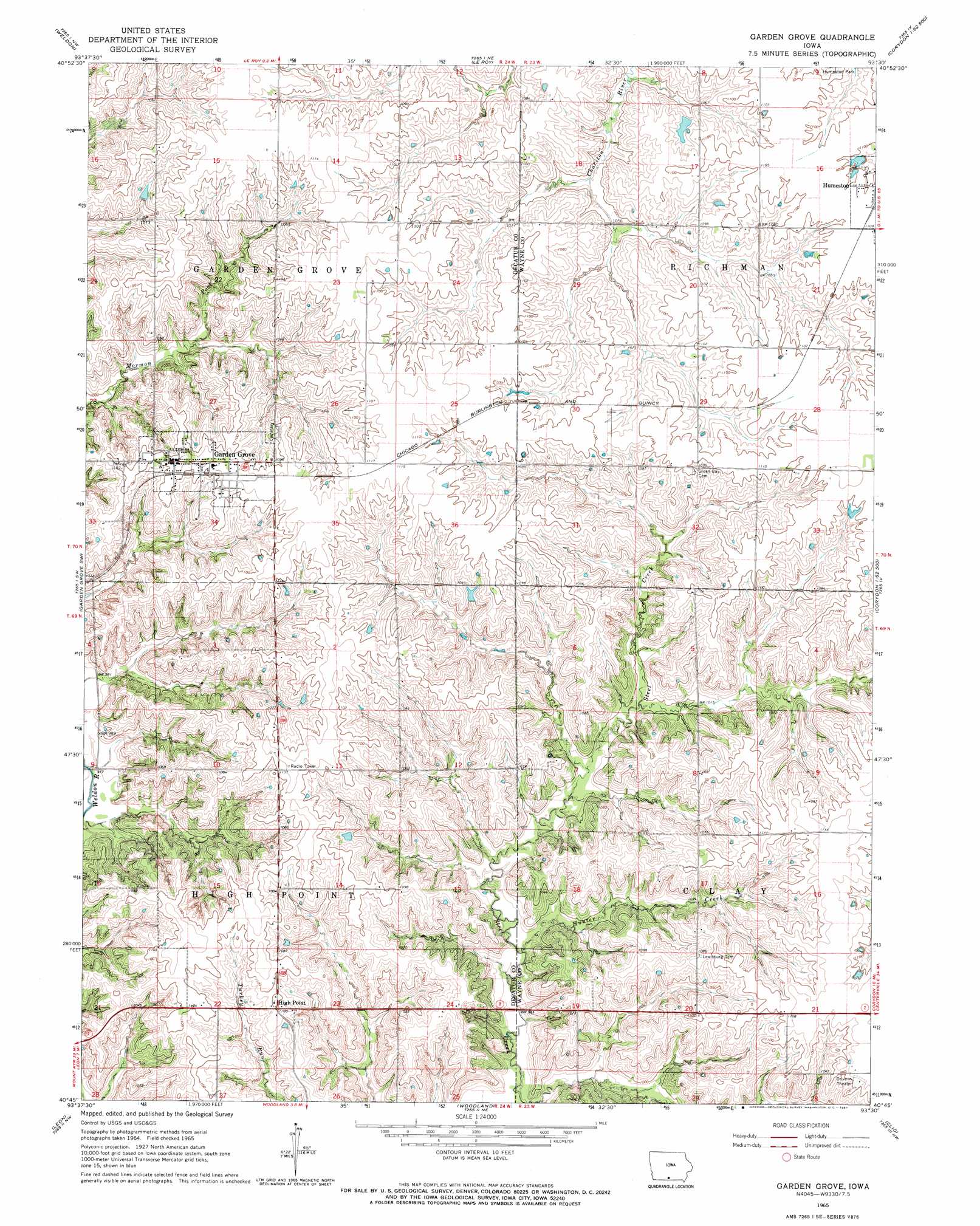
USGS Topo Quad 40093g5 - 1:24,000 scale
| Topo Map Name: | Garden Grove |
| USGS Topo Quad ID: | 40093g5 |
| Print Size: | ca. 21 1/4" wide x 27" high |
| Southeast Coordinates: | 40.75° N latitude / 93.5° W longitude |
| Map Center Coordinates: | 40.8125° N latitude / 93.5625° W longitude |
| U.S. State: | IA |
| Filename: | o40093g5.jpg |
| Download Map JPG Image: | Garden Grove topo map 1:24,000 scale |
| Map Type: | Topographic |
| Topo Series: | 7.5´ |
| Map Scale: | 1:24,000 |
| Source of Map Images: | United States Geological Survey (USGS) |
| Alternate Map Versions: |
Garden Grove IA 1965, updated 1967 Download PDF Buy paper map Garden Grove IA 2010 Download PDF Buy paper map Garden Grove IA 2013 Download PDF Buy paper map Garden Grove IA 2015 Download PDF Buy paper map |
1:24,000 Topo Quads surrounding Garden Grove
Osceola |
Jamison |
Woodburn |
Lucas |
Chariton |
Lacelle |
Weldon |
Le Roy |
Derby |
Corydon Ne |
Van Wert |
Garden Grove Sw |
Garden Grove |
Humeston |
Corydon |
Davis City |
Leon |
Woodland |
Clio |
Allerton |
Akron |
Pleasanton |
Lineville |
Cleopatra |
Powersville |
> Back to 40093e1 at 1:100,000 scale
> Back to 40092a1 at 1:250,000 scale
> Back to U.S. Topo Maps home
Garden Grove topo map: Gazetteer
Garden Grove: Airports
Watkins Private Airport elevation 336m 1102′Garden Grove: Parks
Mormon Pioneer Historic Trailside Park elevation 331m 1085′Garden Grove: Populated Places
Garden Grove elevation 339m 1112′High Point elevation 335m 1099′
Garden Grove: Post Offices
Garden Grove Post Office elevation 339m 1112′Highpoint Post Office (historical) elevation 335m 1099′
Lewisburg Post Office (historical) elevation 332m 1089′
Garden Grove: Streams
Hunter Creek elevation 294m 964′Garden Grove digital topo map on disk
Buy this Garden Grove topo map showing relief, roads, GPS coordinates and other geographical features, as a high-resolution digital map file on DVD: