Prosser Topo Map Nebraska
To zoom in, hover over the map of Prosser
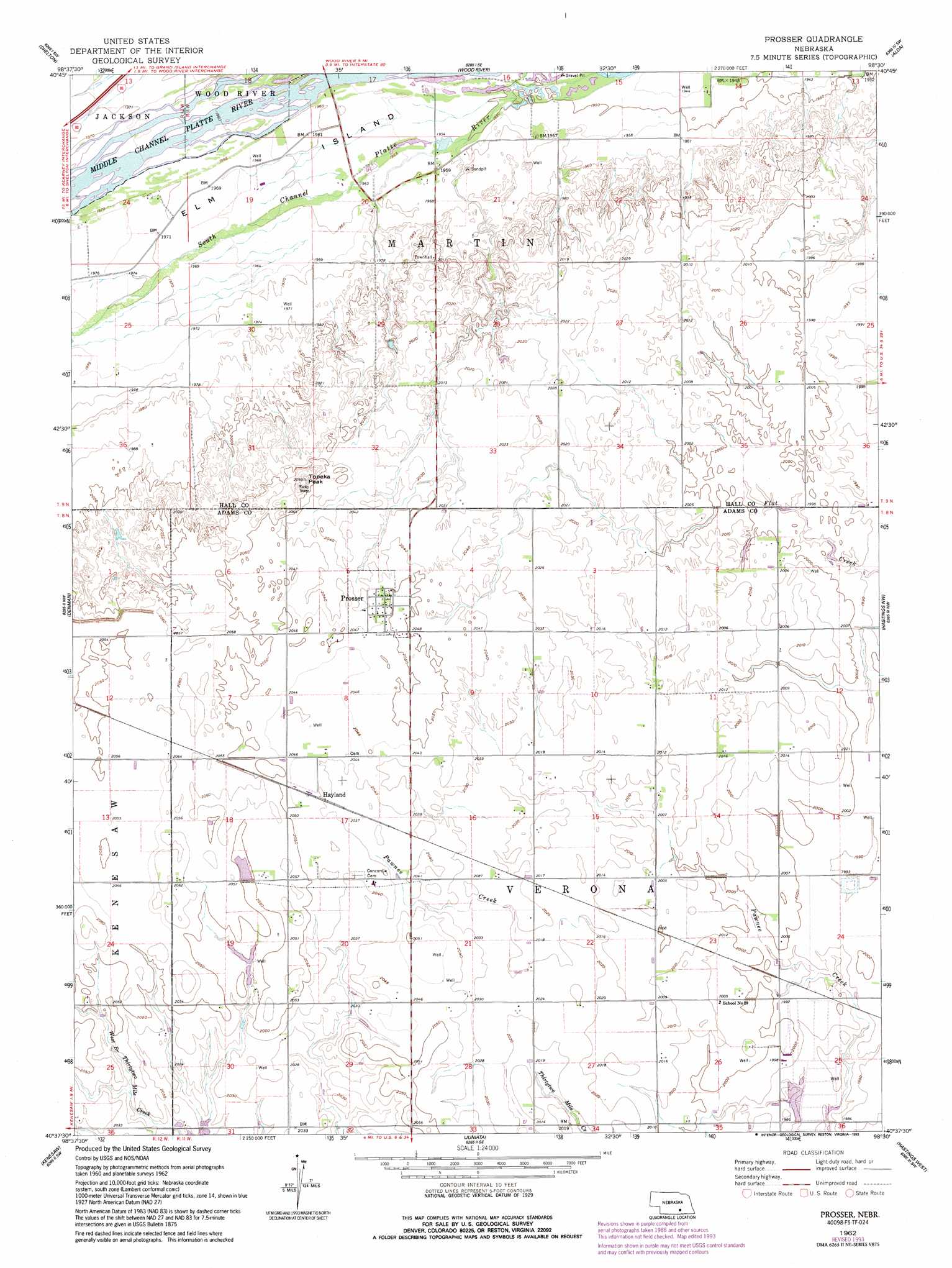
USGS Topo Quad 40098f5 - 1:24,000 scale
| Topo Map Name: | Prosser |
| USGS Topo Quad ID: | 40098f5 |
| Print Size: | ca. 21 1/4" wide x 27" high |
| Southeast Coordinates: | 40.625° N latitude / 98.5° W longitude |
| Map Center Coordinates: | 40.6875° N latitude / 98.5625° W longitude |
| U.S. State: | NE |
| Filename: | O40098f5.jpg |
| Download Map JPG Image: | Prosser topo map 1:24,000 scale |
| Map Type: | Topographic |
| Topo Series: | 7.5´ |
| Map Scale: | 1:24,000 |
| Source of Map Images: | United States Geological Survey (USGS) |
| Alternate Map Versions: |
Prosser NE 1962, updated 1963 Download PDF Buy paper map Prosser NE 1962, updated 1993 Download PDF Buy paper map Prosser NE 2011 Download PDF Buy paper map Prosser NE 2014 Download PDF Buy paper map |
1:24,000 Topo Quads surrounding Prosser
Poole Ne |
Cameron |
Shelton Ne |
Abbott |
Grand Island |
Gibbon North |
Shelton |
Wood River |
Alda |
Doniphan |
Gibbon South |
Denman |
Prosser |
Hastings Nw |
Trumbull |
Heartwell |
Kenesaw |
Juniata |
Hastings West |
Hastings East |
Norman |
Holstein |
Roseland |
Ayr |
Pauline |
> Back to 40098e1 at 1:100,000 scale
> Back to 40098a1 at 1:250,000 scale
> Back to U.S. Topo Maps home
Prosser topo map: Gazetteer
Prosser: Airports
Aknux Airport elevation 617m 2024′Prosser: Populated Places
Hayland elevation 622m 2040′Prosser elevation 625m 2050′
Prosser: Post Offices
Hayland Post Office (historical) elevation 622m 2040′Prosser Post Office elevation 625m 2050′
Prosser: Summits
Topeka Peak elevation 638m 2093′Prosser digital topo map on disk
Buy this Prosser topo map showing relief, roads, GPS coordinates and other geographical features, as a high-resolution digital map file on DVD: